Alert
Alerts
In the footsteps of Frédéric Dard, around the abbey town of Saint-Chef
1 alert on this circuit
ESPACE NATUREL SENSIBLE ETANG DE GÔLE:
Alerte visiteurs
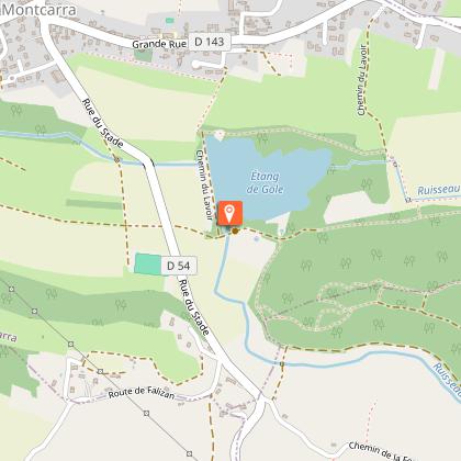
Le parking situé tout près de l'étang n'est plus accessible. 2 options s'offrent aux visiteurs :
- Parking du stade de l'autre côté de la départementale.
- Parking de l'église (centre village) et descente à pieds par le sentier sous l'église.
Description
This circular walk takes you through woodland, meadows and hills. The walk offers panoramic views of the Alps; you’ll enjoy the charm of the adobe houses and the hidden ponds of Crucilleux, not to mention the views of the small vineyards of Saint-Chef.
Technical Information
Altimetric profile
Starting point
Points of interest


Additional information
Distinctions
Listed PDIPR
Updated by
Office du Tourisme Les Balcons du Dauphiné - 07/08/2026
www.balconsdudauphine-tourisme.com/
Report a problem
Environments
Mountain view
Panoramic view
In the country
Open period
All year round daily.
Subject to favorable weather.
Contact
Phone : 04 74 80 19 59
Email : tourisme@balconsdudauphine.fr
Website : https://www.balconsdudauphine-tourisme.com/
Facebook : https://www.facebook.com/profile.php?id=61556501098829
Topo guides and map references
Topo guides references :
The “Walks & Hikes” guidebook for the Balcons du Dauphiné is on sale for €14.90 at the Tourist Information Offices in Crémieu, Morestel, Les Avenières Veyrins-Thuellin and Saint-Chef.
A walking guide entitled “In the Footsteps of Frédéric Dard” (FFR – Balcons du Dauphiné collection) is on sale at the Tourist Information Offices in Crémieu, Morestel, Les Avenières Veyrins-Thuellin and Saint-Chef.
Type of land
Stone
Ground
Hard coating (tar, cement, flooring)
Tricky passages
The descent through the woodland can be slippery in autumn or after heavy rain (stage 3 of the walk).
Guidebook with maps/step-by-step
1 - From the car park, take the Sentier des Rossignols towards La Biousse, then turn left onto the Route d’Arcisse.
At the first junction, take the road on the right towards Basse Biousse.
It crosses a small valley and leads to the entrance to the hamlet.
2 - S’engager à droite sur le chemin qui s’élève en pente douce et continuer jusqu’au poteau « La
Biousse » (360 m).
3 - Turn left towards La Brenaise, first onto the road and then onto the country lane.
Pass the signposts for ‘La Brenaise’ (390 m) and ‘Gaillot Candy’ (390 m). Continue to the right to reach ‘Les Envers’ (400 m).
4 - Turn left onto the road towards Château de Chapeau Cornu. At the first junction, turn right, pass through the hamlet of La Rivoire and head for the signpost marked ‘Croix de la Rivoire’ (405 m).
Continue towards ‘Bois Jallieu’ (315 m) until you reach the signpost marked ‘Château de Chapeau Cornu’ (287 m) opposite the fountain. Take the path leading to the castle’s porch.
5 - Halfway along, turn left onto the track, then take the first path on the right. It goes round the castle and leads down to the country lane. Follow it to the left as far as Lake
Crucilleux and pass the Lac farm.
6 - Turn left onto the path that climbs gently between the fields and head towards the ‘Arcisse’ signpost (265 m). Take the road on the right towards Le Fayet and walk through the village. At the fountain
topped with a cross, turn left and leave Arcisse via the Côte du Merland.
Animals
Yes
Data author
