Alert
Alerts
A scenic walk between Crémieu, a medieval town, and the Dizimieu lake
4 alerts on this circuit
Alerte visiteurs
- From 14/09/2026 to 15/11/2026
Travaux – Fermeture de la montée Saint-Hippolyte du 14 septembre au 15 novembre : accès impossible du lundi au vendredi. La montée reste accessible les samedis et dimanches.
CRÉMIEU, CITÉ MÉDIÉVALE:
Alerte visiteurs
- Difficulté de stationnement lors de grandes manifestations.
- Travaux – Fermeture de la montée Saint-Hippolyte du 14 septembre au 15 novembre : accès impossible du lundi au vendredi. La montée reste accessible les samedis et dimanches.
TABLE DE LECTURE DU PAYSAGE - COLLINE DE SAINT-HIPPOLYTE À CRÉMIEU:
Alerte visiteurs
- From 14/09/2026 to 15/11/2026
Travaux – Fermeture de la montée Saint-Hippolyte du 14 septembre au 15 novembre : accès impossible du lundi au vendredi. La montée reste accessible les samedis et dimanches.
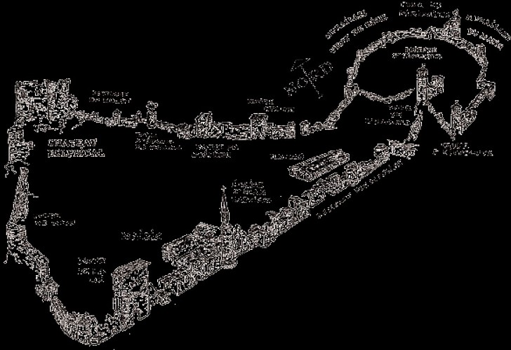
LES REMPARTS ET FORTIFICATIONS DE CRÉMIEU:
Alerte visiteurs
- From 14/09/2026 to 15/11/2026
Travaux – Fermeture de la montée Saint-Hippolyte du 14 septembre au 15 novembre : accès impossible du lundi au vendredi. La montée reste accessible les samedis et dimanches.
Description
Starting from Crémieu, a medieval town, this nature walk – which takes place largely through woodland – offers a refreshing escape in summer when the heat is at its peak, or in spring, when you can enjoy the carpets of wildflowers lining the pond and clearings.
The 360-degree panoramic view of the medieval town: the grand finale of this refreshing loop walk on the outskirts of Lyon.
Technical Information
Altimetric profile
Starting point
Points of interest



Additional information
Distinctions
Listed PDIPR
Updated by
Office du Tourisme Les Balcons du Dauphiné - 14/09/2026
www.balconsdudauphine-tourisme.com/
Report a problem
Open period
All year round daily.
Subject to favorable weather.
Topo guides and map references
Topo guides references :
The "Walks & Hikes" guidebook for the Balcons du Dauphiné is on sale for €14.90 at the Tourist Information Offices in Crémieu, Morestel, Les Avenières Veyrins-Thuellin and Saint-Chef.
A walking guide entitled “Nature Walk around Crémieu” (FFR – Balcons du Dauphiné collection) is on sale at the Tourist Information Offices in Crémieu, Morestel, Les Avenières-Veyrins-Thuellin and Saint-Chef. Price: €1
Type of land
Stone
Ground
Not suitable for strollers
Contact
Phone : 04 74 90 45 13
Email : tourisme@balconsdudauphine.fr
Website : https://www.balconsdudauphine-tourisme.com/
Facebook : https://www.facebook.com/profile.php?id=61556501098829
Environments
Mountain view
Panoramic view
In the country
Guidebook with maps/step-by-step
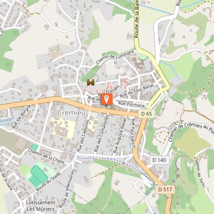
1 - From Place du 8 Mai 1945, follow Rue des Capucins. At the ‘La Chaîte’ signpost (215 m), turn left until you reach the D 517. Turn right for 100 m before crossing the road to take the Montée de la Tyne.
2 - At the first crossroads, turn right onto the Montée des Gorges. After the last property, turn right onto the path that climbs alongside the boundary wall until you reach a road. Turn right and continue to the hamlet of Sigalet, which you pass through.
3 – 100 metres after the hamlet, turn left onto the path which climbs gradually through the woodland until it comes out into a meadow.
4 - Leave the path, which continues straight ahead, and cross the meadow to the left to take the track that leads into the forest. Continue until you reach a wide track that descends to the right towards the village of Peyrieu. At the fountain, turn right onto the Fossas track. Signpost ‘Fossas’ (335 m).
The road turns into a wide track. When you reach the woods, leave the track, which continues to the right, and follow the path to the left, which winds its way up in a wide loop along the edge of the forest to Mont de Rive. Continue downhill to the ‘Fossas’ signpost (335 m).
5 - Continue along the track towards Dizimieu, then follow the village street to the signpost marked ‘Sous le Bourg’ (315 m).
Turn left towards Dizimieu, then turn right onto the path that runs alongside the pond and joins the D140 at the wash house.
Turn left onto the road, then turn right onto the street leading up to the church and the town hall.
6 - Follow the road as it winds down towards the D140; follow this for a few metres before turning onto the Chemin du Vert Poulet, to the right of the cemetery.
At the signpost marked ‘Le Jannay’ (330 m), continue straight on along the road, which, after 150 m, turns into a track.
7 - Leave the track and turn right onto the path which leads downhill into the forest. Turn left at the next two track junctions.
The path descends steadily to the ‘Cuinat et Coquier’ signpost (295 m).
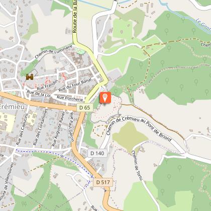
8 - Turn left towards ‘Saint-Hippolyte’ (295 m). Enter the medieval walls.
Follow the path on the left leading to the Clock Tower. Go down the flight of steps towards the village of Crémieu.
Take the road on the left and head towards Rue de la Porcherie, which runs alongside the Great Market Hall. Continue on to Saint-Jean-Baptiste Church.
Turn left, then immediately right onto Place de la Nation.
Walk past the Tourist Office, then turn left after passing under an archway and exit the city walls via the Porte de la Loi. Head to the car park.
Animals
Yes
Data author
