Alert
Alerts
Type of practice
Walking
Very easy
1h45mn
Presentation
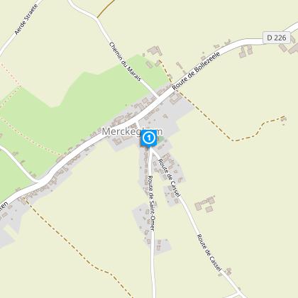
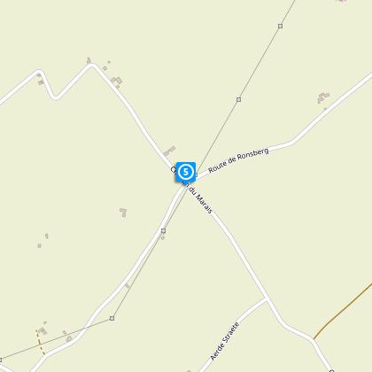
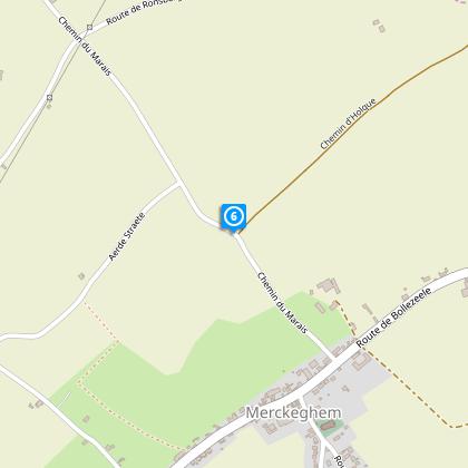
Map
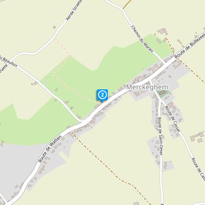
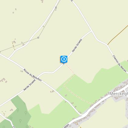
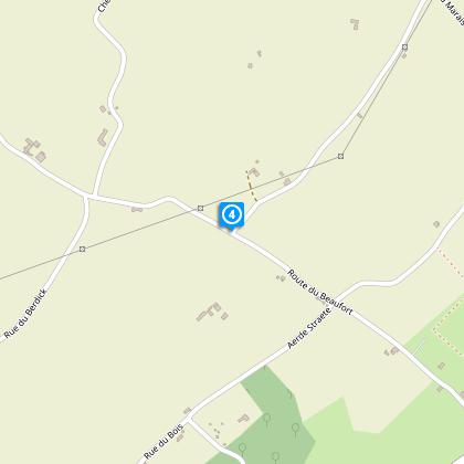
Steps
Cirkwi brief's
Ratings and reviews
See around
Loop of L'Eeckout Veld variant

Credit : Département du Nord
The Cirkwi brief
Explore the Charms of Eeckout Veld: A Majestic Trail in Merckeghem
Venture into the heart of the picturesque French countryside with the Circuit de L'Eeckout Veld. Curated by Nord Tourisme, this magical expedition offers more than just a walk; it's an immersion into an age-old landscape that seems untouched by time. Wander through quaint country roads, hedgerows, and agricultural paths that reveal the beauty of the region's former maritime embankment. The allure of this journey is in the details—the vibrant balance of nature seamlessly integrated with human history. This is your chance to connect with an authentic slice of Northern France, where every step tells a story.
Brief Technical Overview
With a total distance of approximately 3.97 km, the Circuit de L'Eeckout Veld trail varies in elevation from a minimum of 2 meters to a maximum of 58 meters above sea level. The route presents a positive elevation gain of about 61 to 62 meters, making it a relatively gentle climb suitable for most. Signposted in yellow, the path guides walkers through the designated route, although certain segments might prove challenging due to slippery conditions in wet weather.
Seasonal Tips for Travellers
Embarking on the Circuit de L'Eeckout Veld journey demands preparation, especially footwear that can navigate muddy patches post-rain. Spring and Autumn present the lushness of nature but require caution on slippery stretches between points 2 and 3. Summer offers clear paths but don't underestimate the need for hydration. Winter's stark beauty is enchanting, yet paths may be more challenging to tread. Always respect the trail's marking and consider local weather updates before starting your journey.
Merckeghem Histories and Highlights
Merckeghem, sitting elegantly within the Nord region, is not just a backdrop for the Circuit de L'Eeckout Veld; it's a protagonist in its own right. This area, rich in agriculture and history, embodies the spirit of France's northern frontier. Historically, these lands were contested, traded, and cherished - each layer adding to the region's mystique. Exploring here means connecting with centuries of tales, from the simplicity of rural life to the complexities of maritime history.
Weather Patterns and Best Visit Time
Merckeghem's climate is classified as temperate maritime, characterized by mild temperatures and sufficient rainfall year-round. The region experiences warm summers with cooler, wet winters, making late spring to early summer the optimal visiting period. During May and June, you can enjoy comfortable temperatures and the full bloom of local flora, enhancing your walking experience on the Circuit de L'Eeckout Veld.
Automatically generated.
Technical Information
Walking
Difficulty
Very easy
Duration
1h45mn
Dist.
4 km
Type of practice
Walking
Very easy
1h45mn
Show more
Altimetric profile
Starting point
Eglise, chemin de Cassel
,
59470
MERCKEGHEM
Lat : 50.865891068Lng : 2.29358004739
Steps
Data author

Ratings and reviews
To see around