Alert
Alerts
Type of practice
Walking
Medium
5h
Presentation
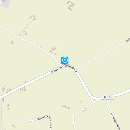
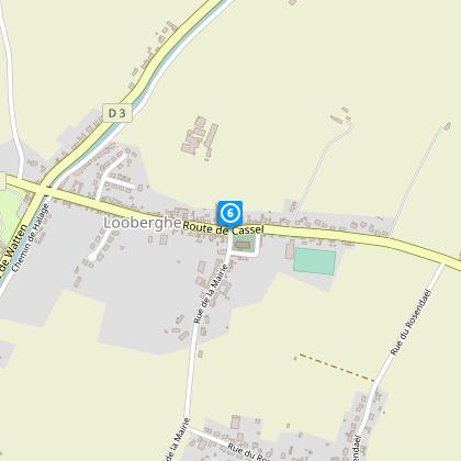
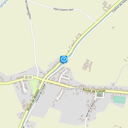
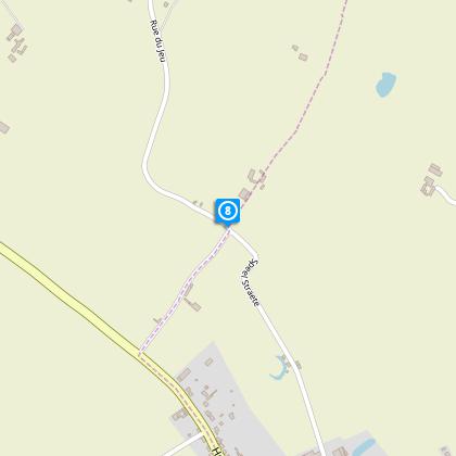
Map
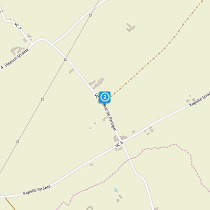
Steps
Points of interest
Cirkwi brief's
Ratings and reviews
See around
Circuit of the new lands

Credit : Nord Tourisme
The Cirkwi brief
Discover Flanders' Rich Fields: A Scenic Route
Nestled within the heart of Flanders Maritime, this scenic path, curated by Nord Tourisme, offers more than just a hiking experience. Journey through the fertile lands of Flanders, where silence and tranquility are your companions. Meandering through agricultural pathways, this route unfolds the rural canvas of wheat fields punctuated by semi-bocage hills. Historic chapels dot the path, narrating the religious essence of the region. The opportunity to witness grebes and coots gliding along the water bodies adds a serene touch. Midway, the welcoming "Café Rando" in Looberghe invites for a warm break. This description sketches an itinerary showered in calmness and natural beauty, promising an immersive exploration.
Technical Insight and Stats
Spanning approximately 17.93 kilometers, with an altitude ranging mildly from the lowest point up to 17 meters high, the journey is marked by a total positive elevation of about 45-46 meters. This technical briefing illustrates the circuit as moderately easy, suitable for most walking enthusiasts. The yellow markers along the route ensure navigational ease, presenting an accessible experience for followers. Such specifications confirm this trek as appealing to those who appreciate gradual elevations and clear directions.
Seasonal Advice for Travelers
Regardless of the season, this journey offers unique spectacles. In spring and summer, the verdant landscape bursts into life, making it a photographer's paradise. However, the paths can become slippery after rain; sturdy footwear is advised. Autumn brings a palette of colors, perfect for leisurely walks, but shorter days mean an earlier start is wise. Winter, though stark, has a beauty of its own; dress in layers and check the weather before setting out. Safety-wise, stay hydrated and keep the Café Rando in mind as a checkpoint or shelter if necessary.
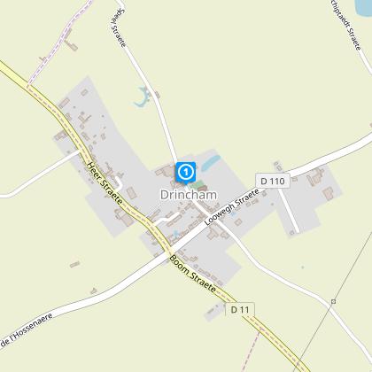
Drincham: A Historical Snapshot
Drincham, within the Flanders Maritime region, serves as the starting point of this rich journey. This area, steeped in agricultural tradition, not only showcases the robust bond between mankind and nature but also reflects an intricate history of fortitude and spiritual reverence. The route, sprinkled with historic chapels, captures the essence of the religious landscape that has shaped local communities over centuries. Understanding Drincham and its surroundings offers a captivating glimpse into the heritage that has influenced this serene picturesque landscape.
Weather Patterns: Best Visit Times
Flanders Maritime enjoys a temperate maritime climate, characterized by mild winters and cool summers, with moderate rainfall throughout the year. This balanced climate makes the "Circuit des nouvelles terres" hospitable for visitors in all seasons. However, for the most pleasant experience, late spring through early autumn is ideal. During this period, the weather is most favorable, allowing full enjoyment of the landscapes and optimal conditions for walking. Always check the local forecast before embarking on your journey to ensure the best possible experience.
Nestled within the heart of Flanders Maritime, this scenic path, curated by Nord Tourisme, offers more than just a hiking experience. Journey through the fertile lands of Flanders, where silence and tranquility are your companions. Meandering through agricultural pathways, this route unfolds the rural canvas of wheat fields punctuated by semi-bocage hills. Historic chapels dot the path, narrating the religious essence of the region. The opportunity to witness grebes and coots gliding along the water bodies adds a serene touch. Midway, the welcoming "Café Rando" in Looberghe invites for a warm break. This description sketches an itinerary showered in calmness and natural beauty, promising an immersive exploration.
Technical Insight and Stats
Spanning approximately 17.93 kilometers, with an altitude ranging mildly from the lowest point up to 17 meters high, the journey is marked by a total positive elevation of about 45-46 meters. This technical briefing illustrates the circuit as moderately easy, suitable for most walking enthusiasts. The yellow markers along the route ensure navigational ease, presenting an accessible experience for followers. Such specifications confirm this trek as appealing to those who appreciate gradual elevations and clear directions.
Seasonal Advice for Travelers
Regardless of the season, this journey offers unique spectacles. In spring and summer, the verdant landscape bursts into life, making it a photographer's paradise. However, the paths can become slippery after rain; sturdy footwear is advised. Autumn brings a palette of colors, perfect for leisurely walks, but shorter days mean an earlier start is wise. Winter, though stark, has a beauty of its own; dress in layers and check the weather before setting out. Safety-wise, stay hydrated and keep the Café Rando in mind as a checkpoint or shelter if necessary.
Drincham: A Historical Snapshot
Drincham, within the Flanders Maritime region, serves as the starting point of this rich journey. This area, steeped in agricultural tradition, not only showcases the robust bond between mankind and nature but also reflects an intricate history of fortitude and spiritual reverence. The route, sprinkled with historic chapels, captures the essence of the religious landscape that has shaped local communities over centuries. Understanding Drincham and its surroundings offers a captivating glimpse into the heritage that has influenced this serene picturesque landscape.
Weather Patterns: Best Visit Times
Flanders Maritime enjoys a temperate maritime climate, characterized by mild winters and cool summers, with moderate rainfall throughout the year. This balanced climate makes the "Circuit des nouvelles terres" hospitable for visitors in all seasons. However, for the most pleasant experience, late spring through early autumn is ideal. During this period, the weather is most favorable, allowing full enjoyment of the landscapes and optimal conditions for walking. Always check the local forecast before embarking on your journey to ensure the best possible experience.
Automatically generated.
Technical Information
Walking
Difficulty
Medium
Duration
5h
Dist.
18 km
Type of practice
Walking
Medium
5h
Show more
Altimetric profile
Starting point
parking de l'église
,
59630
DRINCHAM
Lat : 50.9069215232Lng : 2.31032197485
Steps
Data author

Ratings and reviews
To see around