Alert
Alerts
Type of practice
Walking
Very easy
4h
Presentation
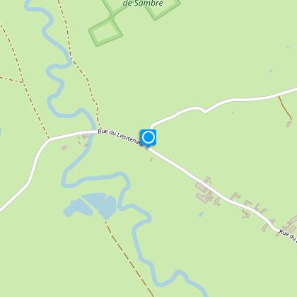
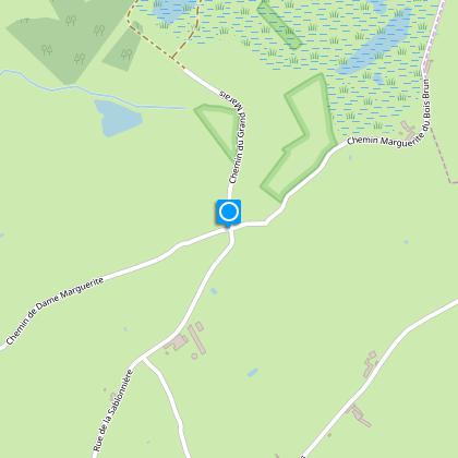
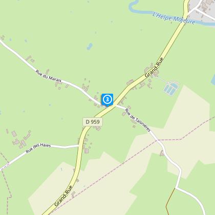
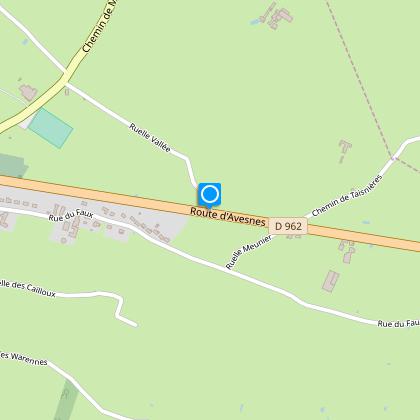
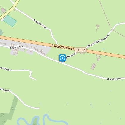
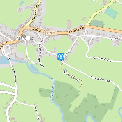
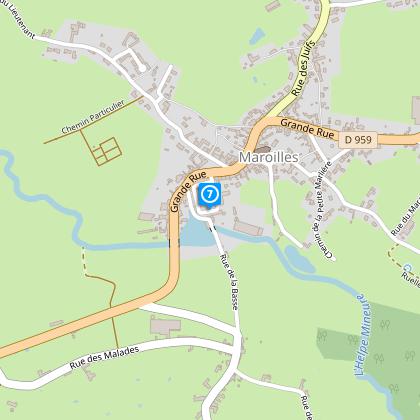
Map
Steps
Points of interest
Cirkwi brief's
Ratings and reviews
See around
Dame Marguerite Circuit

Credit : Nord Tourisme
The Cirkwi brief
Explore the Enchanting Dame Marguerite Path in Maroilles
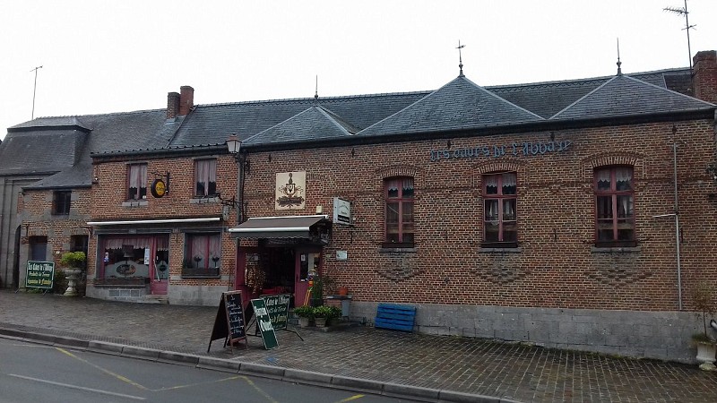
Venture onto the Dame Marguerite circuit, an inspiring journey meticulously curated by Nord Tourisme. This trail meanders through the lush bocage of Maroilles, intertwining the serene country lanes with earthy pathways. It's an exploration of the notable farms nestled in the Helpe Mineure valley, inviting travelers to immerse themselves in the authentic charm of the Avesnois region. The highlight, The Abbey's Caves Café-Rando, beckons with its rich display of local produce, promising a tranquil respite amidst your adventures. This circuit offers a sensorial dive into the heart of Northern France's countryside, echoing the serene and untouched beauty that awaits every traveler.
Brief Technique for Hikers
This journey spans approximately 12.4 kilometers, presenting an altitude variance with points lying between 133 and 187 meters above sea level. The trail's total positive elevation shift is closely bracketed between 101 and 100 meters, indicating a relatively moderate climb throughout. Signposted with yellow markers, the route optimizes the encounter between accessibility and a slight physical challenge, making it an ideal expedition for moderate level hikers. This concise overview mirrors the technical essence of the trail, underscoring its navigability and the physical prerequisites for an enjoyable trek.
Seasonal Guide and Safety Tips
Embarking on the Dame Marguerite journey offers unique seasonal charms but warrants specific precautions. During spring and summer, the path's beauty is at its zenith, though proper hydration and sun protection are paramount. Autumn brings a palette of colors but also slippery paths; sturdy footwear is essential. Winter treks are serene yet demand weather-appropriate gear and early start times to navigate safely before dusk. Irrespective of the season, always notify someone of your itinerary, carry a mobile phone, and stay on marked trails to ensure a safe and pleasant journey.
A Glimpse into Maroilles’ Rich Heritage
Maroilles, situated in the Avesnois region of Northern France, stands as a beacon of history and culture. The area, known for its lush bocage and dairy farming, is notably home to the Maroilles cheese, reflecting the region's deep gastronomic heritage. The historic Abbey of Maroilles, from which the Dame Marguerite circuit composes its starting point, echoes the spiritual and cultural significance dating back to the 7th century. This territory, steeped in history, offers not just a scenic trek but a journey through the epochs that shaped this enchanting region.
Weather Insights for Avesnois Visits
The Avesnois region, epitomizing Northern France's climate, offers a temperate climate marked by varied seasonal changes. Winters are generally cool, making it essential to dress warmly for those planning their visits during the colder months. In contrast, summers are pleasantly mild, ideal for exploring the outdoors. The optimal time to visit would be late spring through early autumn, where the weather conditions are most favorable for hiking adventures. Always check the weather forecast before setting out, as conditions can vary, ensuring your experience along the Dame Marguerite circuit remains memorable for all the right reasons.
Automatically generated.
Technical Information
Walking
Difficulty
Very easy
Duration
4h
Dist.
12 km
Type of practice
Walking
Very easy
4h
Show more
Altimetric profile
Starting point
6 Voie Communale de l'Abbaye
,
59550
MAROILLES
Lat : 50.1328678536Lng : 3.75880908369
Steps
Data author

Ratings and reviews
To see around