Alert
Alerts
Type of practice
Walking
Very easy
2h40mn
Presentation
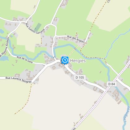
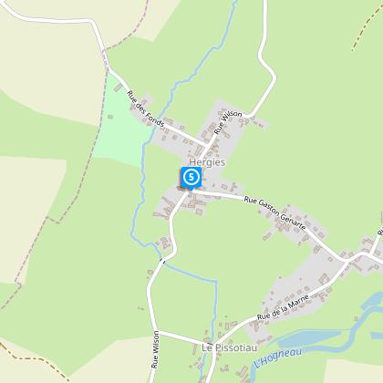
Map
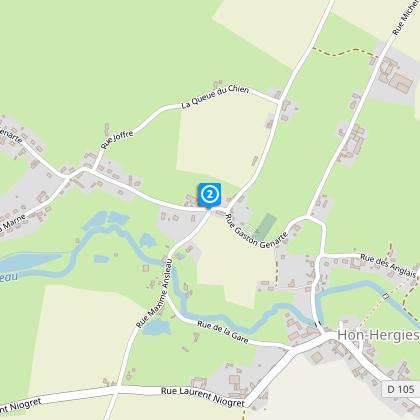
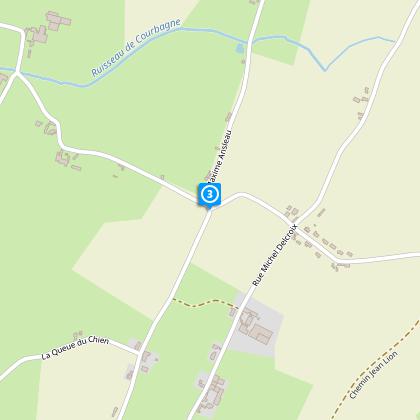
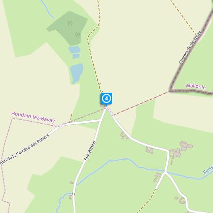
Steps
Cirkwi brief's
Ratings and reviews
See around
Old Machines Circuit


Credit : Nord Tourisme
The Cirkwi brief
Explore Historic Machinery on Hon-Hergies’ Enchanting Path
Crafted by Nord Tourisme, this itinerary offers an intriguing juxtaposition - a walk through time guided by ancient agricultural machines, nestled in the serene landscapes of Hon-Hergies. Perfect as a complement to "La Tournée des Chapelles," this path entices with its yellow markers through history, enabling a connection across generations. The essence captured is not just in the machinery but in the atmosphere it creates; it's a walk that engages both mind and heart, underlining the importance of preserving our past while being fully immersed in the natural beauty that frames each step.
Technical Overview: Essential Route Details
Covering a total of 8.53 km, this route kicks off from the parking area opposite the salle des Fêtes in Hon-Hergies. With an altitude ranging between 104 and 145 meters, the trail presents a gentle yet noticeable variation in elevation totaling an ascent and descent of 86 meters each. This path, marked clearly with yellow, is laid out to be engaging throughout the year. However, participants are advised to equip themselves with waterproof footwear during rainy periods to comfortably navigate the terrain.
Seasonal Tips for a Smooth Journey
Regardless of the season, exploring this path requires some planning. Spring and autumn are particularly captivating, with nature's palette at its most vibrant. However, these seasons also bring rain; hence, waterproof gear is a must. Summers offer longer days, making it an ideal time for those looking to savor each machine's historical context without haste. Winter, while crisp, requires careful footing, especially over areas that can become slippery. Always carry water, and regardless of the season, a charged phone for emergencies is essential.
Deep Dive into Hon-Hergies’ Rich Narratives
Hon-Hergies, not merely a dot on the map but a testament to the evolution of agriculture and local craftsmanship. Situated in the heart of the Nord department in France, this region is steeped in history. Each agricultural machine along the route tells a story, a glimpse into the ancestors' daily lives, and reflects the ingenuity required to cultivate the land. This journey does more than traverse physical distance; it bridges the gap between past and present, highlighting the enduring spirit of the region.
Understanding Regional Weather Patterns
The climate of Hon-Hergies, characterized by mild summers and cool winters, is conducive for year-round exploration. However, the best visiting times span from late spring to early autumn when the weather is most favorable for outdoor activities. Precipitation is fairly distributed throughout the year, with occasional rain spells making waterproof gear a practical choice for visitors. Understanding this climate aspect enriches the overall experience, allowing for optimal planning and enjoyment of this historical journey through nature.
Automatically generated.
Technical Information
Walking
Difficulty
Very easy
Duration
2h40mn
Dist.
8.5 km
Type of practice
Walking
Very easy
2h40mn
Show more
Altimetric profile
Starting point
Parking, face à la salle des Fêtes
,
59570
HON-HERGIES
Lat : 50.3261056354Lng : 3.8196985605
Steps
Data author

Ratings and reviews
To see around