Alert
Alerts
La Haute-Dore
Description
A trail following in the footsteps of Haute-Dore's industrial past, from the Vernet mill to the Piers mill and the former Aubapeyre quarry. Nature is omnipresent and has reclaimed the landscape, including some magnificent trees.
Technical Information
Altimetric profile
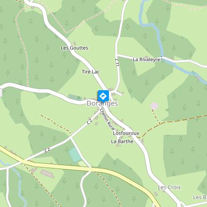
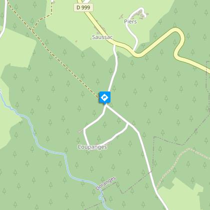
Starting point
Steps
Additional information
Tips
View of the Forez mountains.
Updated by
Conseil départemental du Puy-de-Dôme - 02/06/2026
www.puydedome-tourisme.com/
Report a problem
Environments
In the country
Presence of livestock and guard dogs
Distinctions
Listed PDIPR
Open period
From 01/01 to 31/12 daily.
Subject to favorable weather.
Location complements
From Arlanc, take the D907 towards Mayres. Then fork right onto the D38 towards Saint-Alyre-d'Arlanc. In the village of Saint-Alyre-d'Arlanc, follow the D999 towards Saint-Germain l'Herm. After 5 km, take the D 132 into the village of Doranges.
Contact
Phone : 07 85 96 70 89
Email : sylviane.echalier-tronchon@vacances-livradois-forez.fr
Website : https://www.auvergne-livradois-forez.com
Reception complements
For your own safety, always take a bottle of water, a hat, warm clothing and footwear suitable for walking.
Depending on weather conditions, certain itineraries are not recommended in bad weather (fog) or are not practicable, or even forbidden, during the winter season.
Some sites are fragile, so stay on the marked trails. Avoid picking wild flowers and disturbing wildlife. Pick up your garbage.
Animals are not allowed on some routes.
Guidebook with maps/step-by-step
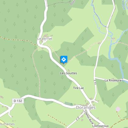
1/ Start near the church: take the D132 uphill, pass the cemetery and, 250 m further on, leave the tarmac on the right onto a forest track. Initially flat, the path then descends through woods to the hamlet of Le Vernet, where you cross the D 260. 30 m further on, leave the tarmac and take a path at right-angles, soon lined with hazel trees for 400 m.
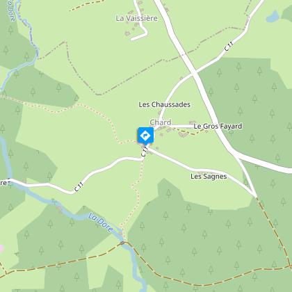
2/ Turn left onto a track leading down to the Moulin du Vernet, which runs alongside a garden wall at the bottom. Cross the road and continue along the asphalt track. Cross the first stream, pass between 2 buildings, turn right and cross another stream on granite slabs. The path then climbs up to the village of Chard, where you come to a cross.
3/ Turn right onto the tarmac road (view of Doranges). After 50 m, follow the track opposite down to Moulin de Piers, which you can see from a bird's-eye view. To the left of a parking area, take a wide forest track rising to the left as far as the Croix de Chard crossroads. Turn right at right-angles onto a forest track for 1500 m, which leads to Aubapeyre.
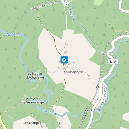
4/ In Aubapeyre, turn right onto a track leading down into the valley to the Moulin d'Aubapeyre. Cross the footbridge and follow the path up to the D999, above Germalanges. Turn right up the D999 for 200 m, then left into a wooded area. At the first crossroads, go straight ahead. Turn left at the crow's-foot. Turn right onto the road.
5/ At the second road leading to Coupanges, take the forest track opposite. Follow it for about 1200 m. Shortly after the meadow, take a path on the right that leads to Coust. In Coust, take a track on the left, to the right of a large building. Cross the D999 at the rest area and continue along the petanque pitch. Turn right to reach Doranges (view of the Monts du Forez).
Proposed and managed by the Conseil départemental du Puy-de-Dôme - PDIPR.
Animals
Yes. Dogs must be kept on a leash due to the presence of herds.
Data author
