Alert
Alerts
Type of practice
Walking
Very easy
2h50mn
Presentation
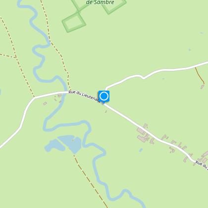
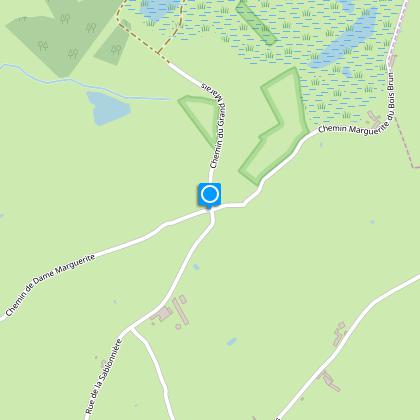
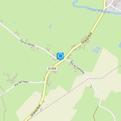
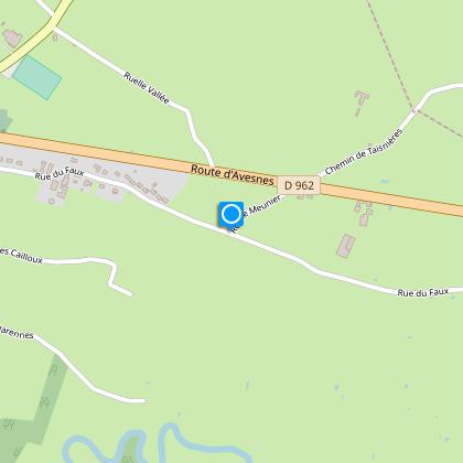
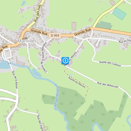
Map
Steps
Points of interest
Cirkwi brief's
Ratings and reviews
See around
Dame Marguerite Circuit - variant

Credit : Nord Tourisme
The Cirkwi brief
Discover the Charm of Maroilles on Foot: A Scenic Trek
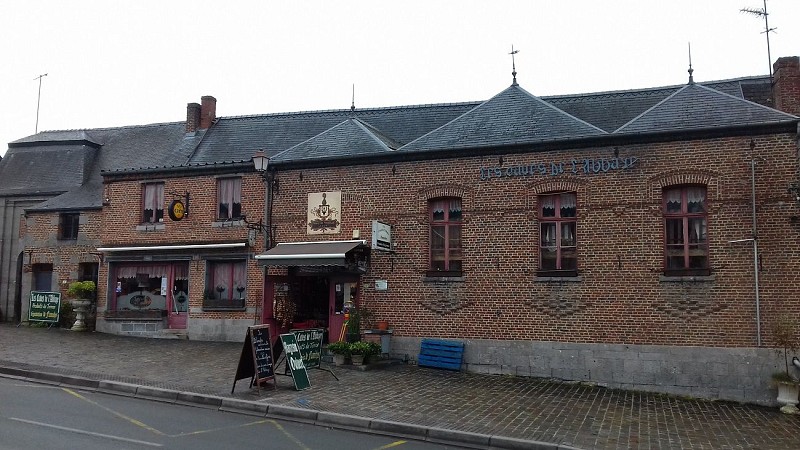
Imagine venturing into the heart of the Avesnois, where the Circuit de Dame Marguerite winds its way through the picturesque bocage landscape. This journey, curated by Nord Tourisme, is an invitation to explore serene country lanes and earth paths, punctuated by remarkable farms nestled in the valley of the Helpe Mineure. A highlight surely is the Les Caves de l'Abbaye, a haven for those who appreciate regional delicacies. This trek promises an immersive experience into the tranquility and culinary pride of Maroilles.
Essential Route Details Unveiled
Spanning a distance of approximately 9.44 km, the route achieves a modest altitude ranging from 132 meters at its lowest to an elevated point of 186 meters. The positive altitude shift experienced throughout is 45 meters, adding a slight challenge to the excursion. This technical composition ensures a manageable yet invigorating trek for participants, irrespective of the season. Such specifications underline the thoughtful design of the trail, aimed at offering a fulfilling outdoor experience.
Seasonal Tips for Trail Adventurers
Embarking on the Circuit de Dame Marguerite offers varying delights throughout the year. Spring and autumn provide cooler temperatures and vibrant landscapes, ideal for those seeking visual delight and comfortable hiking conditions. Summer offers longer daylight hours but prepare for warmer weather. Regardless of the season, sturdy footwear is a must, given the mixed terrain. Importantly, always carry water, especially during warmer months, and consider local weather updates for a safe journey.
Maroilles: A Cultural Tapestry
Maroilles, not just famed for its cheese, stands as a testament to rich historical layers within the Nord region. The village and its surroundings are steeped in history, from the bocage landscape shaping centuries of agricultural tradition to the spiritual heritage evident in the local abbeys and churches. Notably, the Les Caves de l'Abbaye echoes the region's monastic brewing and cheesemaking legacy, offering visitors a taste of local lore and tradition. This region embodies a blend of natural beauty and cultural depth waiting to be explored.
Climate Insights for the Avesnois
The Avesnois region, encompassing Maroilles, features a temperate maritime climate. It experiences mild winters and cool summers, with rainfall distributed fairly throughout the year. This climate ensures the lush greenery of the bocage landscape, providing a refreshing backdrop for hiking. The optimal period for trekking the Circuit de Dame Marguerite would be late spring through early autumn, when the weather is most favorable, making the exploration of this enchanting territory truly memorable.
Automatically generated.
Technical Information
Walking
Difficulty
Very easy
Duration
2h50mn
Dist.
9.4 km
Type of practice
Walking
Very easy
2h50mn
Show more
Altimetric profile
Starting point
34 Grande Rue
,
MAROILLES
Lat : 50.132867999Lng : 3.75880925632
Steps

Data author

Ratings and reviews
To see around