Alert
Alerts
Type of practice
Walking
Very easy
1h30mn
Presentation
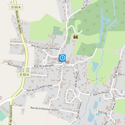
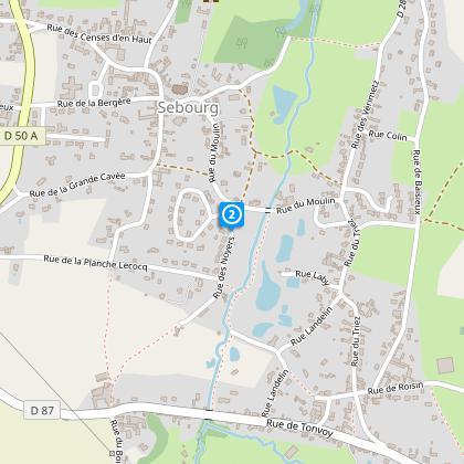
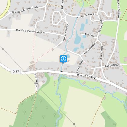
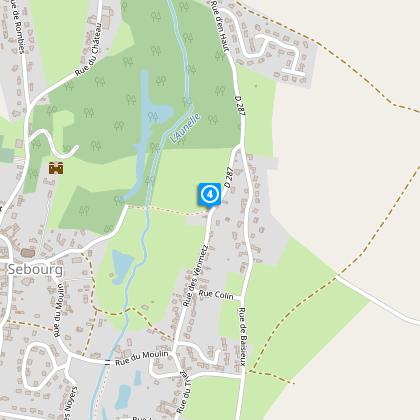
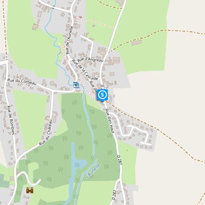
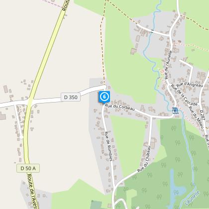
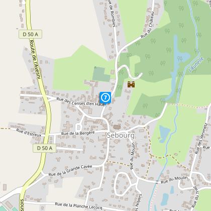
Map
Steps
Cirkwi brief's
Ratings and reviews
See around
The Farms of Sebourg


Credit : Nord Tourisme
The Cirkwi brief
Discover Sebourg: A Picturesque Village Walk by Nord Tourisme
At the gateway of Valenciennes and just a stone's throw from the border, the journey through Sebourg's heritage unfolds like a story from a different era, curated by Nord Tourisme. Imagine strolling through a village nestled in the serene Aunelle valley, where each step leads you through history and natural beauty. This walk isn't just about the landscape; it's about connecting with the past and discovering the hidden gems of a region rich in culture and tradition. Let yourself be guided by the winding paths and the stories they hold.
Technical Insights of Sebourg's Walk
This route, spanning 6.3km, presents a modest challenge with its altitude variations ranging from 45 to 88 meters and a total positive elevation gain of around 65 meters. Marked by a yellow trail, it offers an accessible yet engaging experience for walkers of varying skill levels. The calculated distance and elevation data emphasize a well-designed route that maximizes scenic views and historical sites, making every step worth the effort.
Seasonal Tips for Sebourg Explorers
Embarking on this picturesque journey through Sebourg is a delight throughout the year, but each season paints the landscape in a unique palette. In spring, the blossoming flora accentuates the historical architecture, making it a photographer's dream. Summers offer lush, full canopies for shade, ideal for leisurely walks. Fall transforms the path into a mosaic of warm colors, perfect for witnessing the change of seasons. However, winter requires caution; paths can be slippery, so sturdy footwear is advised. Always prepare for variable weather and carry water.
Sebourg: A Historical Gem
Sebourg, nestled in the Nord department within the Hauts-de-France region, stands as a testament to the area's rich tapestry of history and culture. This village, with roots deep in medieval times, has seen the passage of countless generations, each leaving its mark on the landscape and architecture. The region's strategic location near the border has imbued it with a unique cultural blend, evident in its customs, cuisines, and community life. Sebourg's heritage, encapsulated in this walk, offers a window into the soul of the Hauts-de-France.
Climate Guide for Sebourg Visitors
The climate in Sebourg, characteristic of the Hauts-de-France region, ranges from mild, wet winters to warm, occasionally rainy summers. Temperatures rarely reach extremes, making Sebourg a year-round destination. However, the best visiting periods are late spring to early autumn, when you're most likely to enjoy pleasant weather and the full vibrancy of the local landscape. Always check short-term forecasts before your visit, as weather conditions can change.
Automatically generated.
Technical Information
Walking
Difficulty
Very easy
Duration
1h30mn
Dist.
6.3 km
Type of practice
Walking
Very easy
1h30mn
Show more
Altimetric profile
Starting point
20
Mairie ou salle polyvalente
,
59990
SEBOURG
Lat : 50.3516674199Lng : 3.65173162008
Steps
Data author

Ratings and reviews
To see around