Alert
Alerts
Tour du lac du Mont-Cenis - 2-day hike

IGN cards


Description
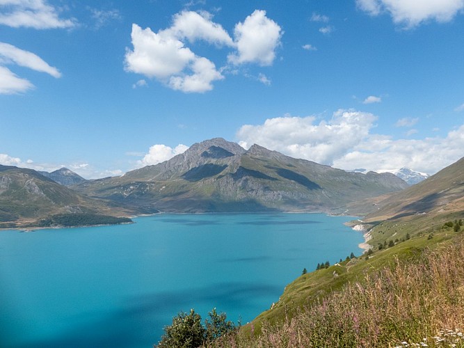
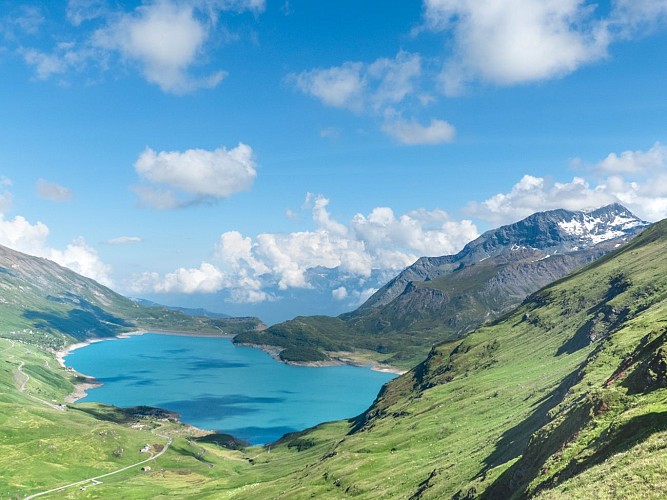
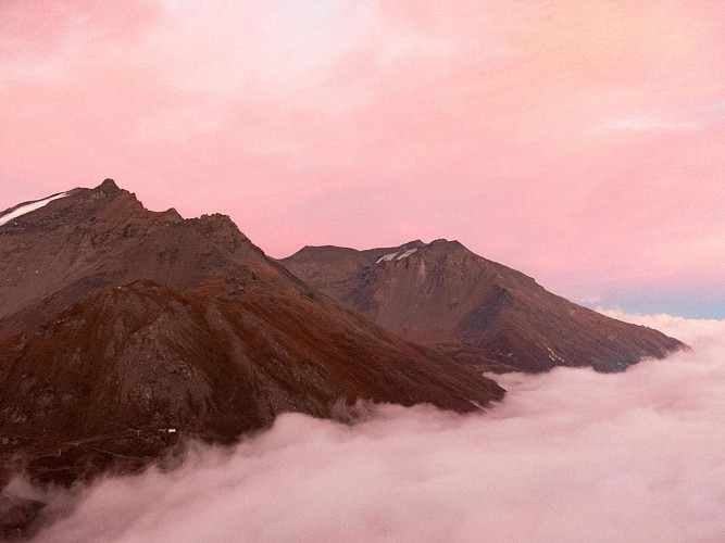
Treat yourself to a trip around Lake Mont Cenis. Take the time for a total immersion between passes and balconies. Fabulous viewpoints await you! Your 2nd stage will be spiced up by a tricky passage (handrail with no technical difficulty).
Technical Information
Altimetric profile
Starting point
Points of interest


Date and time
- From 15/06/2026 to 15/09/2026
Additional information
Open period
Itinerary accessible outside snow periods and subject to favorable weather conditions. Check the local weather forecast in real time up to the day of your departure. Information on trail and hut access conditions is available from the tourist office.
Updated by
Communauté de communes Haute Maurienne Vanoise - 23/12/2025
www.cchautemaurienne.com
Report a problem
Environments
Lakeside or by stretch of water
Mountain view
Waterside
Lake view
Mountain location
Lake 5 km away
Presence of livestock and guard dogs
Contact
Phone : 04 79 05 99 06
Email : info@hautemaurienne.com
Website : https://www.haute-maurienne-vanoise.com
Type of land
Stone
Ground
Grit
Not suitable for strollers
Location complements
In front of the Val Cenis Lanslebourg tourist office, take the D1006 to the Col du Mont Cenis. Limited parking at the pass. Possibility of parking for several nights.
I'll get there by bus: Line 5 - Col du Mont-Cenis stop (vehicle equipped with a 5-seater bike rack).
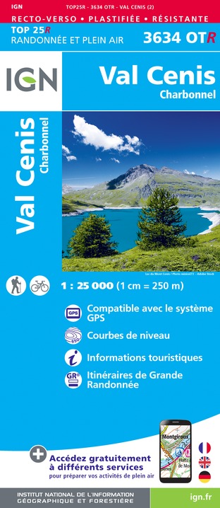
Topo guides and map references
Map references :
IGN Top 25 3634 OT Val Cenis - Charbonnel
Reception complements
You must book your overnight stay in a refuge in advance.
Stay on the trails, following the signs, and take your garbage with you.
Guidebook with maps/step-by-step
DEPARTURE: Val-Cenis - Col du Mont-Cenis
1/ DAY 1: Col du Mont-Cenis (2081 m) - Refuge du Petit Mont-Cenis (2110 m). Duration: 6h30/ Ascent: + 530 m / - 500m
2/ DAY 2: Refuge du Petit Mont-Cenis (2110m) -Col du Mont-Cenis (2081m). Duration: 7h / Ascent: + 900 m / - 930 m
Animals
Yes. Animals must be kept on a leash throughout this itinerary for your safety and that of the herds.
Data author
