Alert
Alerts
Snowshoe trail: the Golf loop
Description
Starting from Mijoux, the Golf loop offers an easy and varied walk: coniferous forest, pretty clearings near the golf course and the gentle murmur of the river in the background. An ideal route for a simple escape.
This winter walk offers a beautiful journey through the snow-covered Valserine Valley. Accessible on foot or with snowshoes, the marked trail winds its way between clearings and forests, following the river. Ideal for a family outing, this gentle route is perfect for children and sledging. Only accessible during the snowy season, it reveals the full magic of the Jura landscapes in winter.
Technical Information
Altimetric profile
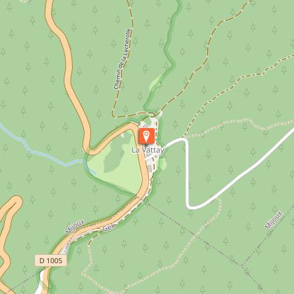
Starting point
Points of interest
Additional information
Contact
Phone : 04 50 28 09 16
Website : https://www.paysdegex-montsjura.com
Facebook : https://www.facebook.com/PaysdeGexStationMontsJura
Open period
From 01/12 to 31/03 daily.
Subject to snow conditions.
Environments
Ski resort
Mountain location
River 5 km away
Type of land
Non-groomed itinerary
Topo guides and map references
Map references :
3327ET - MOREZ LES ROUSSES
SLOPES : From the Jura Mountains
TRACK MAPS: From ENJ
MAP: Hiking in Pays de Gex and the Haute Chaîne du Jura. On sale at the Tourist Office
Updated by
Office de Tourisme du Pays de Gex - 29/01/2026
www.paysdegex-montsjura.com
Report a problem
Reception complements
▶Preparing for a winter outing in the mountains
Before setting off on a hike, snowshoe or ski tour, there are a few key steps you need to take to ensure your safety and that of your companions.
▶1. Check the weather and conditions
Check the general and local weather conditions (changes during the day, fog, wind, etc.).
Find out about the quality of the snow (powdery, icy, blowing snow, etc.).
Make sure there is no precipitation forecast.
▶2. Prepare your route
Study the approach, the height of the route and the access conditions.
Estimate the journey time and look for possible escape routes.
Use reliable resources: IGN maps, GPS, topographical guides.
▶3. Assess the risks
Seek advice from local professionals: guides, refuge wardens, tourist offices, etc.
Take account of natural hazards (avalanches, fog, slippery terrain, etc.).
▶4. Inform your friends and family
Share your itinerary, departure and return times.
Give the number of participants and their telephone numbers.
Indicate the vehicle(s) you will be using and where you will be parking.
▶5. Check your equipment
-Never go off on your own.
-Use equipment that is suitable for the activity, properly adjusted and in good condition.
-Take along :
-Headlamp
-Complete first aid kit
-Survival blanket
-Mobile phone + external battery
-Water bottle + snacks
-Wear clothing suited to the weather (cold, wind, damp...).
-Appropriate hiking boots, including for children.
-Walking poles recommended for balance and comfort.
▶6. In the event of a problem
In Europe, dial 112, the free emergency number.
Guidebook with maps/step-by-step
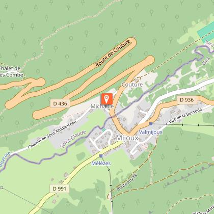
(1) From the Mijoux Tourist Office, exit on the right onto Rue Royale and walk down the street.
(2) Cross the Charlemagne Bridge (snowshoes in hand). At the end of the bridge, turn left towards Saint-Christophe Church, which is visible from the village.
(3) When you reach the church, put on your snowshoes. The trail starts on the right-hand side of the monument; continue along this path until you reach the crossroads with the road.
(4) Carefully cross the Route de Couture, then take the path of the same name. Follow this path until you reach the golf course.
(5) Before reaching the golf course, turn right. A small bridge allows you to cross the Valserine river and reach the other bank.
The return journey follows the Pellagrue cross-country ski trail through pleasant coniferous woodland until you reach the village of Mijoux from the west.
Animals
Yes. Dogs must be kept on a leash and are not permitted on the cross-country ski trail.
Data author
