Le Mont Fourcat
Description
Mount Fourcat 2001m offers an extraordinary 360 ° view over the plains of Roquefixade, Lavelanet and Mirepoix and on the Pyrenees Ariégeoise. The summit, a vast dome, making it one of the most welcoming sites.
Technical informations
6.3 km
|
max. 1991 m
min. 968 m
955 m
| |||||||||
Styles : HikingMountain Public : Experienced hikers | ||||||||||
Altimetric profile
Starting point
Steps
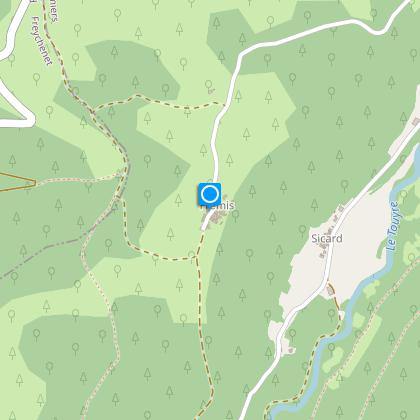
Starting point from the hamlet of Fremis
Cross the hamlet and climb to the right on a dirt track. Two directions: to the right Le Mont Fourcat: to the left the village of Montferrier.
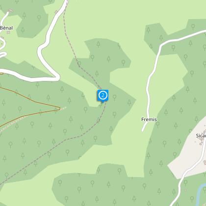
Step 2
Turn right along the dirt track and walk for 10 minutes to arrive on the Forest track.
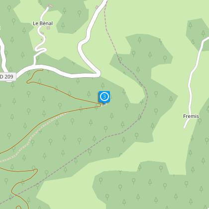
Step 3
Turn left on the Forest track and climb for about 350 metres.
Step 4
Then turn left and climb into the woods to arrive at a path crossroads.
Step 5
Take the trail opposite which heads back into the beech forest for about 1h.45 (to arrive at the Coulobre Refuge (1560 metres altitude), on the left is the Prat Moussou Refuge. The refuge is available to the Public.
Step 6
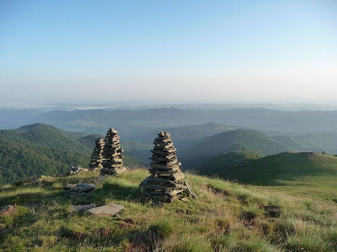
From the Coulobre Refuge follow the ridge path passing the “Three Men”, three Cairns, the height of men,to the summit of Mont Fourcat at 2001 metres altitude ( 1 hour).
Points of interest
The old shelter Coulobre
The old shelter of Prat Moussou
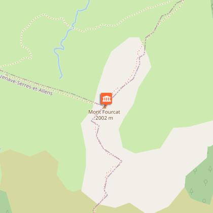
Mount Fourcat
The massif of Tabe is the high mountain of Pays d'Olmes. Thus, from certain altitudes you may be lucky enough to see a herd of Isards, a flock of mouflons, the capercaillie or ptarmigan. During the day you can admire the flight of some raptors.
Additional information
To see
The Isards
The mouflon capercaillie and black grouse
The speech therapist and other raptors
Data author
