Alert
Alerts
La Pierre trail
Description
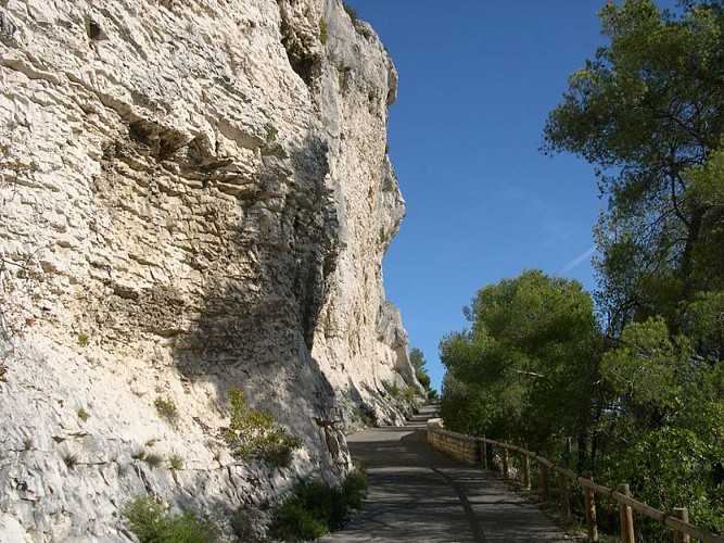
This route allows you to discover Orgon's geoheritage and appreciate the flora and fauna variety of the different natural environments.
From the museum, climb to the arena and take the path with the windmill adjacent to the chains of the DFCI (prevention policy for forest fires) and go through the pine forest.
1 – At the direction sign, turn right towards the chapel. Let on the right and go on the left trail. Continue until about 200 m. An old quarry appair on the left.
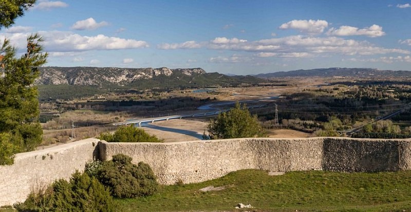
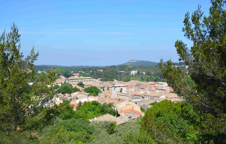
2 – Climb the path until the viewpoint then take the trail opposite the viewpoint towards the pine forest. Go down the steps and go along a rainwater ditch bordered by drystone walls. Meet the direction sign.
3 – Turn right towards N. D. Beauregard. Climb to the cemetery going along the right side.
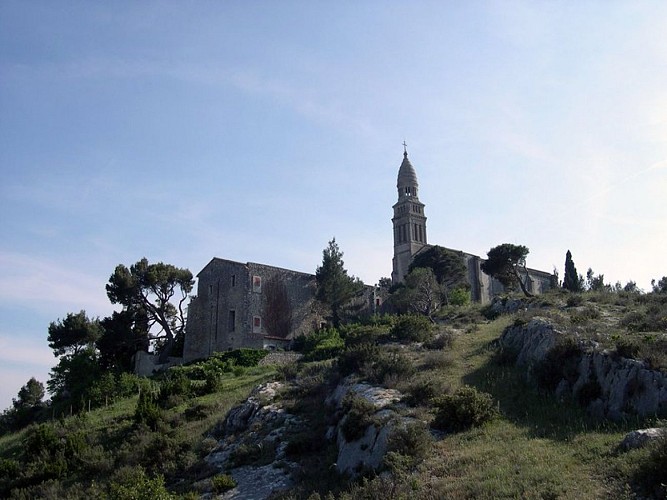
4 – Cross the road to the cemetery. Take the stairs and go up the little road of N.D. Beauregard. Go up to the chapel. Pass under the porch to the left and climb up to the orientation table.
5 – Go back down, pass under the porch again and take the path to the oratories on the left. Go down the steps and then turn to the right and follow the path to the reservoirs. Go down the trail towards the ruins of the castle of the Duke of Guise.
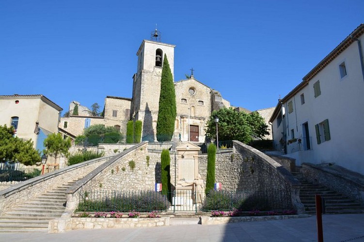
6 – Pass under the Porte de l'Hortet, a fortified gateway. Go down until the church square and take the stairs in the shape of a "horseshoe" to get to the Place de la Victoire. Continue through the Rue Jules Robert until the Porte Sainte-Anne, a fortified gateway. Pass the gateway and take the stairs on the left connected to the Urgonia Museum to end the walk.
Technical Information
Altimetric profile
Starting point
Points of interest


Additional information
Public transport
Search for the public transport timetables on the website www.lepilote.com in the municipality of Orgon.
Advice
Follow the blue markings from the Urgonia Museum to the Notre-Dame de Beauregard chapel (from the starting pint to the reference point n°5), then the yellow markings of the latter until the Porte de l'Hortet. Access to forest areas is regulated from June to September. Inquire on 08 11 20 13 13 (price of a local call) or on www.bouches-du-rhone.gouv.fr Download the “Fire prevention” application.
Advised parking
Car park opposite the museum and the Orgon tourist information desk and car park of the arenas.
Access
On the D7N, follow the signs "Urgonia Museum".
Arrival
Urgonia Museum, Orgon
Ambiance
& Laquo; This walk around the town of Orgon brings a new vision of the landscapes. The observation of the pure urgonian limestone and fossils, as well as of the overview of the valley of Lavau, where a lake surrounded by steep cliffs nestles, make me travel with every visit into the mysteries of time. This geomorphological and geological diversity visible from the orientation table of the Beauregard site opens my eyes to the richness of our land. & Raquo; Fabrice Aubert, head of the Urgonia Museum.
Departure
Urgonia Museum, Orgon
