Alert
Alerts
The upstream sections of the gorges of Véroncle


Description
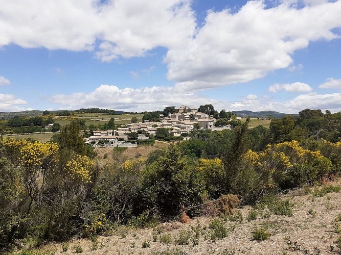
A harmonious hilltop village, an amazing natural site, singular hydraulic remains and a rural heritage of beauty!
At the entrance of the village, at the junction of the D4 and D15, take the little road going down which is across the school yard. Leave the village, take a beautiful hairpin bend, then lower (point 447) take the track across. 700m further, do not miss the start of the trail to the right (PR). Go down two rocky switchbacks, pass the ruins of the old dam and the mill ponds, then continue to the valley bottom. Pass the Devissé windmill and continue going.
1 - In front of the ruins of the Charlesse mill and its penstock, rise right on a rocky path that winds around the foothills of the Gorges (PR). Switch to the left over the undergrowth and turn left at the intersection of a trail.
2 - At the intersection ''Vezaule'', continue left the balcony trail. After four hairpin bends, come out at the bottom of the Gorges.
3 - Make a short back and forth to the right to see the Jean de Marre mill located just downstream, then go up some thirty meters upstream to a rocky slab. Do not climb the steep path to the right but continue on the one that runs along the river bed. 200m further after a small leap, cross a ford, take the path on the opposite bank in the downstream direction. Climb two stony steep paths, reach the old track and continue climbing the milder slope. Reach the plateau and continue the path until the track.
4 At the crossroads "Lauzière'', turn left and follow the trail. Pass two curves and the entrance to the campsite and continue on the small road of Bois d'Audibert. At the crossroads just after the entrance to the vacation center, go left. Reach the D4 (calvary), turn left and reach the heart of the village of Murs.
Technical Information
Altimetric profile
Starting point
Points of interest


Additional information
Advised parking
Parking at the entrance of the village coming from Apt
Advice
Caution with your ankles and some of the steep, rocky or stony passages.
Before point 1 and point 3: ravine bottom passages that can be tricky after a big storm.
Access
At 17km from Apt through the D4 and D2.
Ambiance
"The trail of the Gorges is a luxury offered to the visitor to forget time, to be overwhelmed by the great outdoors, feel the harmony between nature with its harshness and the imprint of mankind living there. Landscapes which were left to us were partly shaped by human activities and reflect its genius to adapt to the constraints and possibilities of the environment. A good balance, which remains fragile!" ". Says Anne-Marie Le Mat, a former mayor of Murs, Comissionner at the Luberon RNP.
Arrival
VIllage of Murs
Departure
Outside the town hall of Murs
