Alert
Alerts
Hiking to the Sarrasins pass
IGN cards


Description
Let yourself be tempted by a high altitude escape at over 2800 m. Through alpine meadows, under the watchful eye of a few discreet chamois, climb up to enjoy a wide-angle view of the surrounding peaks.
Start your day on the banks of the Charmaix on the herbarium trail. The sound of the torrent, sometimes capricious, contrasts with the calm of the forest. Here, you'll be surprised by the diversity of passerines circling above you. Chickadees, kinglets, finches... all enliven the area with their melodious song.
One hairpin bend follows another as you make your way back to the Lavoir parking lot. If you set off early, the summits, tinged with the first light of morning, invite you to take a contemplative break. The gentle murmur of streams, stone bridges and authentic chalets mark your path.
Once you've passed the hamlet of Le Plan, are you ready to take on the winding ascent? Gain altitude and enter a rocky environment populated by marmots and the discreet rock ptarmigan. Hidden in this pure, mineral setting are some of Europe's highest former silver-lead mines.
Ready for a photo? The panorama from the pass more than rewards your efforts.
Technical Information
Altimetric profile
Starting point
Points of interest
Date and time
- From 01/07/2026 to 01/10/2026
Additional information
Open period
From 01/07 to 01/10.
Subject to favorable snow and weather conditions.
Updated by
Communauté de communes Haute Maurienne Vanoise - 23/12/2025
www.cchautemaurienne.com
Report a problem
Environments
Mountain view
Mountain location
Presence of livestock and guard dogs
Contact
Phone : 04 79 05 99 06
Email : info@hautemaurienne.com
Website :
https://www.haute-maurienne-vanoise.com
http://www.cchautemaurienne.com/jy-vais-en
Type of land
Rock
Stone
Ground
Not suitable for strollers
Location complements
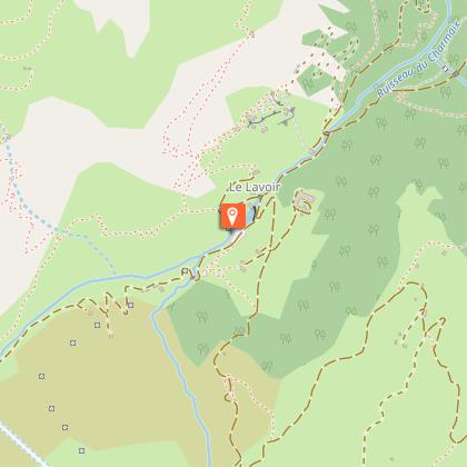
I'm going by car: park in the Lavoir parking lot on the driveway.
Topo guides and map references
Topo guides references :
Map and booklet "Haute Maurienne Vanoise. 115 walks and hikes - 35 trail routes. For all levels" (sold for €10 in Tourist Offices) - Red route n°83
Map references :
Map IGN 3535OT - Névache Mont Thabor
Reception complements
The duration of hiking trails is calculated using reference paces: 300 m/h ascent, 500 m/h descent and 4 km/h on the flat.
As hazards may occur at any time on the routes, the GPX tracks provided are not contractual. They are given for information only. Riders use them at their own risk, depending on their level of technological proficiency and their understanding of the terrain.
Guidebook with maps/step-by-step
To guide you in the field, consult the "step-by-step" directional diagram provided in pdf.
Animals
Yes. Out of respect for wildlife, please keep your dog on a lead.
Data author
