Alert
Alerts
Malseroud marsh and pond

Description
An easy hike to discover the wealth of biological species (fauna, flora) in the river, pond and wet meadows.
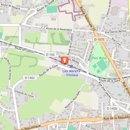
Access via Les Abrets-Fitilieu train station (+2km round trip).
ROUTE
Take a narrow country road through the forest, then a wide track through more open countryside to reach the marshes, you follow the river Bourbre on your left. The track is often shaded at this point. You pass a number of farms and arrive at ‘Château de Donat’.
Take the path to the right and turn left to see the beautiful brick tower, last remaining evidence of the residence built around 1870.
Continue to the Malseroud pond, classified as a Sensitive Natural Area. This wetland area is ideal for observing birds (coots, grebes, herons), dragonflies, frogs and more. You can walk around the pond. An educational booklet is available at the Tourist Office and on www.tourisme-valsdududauphine.fr. Dogs must be kept on a leash around the pond to preserve the tranquillity of the species.
On the way back, the paths and small country roads go through cultivated fields and small copses to take you back to ‘Les Bruniaux’. Then cross the village to return to your starting point.
This loop is very pleasant in summer, but not recommended in wet season (November to April), as the paths through the marshes are often muddy.
WAYMARKING AND SIGNPOSTING
Follow the yellow markers and the crossroads :
FITILIEU > Château de Donat > Les Bruniaux > FITILIEU
Technical Information
Altimetric profile
Starting point
Points of interest
Additional information
Environments
Forest location
In the country
Village -2 km away
Updated by
Office de Tourisme des Vals du Dauphiné - 26/05/2026
www.tourisme-valsdudauphine.fr/
Report a problem
Open period
All year round daily.
Contact
Phone : 04 76 32 11 24
Email : tourisme@valsdudauphine.fr
Website : http://www.tourisme-valsdudauphine.fr/
Facebook : https://www.facebook.com/valsdudauphinetourisme/
Type of land
Stone
Ground
Animals
No
Data author
