Alert
Alerts
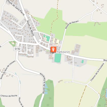
Tire-Gerbe forest
1 alert on this circuit
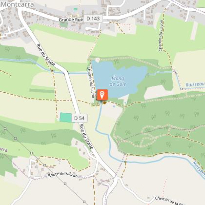
ESPACE NATUREL SENSIBLE ETANG DE GÔLE:
Alerte visiteurs
Le parking situé tout près de l'étang n'est plus accessible. 2 options s'offrent aux visiteurs :
- Parking du stade de l'autre côté de la départementale.
- Parking de l'église (centre village) et descente à pieds par le sentier sous l'église.
Description
Enjoy the coolness of the Tire-Gerbe forest in summer, or continue on to the Gole pond.
ROUTE
The starting point offers unobstructed view of the Vercors and Chartreuse mountains. An orientation table located between the church and the soccer stadium details the landscape. Take rue de Ravette opposite the town hall and follow the path to the hamlet of La Mitagnière. You then reach the Etang de l'Enfer before entering the Tire-Gerbe forest.
The forest path leads down to l'Enfer. At this point, you can extend the hike with a 1km round trip to discover the Etang de Gole, a sensitive natural area. Take a moment to observe the agile frog, dragonflies and great crested grebe.
The return journey to Rochetoirin takes you along a pretty path in a bucolic setting, sometimes wooded, sometimes more open, then along the Reculfort road back to the starting point. Stay vigilant, however, as you follow the D54 for 150m shortly after l'Enfer.
WAYMARKING AND SIGNPOSTING
Follow yellow markings and the following signposts:
Tire-Gerbe > Le Grand Poste > L'Enfer > Possibility of a return trip to Etang de Gole > Bonnard > Le Gayet > Les Tournas > Return to ROCHETOIRIN
Technical Information
Altimetric profile
Starting point
Points of interest
Additional information
Environments
In the country
Forest location
Village -2 km away
Updated by
Office de Tourisme des Vals du Dauphiné - 15/04/2026
www.tourisme-valsdudauphine.fr/
Report a problem
Open period
All year round daily.
Contact
Phone : 04 76 32 11 24
Email : tourisme@valsdudauphine.fr
Website : http://www.tourisme-valsdudauphine.fr/
Facebook : https://www.facebook.com/valsdudauphinetourisme/
Type of land
Stone
Ground
Hard coating (tar, cement, flooring)
Animals
Yes
Data author
