Alert

Alerts

To see around
See more
Open
Close
Show
Show
Show
Show
Show
Show
Show
Show
Show
Show
Show

Oups... It would appear that Cirkwi does not have permission to use your location.

Presentation
Description
Map
Points of interest
Ratings and reviews
See around

VTTAE 9 red circuit - Revers du Revermont (short version) - Espace Revermont Base FFvélo
VTTAE 9 red circuit - Revers du Revermont (short version) - Espace Revermont Base FFvélo

Description

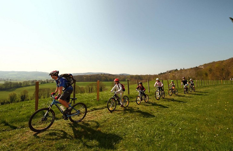
A VTTAE circuit in the foothills of the Revermont region for a discovery ride that gives pride of place to the landscape and heritage.
From the foothills to the foot of the mountains.

A climb to the listed site of Mont Myon at 650 m, passage over the Plain Champ pass, Dingier chapel, typical village of Salavre... and St Rémy du Mont and the ancient Coligny for the full version.

The black equivalent of muscular mountain biking!

Possible departures from Salavre and Verjon.

Technical Information

Mountainbiking
Difficulty
Medium
Duration
2h10mn
Dist.
30 km
Show more

Altimetric profile

Starting point

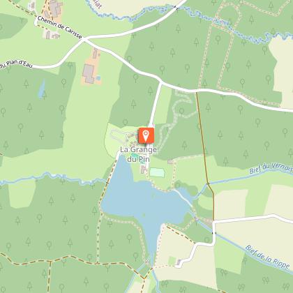
La Grange du Pin , 01370   Val-Revermont
Lat : 46.305858Lng : 5.355334

Points of interest

image du object

Espace Revermont mountain bike base

Espace Revermont mountain-biking base, accredited by the Fédération Française Vélo. Rendezvous in the heart of the Revermont mountains. 26 circuits, 6 marked trails from 4 to 32 km. - 650 km of marked trailsWith its hilly terrain, wild landscapes and invigorating nature, the Revermont is a great destination for mountain bikers and handlebar enthusiasts. Revermont, a land of mountains. Its sunny slopes stand in stark contrast to the misty mornings of the Bresse bocage. It's a privileged vantage point, with views across the Mâconnais to the Lyonnais mountains, the Jura and the Alps. Prepare your outings according to your desires... descents, false flats and climbs follow one another at a good pace. Cross wild, damp valleys where the moss on the trees is omnipresent. everywhere. The scenery is astonishing. Play with the Revermont mountains and ride across the plateaus on pretty single tracks that alternate between forests, meadows, dry grasslands, hillsides and ridges. Ride along the banks of the Suran or through the narrow streets of picturesque villages. At 660 m, Mont Myon is probably the most sought-after symbol. Listed as a remarkable natural site, it remains a target for many hikers. The Ain Gorge, with its cliffs, wildlife, lookouts and wilderness, is another emblematic Revermont site. Further south, the Revermont vineyards (AOP Bugey Cerdon), dominated by the Cuiron rocks and the Croix de la Dent, with their picturesque villages and vast forests. 5 departure points: Base de loisirs de la Grange du Pin à Cuisiat (Val Revermont), Stade à Simandre sur Suran, mairie de Ceyzériat, mairie de Cize and base de loisirs de l'Ile Chambod. 4 levels / 650 km marked / VTT FFCT label

330 chemin de la La Grange du Pin 01370 Val-Revermont
- Bourg-en-Bresse destinations - Office de tourisme -
Consulter

Additional information

Distinctions

Listed PDIPR
Label VTT - FFCT

Updated by

Bourg-en-Bresse Destinations - Office de tourisme - 16/06/2026
www.bourgenbressedestinations.fr
Report a problem

Environments

Close to GR footpath
Mountain view
Forest location
Beach within 300 m
In the country
Lake -5km away
Village -2 km away

Open period

All year round daily.

Topo guides and map references

Topo guides references :
Base VTT FF Vélo - Espace Revermont / Grand Bourg Agglomération

Type of land

Ground
Grit

Tricky passages

Safety instructions
No technical passages to report. Please respect the mountain biker's charter.
Please remain cautious on roads and paths, especially at crossings and junctions.
Please respect other road users and keep in mind our natural reflexes.

The Revermont routes may cross pastures, so be sure to close the gates and respect the peace and quiet of the herds.

Respect each other's activities: in the mountains, there's room for everyone!
www.pasto-kezako.fr/

Certain areas may be affected by protected sites: Natura 2000, ENS, classified sites... let's respect nature, stay on the trails, be discreet in our attitudes and tracks...

The routes include hiking, trail and horse-riding circuits, as well as certain hunting areas. Please respect other users of the land.

Report a problem
Damaged markings, safety incident, conflict of use or illegal dumping?
Locate and report the situation via the national SURICATE system, from the application or online: sentinelles.sportsdenature.fr/

Equip yourself
We strongly recommend that you bring a bottle of water, a helmet, a cell phone, a route map and a repair kit.
Colorful clothing is also recommended, so as to be clearly visible to other trail users.

Animals

No

Ratings and reviews

To see around
See more
Open
Close
Show
Show
Show
Show
Show
Show
Show
Show
Show
Show
Show
Caution!
We have no information on the difficulty of this circuit. You may encounter some surprises along the way. Before you go, please feel free to inquire more and take all necessary precautions. Have a good trip! 🌳🥾