Alert
Alerts
The three valleys
Description
A beautiful hike with 500 m of height difference which offers many panoramas on the mountains of Auvergne and a variety of landscapes of meadows, forests, streams, valleys and where you can discover the typical rural architecture of Auvergne in Champagnat-Le-Jeune.
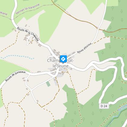
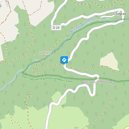
Starting point - From the starting sign go down a small street below and to the right of the D24. Turn right immediately on a grassy path between 2 low walls. Continue the descent and at the 1st T-junction, turn right and at the 2nd left. At the place called "Le Cerf" cross a stone bridge. Go up in the undergrowth, leaving the path on the right. Continue the ascent to the D24.
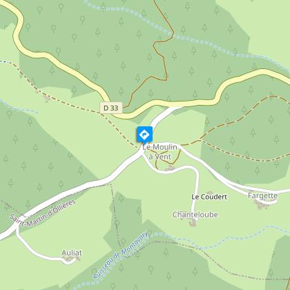
1 - Go up for 20 m and take the track on the left. Continue by ignoring two paths on the left until you reach the hamlet "Le Ceilloux". At the exit join the D33, take it to the left until Peslières (near the church, a German cannon from the First World War). At the end of the village, go up the asphalt road on the right until Lospeux. Pass in front of the cross on the right, continue to climb on the path. Cross several hamlets to the D702.
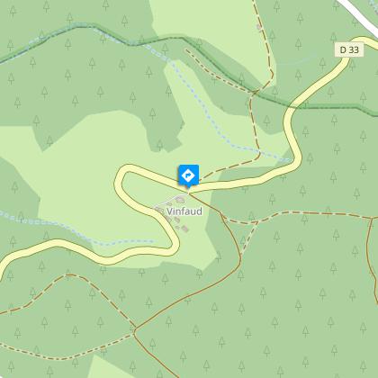
2 - Cross it, go on the asphalt road to the left of the sawmill. Then at the granite cross, take the middle path and walk through the woods. At the T-junction, turn left into the forest alley. Leave 2 paths on the right. Drive up to the D33 (leaving the woods, view of the Cézallier mountains, the Monts Dore and the Chaîne des Puys; orientation table on the D33 on the left at 200 m).
3 - Go down a wide path opposite. At the D132E turn left. 400 m after leaving Edmesse's hamlet, turn right onto a dirt road. At the crossing, continue straight ahead until you reach the D266E.
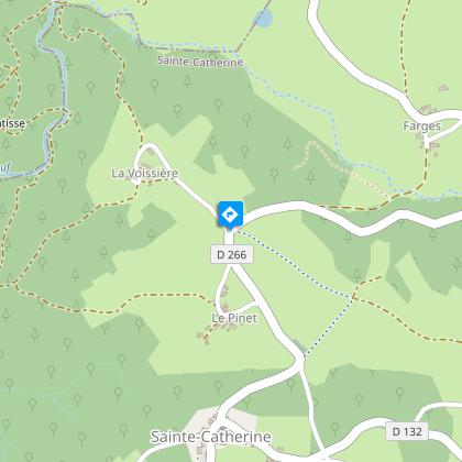
4 - Take the asphalt road opposite. Continue straight ahead. At the first house on the right of the hamlet of La Voissière, go down to the right on a road. Cross a first stream on a granite slab, turn left, enter a bridge that crosses the stream of Chateauneuf. After the bridge, turn left and go straight up, ignoring the right path. At an intersection, continue to the right until the crossroads after the hamlet of Rodel.
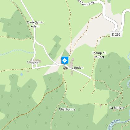
5 - Turn left. At the fork stay on the left. 500 m after the place called Charbonne go up to the right in the forest. At a crossroads, continue in front. At the next crossroads of 5 paths (storage area), go down a wide path to the left. Continue straight ahead. At the cross turn left on the road to reach the starting point.
Technical Information
Altimetric profile
Starting point
Steps
Additional information
Tips
- Peslières: near the church, a German cannon from the 14-18 war.
- View of the Cézallier mountains, the Dore mountains and the Dômes range.
- Orientation table.
Updated by
Conseil départemental du Puy-de-Dôme - 03/06/2026
www.puydedome-tourisme.com/
Report a problem
Environments
In the country
Forest location
Presence of livestock and guard dogs
Distinctions
Listed PDIPR
Open period
From 01/01 to 31/12 daily.
Subject to favorable weather.
Location complements
On the A75 at Issoire, take exit 13 towards Parentignat on the D996, then towards Le Verne-la-Varenne on the D999. At Sarpoil, take the D214 towards Barsat. On leaving the village, take the D24 to Champagnat-le-Jeune. Parking on the square (near the church).
Contact
Phone : 04 73 89 15 90
Email : tourisme@capissoire.fr
Website : http://www.issoire-tourisme.com
Reception complements
For your own safety, always take a bottle of water, a hat, warm clothing and footwear suitable for walking.
Depending on weather conditions, certain itineraries are not recommended in bad weather (fog) or are not practicable, or even forbidden, during the winter season.
Some sites are fragile, so stay on the marked trails. Avoid picking wild flowers and disturbing wildlife. Pick up your garbage.
Animals are not allowed on some routes.
Guidebook with maps/step-by-step
1/ From the start sign, go down a small street below and to the right of the D24. Immediately turn right onto a grassy path between 2 low walls. Continue downhill and at the 1st T-junction, turn right, then left at the 2nd. At "Le Cerf", cross a stone bridge. Climb up into the undergrowth, leaving the path on your right. Continue up to the D24.
2/ Go up for 20 m and take the left-hand track. Ignore two tracks on the left to reach the hamlet of "Le Ceilloux". At the exit, join the D33 and turn left to Peslières (near the church, a German cannon from the 14-18 war). On leaving the village, take the tarmac road on the right to Lospeux. Pass the cross on your right and continue up the track. Pass through several hamlets until you reach the D702.
3/ Cross it and take the tarmac road to the left of the sawmill. At the granite cross, take the middle path through the woods. At the T-junction, turn left into the forest lane. Leave 2 tracks on your right. Continue until you reach the D33 (as you leave the wood, there's a view of the Cézallier mountains, the Monts Dore and the Chaîne des Puys; orientation table on the left of the D33 200 m further on).
4/ Go straight down a wide track. At the D132E turn left. 400 m after leaving the hamlet of Edmesse, turn right onto a dirt track. At the crossroads, go straight on to the D266E.
5/ Take the tarmac track opposite. Continue straight ahead. At the first house on the right of the hamlet of La Voissière, turn right down a track. Cross the first stream on a granite slab, then turn left onto a bridge over the Chateauneuf stream. After the bridge, turn left and go straight up, ignoring the path on the right. At a crossroads, continue right to the crossroads after the hamlet of Rodel.
6/ Turn left. At the fork, keep left. 500 m after Charbonne, turn right into the forest. At a crossroads, continue straight ahead. At the next crossroads of 5 tracks (storage area), turn left down a wide track. Continue straight ahead. At the crossroads, turn left onto the road to return to the starting point.
Proposed and managed by the Conseil départemental du Puy-de-Dôme - PDIPR.
Animals
Yes. Dogs must be kept on a leash due to the presence of herds.
Data author
