Alert
Alerts
The Four Lords milestone
Description
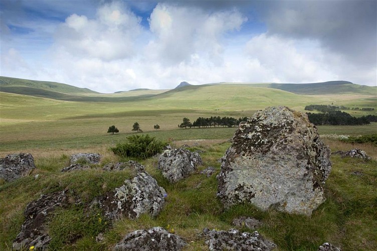
The circuit leads to the Trador waterfall, which cascades down the basalt organs over two levels, then leads to the summit of the Ordanche banne. The 4 Seigneurs milestone marks the junction of the communes of Perpezat, Laqueuille, Murat-le-Quaire and Le Mont-Dore.
Technical Information
Altimetric profile
Starting point
Additional information
Distinctions
Listed PDIPR
Tips
- The Trador waterfall (volcanic "organ").
- The Verdeix stream.
- View of the ruins of Cros de Sac.
- View of Charlannes, the Dordogne and Mont-Dore valleys, the Sancy massif and puy Gros.
- The pastures around the banne d'Ordanche.
- View of the Cantal mountains.
- Orientation table at Banne d'Ordanche.
- Col de Saint-Laurent.
- The Quatre Seigneurs milestone.
- View of the Chaîne des Puys.
- Nearby: Laqueuille spring water.
Updated by
Conseil départemental du Puy-de-Dôme - 03/06/2026
www.puydedome-tourisme.com/
Report a problem
Environments
Forest location
Mountain view
Mountain location
Presence of livestock and guard dogs
Open period
From 01/01 to 31/12 daily.
Subject to favorable weather.
Contact
Phone : 04 73 65 89 77
Email : infostourisme@auvergnevolcansancy.com
Facebook : https://www.facebook.com/auvergnevolcansancy/
Topo guides and map references
Topo guides references :
2015 - Randos au fil de l'eau - Discovering the Puy-de-Dôme - Conseil départemental du Puy-de-Dôme.
2019 - Volcano hikes - Discovering the Puy-de-Dôme - Conseil départemental du Puy-de-Dôme.
Type of land
Ground
Location complements
Head for Laqueuille (50 km south-west of Clermont-Ferrand) on the D 922, up the street opposite the war memorial to reach the foirail. Start sign at end of parking lot on right.
Reception complements
For your own safety, always take a bottle of water, a hat, warm clothing and footwear suitable for walking.
Depending on weather conditions, certain itineraries are not recommended in bad weather (fog) or are not practicable, or even forbidden, during the winter season.
Some sites are fragile, so stay on the marked trails. Avoid picking wild flowers and disturbing wildlife. Pick up your garbage.
Animals are not allowed on some routes.
Guidebook with maps/step-by-step
1/ Go up the street opposite the start sign, then turn right onto the road and right again 1 km further on. In the village of Trador, at the cross, head downhill towards the waterfall. At the first intersection, turn left onto the road to the parking lot.
2/ Turn left along the stream, cross a fence and footbridges and walk to the foot of a staircase (10-minute round trip to the waterfall). Climb the steps and continue left. Continue straight ahead along a shady sunken path. At the crossroads, turn left onto
the road. At the hamlet of l'Estomble, take the second turning on the left, which becomes a path. Keep right at the fork; at the T-junction, go left (with a view of the Cros de Sac ruins on your left) and follow the wood to the second intersection.
3/ Go right into the woods. Go straight ahead, cross a very steep path and continue straight ahead on a balcony (Charlannes, Dordogne valley, Mont-Dore valley, Sancy massif, puy Gros). Approx. 100 m before reaching the road, at a post on the right, climb left onto the moor to reach the road. Follow it to the left along the guardrail. At the intersection, cross the road and climb up to the parking lot. Follow a wide track on the right through the pastures towards the banne d'Ordanche (Monts du Cantal, Dordogne valley). Climb a few wooden steps up to the staircase leading down to the left (round trip: banne d'Ordanche - orientation table).
4/ Take it, then follow the path to the crossroads (Col de Saint-Laurent). Go straight up the slope and through the pastures to reach the Quatre Seigneurs milestone. Turn left between two fences, until you reach the gap between them (view of the Chaîne des Puys).
5/ Follow the fence on the left, then enter the undergrowth. The path first follows the left-hand edge, then crosses the forest and finally runs along the right-hand edge. At the end of the wood, go down to the road. Turn right to return to Laqueuille and the starting point.
Proposed and managed by the Conseil départemental du Puy-de-Dôme - PDIPR.
Animals
Yes. Dogs must be kept on a leash due to the presence of herds.
Data author
