Alert
Alerts
On the way to the arkose
1 alert on this circuit
BALADE VIGNERONNE AU DOMAINE LES CHEMINS DE L'ARKOSE:
Alerte visiteurs
Places limitées.
La réservation est obligatoire.
Un e-mail de confirmation vous sera envoyé après validation de votre demande.
Le lieu exact du RDV vous sera indiqué au moment de la réservation.
Description
Overlooking the Allier and the couze Chambon near Coudes, this hike on the plateau allows us to visit the very beautiful village of Montpeyroux and to cross landscapes of pailhats reminiscent of the old winegrowing economy.
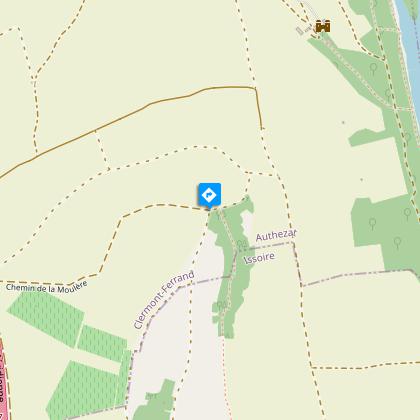
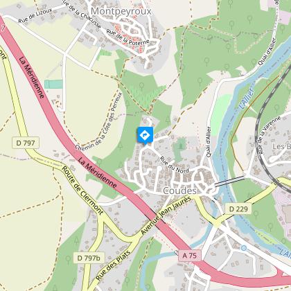
Starting point - From the starting panel, walk along the car park. At the educational farm, turn left and progress on the arkose outcrops (view of the Sancy massif and the Puys chain) until the beginning of the descent. Continue on this road until you reach an intersection at mid-slope.
1 - Turn right and go down immediately to the left until you reach a T-junction. Turn right and continue until you reach a wide flat path at the bottom of the descent. Take it to the left. At the next intersection go down to a road, cross it (access to Chadieu Castle, private site) and continue opposite until the first road on the right.
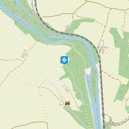
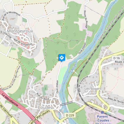
2 - Take it, barrier. Advance in the undergrowth along the banks of the Allier and leaving paths on either side. At the road, go down on the left and continue straight ahead until you reach the first houses of Coudes. Walk up to the level of a path going up to the right.
3 - Engage between hedges and fences, continue along gardens and then in the middle of houses until you reach the road.
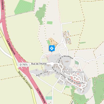
4 - Go up to the right by the Chemin du Cuel. Further to the right, take the Pailhas path (terraces). On the plateau, continue to the left, until you reach the road. Turn left for 100 m, then go up on a road opposite. At the cross, go up the steps and turn right to the Place de l'Église. Go down through the streets of la Quye and des Granges (panorama on the Sancy massif) to reach the entrance of the village (former arkose quarry) and the starting car park.
Technical Information
Altimetric profile
Starting point
Steps

Additional information
Distinctions
Listed PDIPR
Tips
- Montpeyroux: renovated fortified winegrowing village (classified as one of France's Most Beautiful Villages), keep, Romanesque church, ancient arkose quarries, Chadieu castle, Allier river, vegetable gardens at Coudes.
- View of the Sancy massif and Puys chain.
- Off the circuit between points 3 and 4: at the crow's feet, turn left towards a small beach and an island in the Allier (return journey - 20 mins).
- Accessible from Parent - Coudes - Champeix station.
Updated by
Conseil départemental du Puy-de-Dôme - 03/06/2026
www.puydedome-tourisme.com/
Report a problem
Environments
In the country
Forest location
Presence of livestock and guard dogs
Open period
From 01/01 to 31/12 daily.
Subject to favorable weather.
Contact
Phone : 04 73 89 15 90
Email : tourisme@capissoire.fr
Website : http://www.issoire-tourisme.com
Location complements
Take the A75 to Montpeyroux, a village south of Clermont-Ferrand. Parking on the left before the village entrance.
Topo guides and map references
Topo guides references :
2013 - Randonnez-vous - Discovering the Puy-de-Dôme - Conseil départemental du Puy-de-Dôme
Reception complements
For your own safety, always take a bottle of water, a hat, warm clothing and footwear suitable for walking.
Depending on weather conditions, certain itineraries are not recommended in bad weather (fog) or are not practicable, or even forbidden, during the winter season.
Some sites are fragile, so stay on the marked trails. Avoid picking wild flowers and disturbing wildlife. Pick up your garbage.
Animals are not allowed on some routes.
Guidebook with maps/step-by-step
1/From the start sign, follow the parking area. At the educational farm, turn left and follow the arkose outcrops (with views of the Sancy massif and the Chaîne des Puys) to the start of the descent. Continue on this path until you reach an intersection halfway down the slope.
2/ Turn right, then immediately left downhill to a T-junction. Turn right and continue to a wide, flat track at the bottom of the descent. Take this on the left. At the next intersection, go down to a road, cross it (access to Château de Chadieu, a private site) and continue straight ahead to the first track on the right.
3/ Take it, barrier. Continue through undergrowth, skirting the banks of the Allier and leaving paths on either side. At the road, turn left and continue straight on to the first houses in Coudes. Continue until you come to a footpath rising to the right.
4/ Follow the path through hedges and fences, past gardens and then houses, to the road.
5/ Turn right up the Chemin du Cuel. Further up on the right, take the Chemin des Pailhas (terraces). On the plateau, keep left until you reach the road. Turn left for 100 m, then climb the track opposite. At the cross, climb the steps and turn right as far as Place de l'Église. Descend via Rue de la Quye and Rue des Granges (panoramic view of the Sancy massif) to reach the village entrance (former arkose quarry) and the start parking lot.
Proposed and managed by the Conseil départemental du Puy-de-Dôme - PDIPR.
Animals
Yes. Dogs must be kept on a leash due to the presence of herds.
Data author
