Alert
Alerts
Pierre Blanche Wood
Description
The Livradois village of La Chapelle-Agnon, nestled in a verdant woodland setting, is famous for its white stone. Discover the white stone of La Chapelle-Agnon.
Technical Information
Altimetric profile
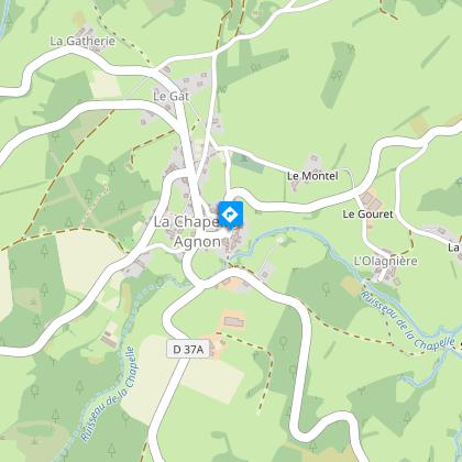
Starting point
Steps
Additional information
Distinctions
Listed PDIPR
Tips
- View of the Forez mountains.
- Panoramic view of the Chaîne des Puys and the Sancy massif.
- Livradois forest.
- Small heritage: iron crosses.
Updated by
Conseil départemental du Puy-de-Dôme - 03/06/2026
www.puydedome-tourisme.com/
Report a problem
Environments
In the country
Forest location
Presence of livestock and guard dogs
Open period
From 01/01 to 31/12 daily.
Subject to favorable weather.
Contact
Phone : 04 73 82 57 00
Email : tourisme.cunlhat@wanadoo.fr
Website : http://www.tourisme-pays-de-cunlhat.com
Location complements
La Chapelle-Agnon (25 mn from Ambert).
Topo guides and map references
Topo guides references :
2014 - Randos à croquer - Discovering the Puy-de-Dôme - Conseil départemental du Puy-de-Dôme
Reception complements
For your own safety, always take a bottle of water, a hat, warm clothing and footwear suitable for walking.
Depending on weather conditions, certain itineraries are not recommended in bad weather (fog) or are not practicable, or even forbidden, during the winter season.
Some sites are fragile, so stay on the marked trails. Avoid picking wild flowers and disturbing wildlife. Pick up your garbage.
Animals are not allowed on some routes.
Guidebook with maps/step-by-step
1/ From the Chapelle-Agnon church. Go up to the main street and leave the village on the Bertignat road (D65). Immediately after the bridge, turn right towards Mayet and drive 500 m (view of the Monts du Forez). Leave the Mayet road and follow a grassy path to the right. Go straight ahead at the first crossroads, then right at the crow's-foot.
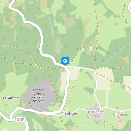
2/ Cross the D87 and take the track opposite. At the intersection, go straight ahead, then turn left at the crow's-foot. In front of the farm, at the entrance to Barissal, turn right onto a sunken track, then left twice.
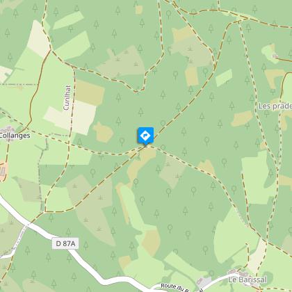
3/ In the Bois des Pradelles, take the track on the left for 20 m. Turn right onto a stony track. At the end of the wood, turn right along a plantation and continue straight ahead at the crossroads. At the entrance to Les Collanges, take the path furthest to the right (view of the Chaîne des Puys and the Sancy massif) and follow it straight ahead.
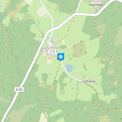
4/ Turn right onto the road, go around the Fraisse farm and take a path through the undergrowth. Continue in the same direction as far as Montmy. At the iron cross in Montmy, go down to the road (view of the Monts du Forez), then take the second track on the right. Keep right at the crow's-foot. Cross the road, take the path opposite and go straight back to the church.
Proposed and managed by the Conseil départemental du Puy-de-Dôme - PDIPR.
Animals
Yes. Dogs must be kept on a leash due to the presence of herds.
Data author
