Alert
Alerts
Montravel
Description
A lovely loop through the Livradois-Forez region. Montravel is known for its powerful Baffie seigneury and its beautiful views over the mountains and the Boutrand valley, also prized for its fishing spots.
Technical Information
Altimetric profile
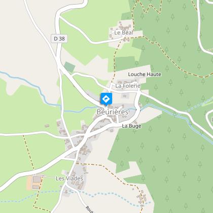
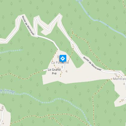
Starting point
Steps
Additional information
Tips
- The villages of Beurières and Montravel.
- Views over the Dore plain, Arlanc and the Livradois mountains.
- Heritage: chapel and cross.
Updated by
Conseil départemental du Puy-de-Dôme - 02/06/2026
www.puydedome-tourisme.com/
Report a problem
Environments
In the country
Forest location
Mountain view
Presence of livestock and guard dogs
Distinctions
Listed PDIPR
Open period
From 01/01 to 31/12 daily.
Subject to favorable weather.
Location complements
From the town of Arlanc, take the D38 towards Beurrières for 5 km.
Contact
Phone : 04 73 95 03 55
Email : office-tourisme.arlanc@wanadoo.fr
Website : http://www.arlanc.com
Reception complements
For your own safety, always take a bottle of water, a hat, warm clothing and footwear suitable for walking.
Depending on weather conditions, certain itineraries are not recommended in bad weather (fog) or are not practicable, or even forbidden, during the winter season.
Some sites are fragile, so stay on the marked trails. Avoid picking wild flowers and disturbing wildlife. Pick up your garbage.
Animals are not allowed on some routes.
Guidebook with maps/step-by-step
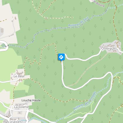
1/ From Beurières church, take the lane between the church and the restaurant. At the crossroads, take the road opposite towards La Folerie. 20 m further on, leave this road and take the path opposite. At the crossroads, go straight up to Le Béal (view of the village of Beurières). At the crossroads, continue straight ahead towards the honey mill. Just after, turn left at the crow's-foot. Keep to the main path until you reach a fork; continue uphill to the right.
2/ At the road, go right for 350 m, then take the path leading up to the left. 10 m further on, at the crow's feet, go straight on. Pass under the hamlet of Olliergues and continue to the tarmac. At the crossroads, turn right onto the road. 30 m further on, climb the track opposite. Follow the low wall and keep to the same path.
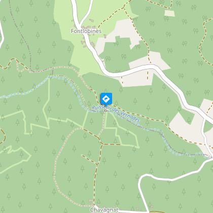
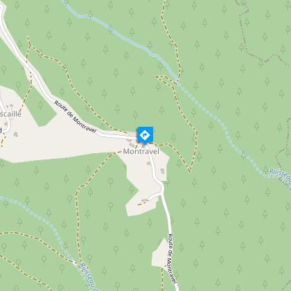
3/ At the crow's-foot, go down to the right, cross the stream and go back up the same way. 200 m further on, turn right. Take the road to the right and enter the hamlet of Chavagnat. At the crossroads, turn right. Follow the main track. Cross the stream and take the first path on the left. Climb the forest path. Join a more marked track; turn right towards Montravel.
4/ At the chapel, turn right into the hamlet. Follow the path to the right (view of the Dore plain, Arlanc and the Livradois mountains). Continue straight ahead. At the crossroads, turn left onto the road. Turn left for 20 m and follow the path down to the right.
5/ Turn left at La Pascaille and, just after the cross, fork left. Drive alongside the EDF substation and follow the path opposite. At the crossroads of 4 paths, turn right. At the "patte d'oie" (crow's-foot), go right downhill (caution: dangerous descent). At the stream, continue straight ahead. Follow the meadows (view of Arlanc and the Livradois mountains), continue to the road. Turn left into Beurières. Continue straight through the village.
Proposed and managed by the Conseil départemental du Puy-de-Dôme - PDIPR.
Animals
Yes. Dogs must be kept on a leash due to the presence of herds.
Data author
