Alert
Alerts
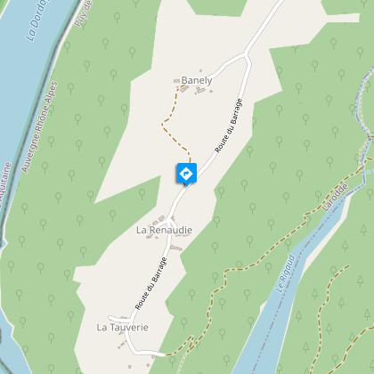
La Renaudie
Description
At an altitude of over 700 m, surrounded by woods and water, the Dordogne plateaux offer panoramic views of the two great volcanic massifs of the Auvergne: the Monts Dore and the Cantal strato volcano.
Technical Information
Altimetric profile
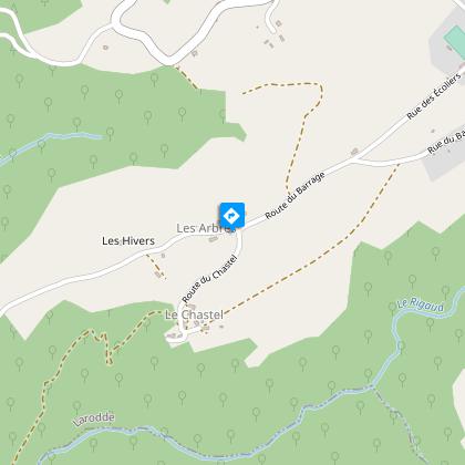
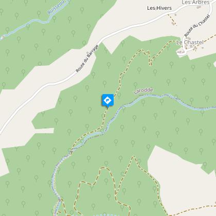
Starting point
Steps
Additional information
Tips
- Views of the Bort-les-Orgues dam reservoir.
- Views over the Dordogne and the ancient priory of Port-Dieu.
- Panoramic views of Auvergne's two great volcanic massifs: the Monts Dore and the Cantal strato volcano.
Updated by
Conseil départemental du Puy-de-Dôme - 02/06/2026
www.puydedome-tourisme.com/
Report a problem
Environments
In the country
Forest location
Presence of livestock and guard dogs
Distinctions
Listed PDIPR
Open period
From 01/01 to 31/12 daily.
Subject to favorable weather.
Location complements
From Tauves, 65 km south-west of Clermont-Ferrand on the D922, follow signs for Bort-les-Orgues. At Quatre-Vents, turn right as far as Larodde. Continue towards Bort-les-Orgues for 100 m, then turn right towards La Renaudie until you reach a cross on a median strip.
Contact
Phone : 04 73 65 89 77
Email : infostourisme@auvergnevolcansancy.com
Facebook : https://www.facebook.com/auvergnevolcansancy/
Reception complements
For your own safety, always take a bottle of water, a hat, warm clothing and footwear suitable for walking.
Depending on weather conditions, certain itineraries are not recommended in bad weather (fog) or are not practicable, or even forbidden, during the winter season.
Some sites are fragile, so stay on the marked trails. Avoid picking wild flowers and disturbing wildlife. Pick up your garbage.
Animals are not allowed on some routes.
Guidebook with maps/step-by-step
1/ From the start sign, take the road towards La Renaudie for about 2 km (views to the left over the Bort-les-Orgues dam reservoir, then to the right over the Dordogne and the former Port-Dieu priory). At the first fork in the road, turn right towards Banely. At the first houses, leave the road and turn right, then immediately left, into a meadow. Follow the fence to the left and then the track opposite until you reach the road.
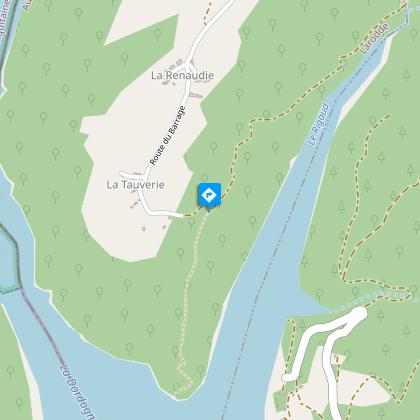
2/ Turn right as far as the hamlet of La Renaudie. At the crossroads, keep left. After the last house (view of the dam reservoir), go down the track into the undergrowth. Pass the first hairpin bend and continue for 100 m to the first downhill path on the left.
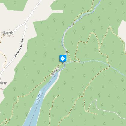
3/ Take this path and stay on it, ignoring the paths on either side. After a brook, climb back up and continue along the hillside, overlooking the Rigaud. Stop 50 m before the stream.
4/ Turn left up a faint track, then continue on a path alongside the stream. After the footbridge, go straight up and take a left-hand path again along the Rigaud. After another footbridge, continue on the path opposite until you reach a fork.
5/ Keep right. Climb a winding path which becomes a track to reach the hamlet of Le Chastel. Follow the road to the left to reach the starting point.
Proposed and managed by the Conseil départemental du Puy-de-Dôme - PDIPR.
Animals
Yes. Dogs must be kept on a leash due to the presence of herds.
Data author
