Alert
Alerts
The Guéry plateau
Description
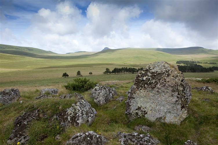
A beautiful mountain itinerary accessible to families. You'll discover the high-altitude Lac du Guéry (1,268 m), the high mountain plateaus and the summit of Puy Gros overlooking the valleys and spa towns of La Bourboule and Le Mont-Dore.
Technical Information
Altimetric profile
Starting point
Steps
Additional information
Distinctions
Listed PDIPR
Tips
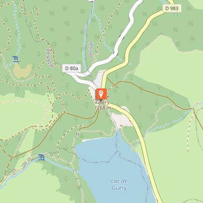
- Lac du Guéry.
- Waterfall and basalt organs.
- Borne des Quatre Seigneurs.
- Banne d'Ordanche.
- Views of La Bourboule, Murat-le-Quaire, Le Mont-Dore and the glacial valley of the Dordogne.
Updated by
Conseil départemental du Puy-de-Dôme - 02/06/2026
www.puydedome-tourisme.com/
Report a problem
Environments
Mountain view
Mountain location
Presence of livestock and guard dogs
Open period
From 01/01 to 31/12 daily.
Subject to favorable weather.
Contact
Phone : 04 73 65 89 77
Email : infostourisme@auvergnevolcansancy.com
Website : http://www.auvergnevolcansancy.com
Topo guides and map references
Topo guides references :
2016 - Randos vues d'en haut - Discovering the Puy-de-Dôme - Conseil départemental du Puy-de-Dôme
Type of land
Ground
Location complements
On the D2089, south-west of Clermont-Ferrand, at Randanne, take the D983 towards Le Mont-Dore. At the crossroads with the D80, stop at the parking lot near the cross-country skiing center.
Reception complements
For your own safety, always take a bottle of water, a hat, warm clothing and footwear suitable for walking.
Depending on weather conditions, certain itineraries are not recommended in bad weather (fog) or are not practicable, or even forbidden, during the winter season.
Some sites are fragile, so stay on the marked trails. Avoid picking wild flowers and disturbing wildlife. Pick up your garbage.
Animals are not allowed on some routes.
Guidebook with maps/step-by-step
From the start sign, near the Centre Montagnard, follow the path down to the lake, then take the first path on the right. Take the pontoon, go up into the forest, turn left and continue along the path beside the lake (view of Lac de Guéry). At a T-junction (information panel), turn right into the beech forest following the rope (waterfall and basalt organs) and continue up through the wood to the barrier.
1 / Cross the barrier, passing over pontoons in a pasture (view of Col de la Croix Morand and Puy de la Tache). Walk along a wood and enter it by the stepladder. Turn right onto a wide track and, at the first intersection, left onto a carriage road. About 300 m after the first Canadian crossing, turn right at the stepladder before a fence and follow the track towards Puy Loup. At the refuge (panoramic view), turn left on the ridge track towards Banne d'Ordanche, cross the enclosure of Borne des quatre seigneurs (Borne 4 faces) and continue straight ahead. At the Col de Saint Laurent go straight ahead, pass the barrier and at the milestone go left along the fence (on the right is Banne d'Ordanche and La Bourboule), then climb back up to the ridge. Head right, away from the fence. At a small summit, descend via a chicane to a wide path below.
2/ Climb to the left for about 300m, turn right, pass a chicane, reach the path on the Puy Gros crest (view of the Sancy massif, Le Mont Dore, La Bourboule, Murat le Quaire) and continue towards the top of this puy after crossing a stepladder. At the top of the Puy Gros, turn left towards a large flat rock, then a second one, and take a path, heading NE, not very visible at first, which leads down to a crossroads (signpost).
3/ Go left for approx. 300 m, fence off to the right, then go right downhill. Take the passageway and the stepladder, then follow the track to the left through the estive. Cross the fence and continue to the stepladder. Cross it, climb between the fences and descend to the edge of the wood. Ignore a track on the left to join a wide path. Turn left. At the lake, fork left, enter the wood and climb a winding path overlooking the lake (view of Lac de Guéry). Descend the prepared path and return to the starting point on the path alongside the lake.
Proposed and managed by the Conseil départemental du Puy-de-Dôme - PDIPR.
Animals
Yes. Dogs must be kept on a leash due to the presence of herds.
Data author
