Alert
Alerts
Lake Pavin
Description
The deepest (92 m) and most fascinating lake in Auvergne. The path follows the banks and then meanders past the cirque de la Biche. The mountain pastures and their burons are surrounded by conifers. Panoramic views of the Artense, Sancy and Cantal massifs.
Technical Information
Altimetric profile
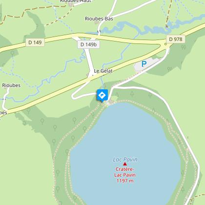
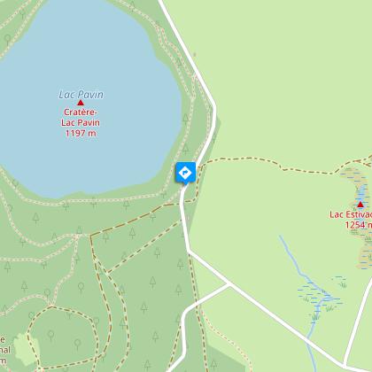
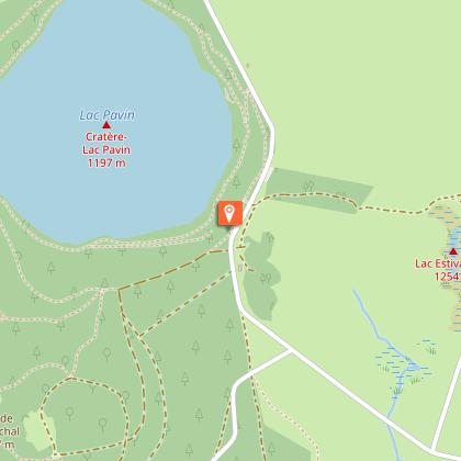
Starting point
Additional information
Tips
- Lake Pavin.
- View of Cantal, Corrèze, Sancy, the Chaîne des Puys and Livradois-Forez.
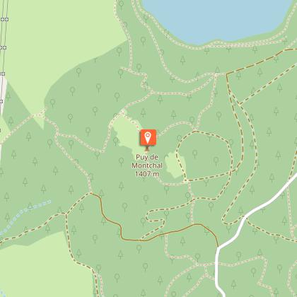
- Puy de Montchal.
- Le creux de Soucy (chasm).
- Nearby: the medieval village of Besse-et-Saint-Anastaise.
Updated by
Conseil départemental du Puy-de-Dôme - 20/05/2026
www.auvergne-destination.com
Report a problem
Environments
Forest location
Mountain location
Presence of livestock and guard dogs
Open period
From 01/01 to 31/12 daily.
Subject to favorable weather.
Contact
Phone : 04 73 79 52 84
Email : otsancy-accueil@sancy.com
Website : https://www.sancy.com/decouvrir/toutes-les-communes/besse-saint-anastaise/
Location complements
Reach Besse-en-Chandesse, 47 km south-west of Clermont-Ferrand, then take the D149 for 2km. Parking and start sign at Espace Nordique Sancy-sud near the Pertuyzat chalet.
Topo guides and map references
Topo guides references :
2015 - Randos au fil de l'eau - Discovering the Puy-de-Dôme - Conseil départemental du Puy-de-Dôme
Reception complements
For your own safety, always take a bottle of water, a hat, warm clothing and footwear suitable for walking.
Depending on weather conditions, certain itineraries are not recommended in bad weather (fog) or are not practicable, or even forbidden, during the winter season.
Some sites are fragile, so stay on the marked trails. Avoid picking wild flowers and disturbing wildlife. Pick up your garbage.
Animals are not allowed on some routes.
Guidebook with maps/step-by-step
1/ Opposite the start sign, near the restaurant, turn right onto the path through the forest. At the intersection, go straight ahead, through a gate (view of the Sancy massif) and follow the signs for "Lac Pavin" through the meadow. Go through the first gate, then the second. At the road, go down and then left as far as Lac Pavin.
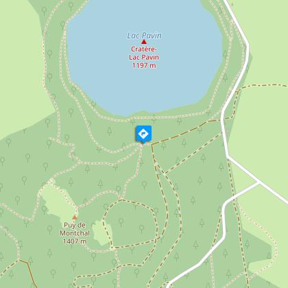
2/ Turn right on the lakeside path, direction "Puy de Montchal", as far as "La pierre carrée". Go right up through the beech forest to a crossroads called "Le ramier".
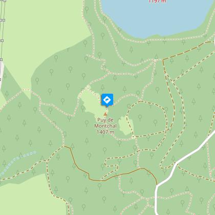
3/ Cross the wide track and go up a path towards "Puy de Montchal" to a crossroads on the lip of Puy de Montchal. Climb to the right to the summit (1407m, view of the Sancy massif). Continue over the crater, leaving it to the left, and descend to a junction of 4 paths. Descend to the right, then at the fork, continue left to a T-junction. Go left for 100m, then left again to reach a road. Turn right, pass the "creux de Soucy" and continue on the road for another 100m to an intersection with a path on the left.
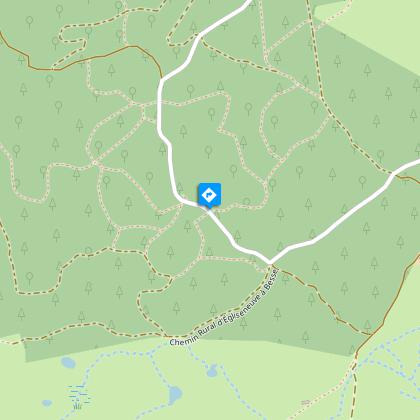
4/ Take this and, at the first intersection, go left. Continue on the main road to a T-junction. Turn left and go straight ahead to reach, after crossing a road, the viewpoint over Lac Pavin and the Sancy massif. Continue for 50 m, cross the road and take the path opposite. Pass 2 stepladders, skirt the end of Lac Estivadoux and climb left to a road. Cross the road and turn left onto a wide track. Continue along this main path until you reach the end of the forest. Turn left, then immediately right, to get back to the starting point.
Please note: hiking with a dog is not possible.
Animals
No. Dogs are not allowed on the mountain pastures where the herds cross.
Data author
