Alert
Alerts
The Gergovie plateau - Lea and Tino's walks
Description
On the Gergovie plateau, Vercingetorix fought against the Romans. Like him, you can keep an eye on the immense landscape as you circumnavigate the plateau. But, by Toutatis et Cervolix, if it's windy, put down your shield and take your kite!
Technical Information
Altimetric profile
Starting point
Additional information
Distinctions
Listed PDIPR
Tips
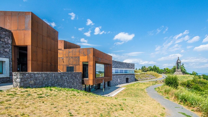
- Monument on the Oppidum.
- View of the Puy de Dôme, the Puys chain and Clermont-Ferrand.
- View of Château d'Opme and the Sancy massif.
- Ruins (Le Rempart Ouest and La Porte Ouest).
- View of Le Crest, Monton, Orcet and the Limagne plain.
- Small heritage site: stele and remains.
Updated by
Conseil départemental du Puy-de-Dôme - 02/06/2026
www.puydedome-tourisme.com/
Report a problem
Environments
In the country
Mountain view
Presence of livestock and guard dogs
Open period
From 01/01 to 31/12 daily.
Subject to favorable weather.
Contact
Website : https://www.clermontauvergnevolcans.com
Location complements
From Clermont-Ferrand take A75, exit 4, direction Orcet. At the 1st set of traffic lights, turn right, direction "Plateau de Gergovie. Parking close to the monument.
Topo guides and map references
Topo guides references :
2013 - Randonnez-vous - Discovering the Puy-de-Dôme - Conseil départemental du Puy-de-Dôme.
2019 - Randos volcans - Discovering the Puy-de-Dôme - Conseil départemental du Puy-de-Dôme.
Reception complements
For your own safety, always take a bottle of water, a hat, warm clothing and footwear suitable for walking.
Depending on weather conditions, certain itineraries are not recommended in bad weather (fog) or are not practicable, or even forbidden, during the winter season.
Some sites are fragile, so stay on the marked trails. Avoid picking wild flowers and disturbing wildlife. Pick up your garbage.
Animals are not allowed on some routes.
Guidebook with maps/step-by-step
1/ From the start sign in front of the restaurant, take the path to the left of the sign. When you reach the microwave tower, take the first path on the right. Continue straight on, following the "Tour du Plateau" sign and keeping to the edge of the plateau. At "chemin de la croix" level (view of Puy de Dôme, the Puys chain and Clermont-Ferrand below), ignore the paths on the right and left.
Stay on the top of the plateau, ignoring the descents to the right (view of Opme castle and the Sancy massif). Continue slightly left along the edge of the plateau. Pass ruins on the right (Le Rempart Ouest, La Porte Ouest). Continue along the grassy path to the roadside parking lot.
2/ Follow the road, then cross it opposite the signpost (view of Le Crest, Monton, Orcet and the Limagne plain). Continue along "Tour du Plateau" (passing water reservoirs: basin and well). Rejoin the road. Cross it (stele and remains). Follow the path parallel to the road. Go past the information point: altitude 720 m. When you reach the road (parking lot) at the aviation beacon, head straight for the Oppidum.
Proposed and managed by the Conseil départemental du Puy-de-Dôme - PDIPR.
Animals
Yes. Dogs must be kept on a leash due to the presence of herds.
Data author
