Alert
Alerts
La butte de Montgacon - Léa and Tino's walks
Description
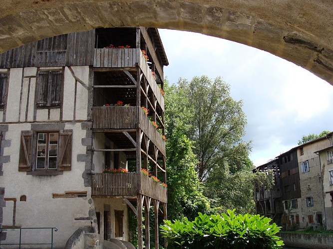
Dovecote, washhouse, shoeing loom... The Butte de Montgacon is one of many mottes in the region. Known since 1056, the Butte de Montgacon is built on the ruins of a castle that was demolished in 1633.
Technical Information
Altimetric profile
Starting point
Additional information
Distinctions
Listed PDIPR
Tips
- Views of the Cézallier, Monts Dore, Chaîne des Puys, Limagne, Livradois-Forez and Bois Noirs.
- Local heritage: statue of Notre-Dame-des-Moissons, traces of the old castle walls, cross, bread oven, washhouse and dovecote.
Updated by
Conseil départemental du Puy-de-Dôme - 02/06/2026
www.puydedome-tourisme.com/
Report a problem
Environments
Mountain view
Presence of livestock and guard dogs
Open period
From 01/01 to 31/12 daily.
Subject to favorable weather.
Contact
Phone : 04 73 86 89 80
Email : contact@plainelimagne.fr
Website : https://www.plainelimagne.com/
Location complements
North-east of Clermont-Ferrand, reach Maringues via Pont-du-Château. At the entrance to Maringues, take the D1043 towards Vichy. After 3.5 km, turn right onto the D55. Parking on the Place de Vensat.
Topo guides and map references
Topo guides references :
2013 - Randonnez-vous - Discovering the Puy-de-Dôme - Conseil départemental du Puy-de-Dôme
Reception complements
For your own safety, always take a bottle of water, a hat, warm clothing and footwear suitable for walking.
Depending on weather conditions, certain itineraries are not recommended in bad weather (fog) or are not practicable, or even forbidden, during the winter season.
Some sites are fragile, so stay on the marked trails. Avoid picking wild flowers and disturbing wildlife. Pick up your garbage.
Animals are not allowed on some routes.
Guidebook with maps/step-by-step
1/ From the start sign, go straight up the path to the left of the cross (view of Cézallier, Monts Dore, Chaîne des Puys, Limagne). At a water tower, turn left around the Montgacon hill and continue to the first Montgacon farm. Climb the grassy path to the top of the hill: statue of Notre-Dame-des-Moissons; traces of the old castle walls and panoramic view. Descend to the farm.
2/ Continue through the village. At the last houses, go straight down the asphalt road (view of Livradois-Forez and Bois Noirs). At a junction of 4 paths, fork right. As you approach the first houses in the village of La Barbine, turn right. Drive through the village as far as the cross on the square (cross, bread oven and wash-house).
3/ Turn right onto the D43B and 300 m further on, take a track on the right which climbs up towards the hillock. Ignore a left-hand track and 50 m further on, at a T-junction, take the left-hand track. Continue straight ahead to return to Vensat (horseshoeing loom at the entrance to the village) and join the square (wash-house, bread oven and dovecote).
Proposed and managed by the Conseil départemental du Puy-de-Dôme - PDIPR.
Animals
Yes. Dogs must be kept on a leash due to the presence of herds.
Data author
