To see around
See more
Open
Close
Show
Show
Show
Show
Show
Show
Show
Show
Show
Show
Show

Oups... It would appear that Cirkwi does not have permission to use your location.

Description
Map
Steps
Points of interest
Ratings and reviews
See around

Track Menhir

Sentier du Menhir
Sentier du Menhir
Sentier du Menhir
Sentier du Menhir
Sentier du Menhir
Credit : Roquefort Tourisme

Description

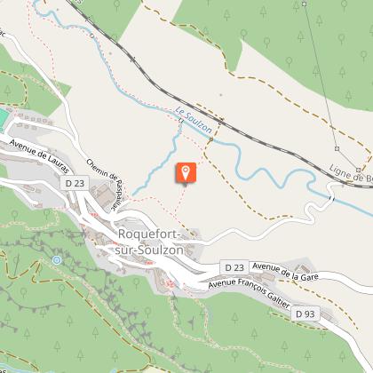
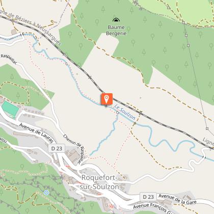
At the foot of the renowned Roquefort, a village with a long-standing cheese tradition, let yourself be charmed by a hiking loop which goes into the Soulzon valley through a refreshing undergrowth: a family getaway along the banks of the brook.1 - When you come out of the Tourist Office, turn right alongside the Conteynes wood to the drinking water fountain. Take the little path on the right, and pass through the housing estate on a tarmac road. Continue straight on to a large green and white building. 2 - Leave this on your right and head left behind the municipal workshops, then take a left down a little shaded pathway.At the end of this path, go left down to the crossroads with a wide path and turn left until you reach the sharp bends. Before crossing the river over the footbridge, you can take a return trip to the menhir which is further downstream. 3- Walk along the river on the bank opposite the menhir to the second footbridge.Cross the river again. After 300 m and a small slope, turn left to get back onto the road. 4 - Cross this road to take a path up to the Tourist Office through the Conteynes wood.

Technical informations

This circuit was updated on: 21/02/2024
3.4 km
1 h
max. 550 m
min. 436 m

Altimetric profile

Starting point

Lat : 43.981282Lng : 2.981621

Steps

image du object
1

Buissière

La buissière est constituée d'une double haie de buis. Ici, dans sa première partie, le côté droit a été détruit pour permettre un passage plus aisé. Mais les vents dominants sont encore bien freinés par la haie restante. Dans sa seconde partie, la buissière est intacte. Ce type de voie de communication est commun sur les causses, où le climat est rude et contrasté. Les troupeaux y sont protégés du vent, de la neige, et de la chaleur... et pas de moyen de s'échapper de ce "tuyau" !Les hommes, les chars, les carrioles empruntaient également ces chemins pour les mêmes raisons.Liaisions entre hameaux, pâtures, bergeries, points d'eau, les buissières témoignes des modes d'utilisation des espaces agricoles.Information : La Pyrale du buis est active de mai à octobre, les chenilles mangent les feuilles des buis et ainsi les dénudent. Elles descendent des arbres et se déplacent grâce à des fils (phénomène gênant en randonnée mais sans danger).

- Parc naturel régional des Grands Causses -
Consulter
image du object
2

Menhir du Soulzon

Cette grosse pierre aux formes arrondies de plus de 3 mètres de haut est communément appelée dans la région "menhir". En fait aucune caractéristique liée à un menhir authentique n'a été mise en évidence (un menhir est une pierre longue dressée par l'homme, et date de - 3500 à - 2000 ans avant J-C).Les interprétations diffèrent à son sujet : s’agit-il d’un simple vestige de l’éboulis du Combalou sur lequel on aurait gravé une croix pour en faire, par exemple au Moyen Âge, une borne limitrophe entre les communautés de Montclarat et de Tournemire ? Ou s’agit-il plutôt d’un ancien menhir ayant fait l’objet d’une christianisation (2 croix profondemment gravées côte à côte) comme cela fut fait pour tant d’autres ?

- Parc naturel régional des Grands Causses -
Consulter

Points of interest

image du object

Buissière

A buissière is a protective pathway made of two rows of box trees. In this case, the right side of the first part of the hedge has been removed in order to allow an easier passage. Nevertheless, the remaining hedgerow is still efficient against the prevailing winds. The other side of the buissière is still intact. This means of traversing the Causses is still used, because of the harsh and contrasted climate – very hot in summer and freezing in winter. In the buissière, the sheep flocks are sheltered from wind, snow and heat...No way to escape from this system of “channels”! People and carts also used to take these pathways for similar reasons. As connections between hamlets, grazing lands, sheepfolds and water ponds, buissières bear witness to the use of the pastoral areas.Information : Box tree moths are active from May to October. During the caterpillar phase, they feed on the leaves of box trees. They crawl down trees and move on long silken threads, although these threads are annoying when hiking they do not pose any health risk

- Parc naturel régional des Grands Causses -
Consulter
image du object

Soulzon Menhir

This large stone with rounded shapes is over three metres high and is often referred to as a “menhir”, although no features corresponding to an authentic menhir has been identified (a menhir is a large upright standing stone erected by man between 3500 and 2000 BC). Different interpretations have been given about its origins: is it a mere remnant of one of the Combalou's many fallen rocks, upon which a cross was carved in medieval times to turn it into a territorial marker, a boundary stone for instance, between the Montclarat and the Tournemire communities? Or is it an ancient menhir that was Christianised (2 crosses deeply engraved next to each other) as so many other megaliths were?

- Parc naturel régional des Grands Causses -
Consulter

Additional information

Departure

Roquefort Tourist Office

Arrival

Roquefort Tourist Office

Ambiance

You will see on the creek bank an impressive 3 m metre high stone stuck in the ground. Different interpretations have been given about it: is it a mere remnant of the Combalou's  fallen rocks, upon which two crosses were carved in the medieval times to turn it say, into a boundary stone between the Montclarat and the Tournemire communities? Or is it an ancient menhir that was Christianised as so many other megaliths were? In any case, this stone is an enthralling excuse to explore the Soulzon valley throughout a maze of rocks and lush vegetation.

Access

Roquefort-sur-Soulzon, à 25 km au Sud-Ouest de Millau par les D 992, D 999 et D 23. A 14 km de St-Affrique par la D999 en direction de Millau. Bifurquer à droite après Lauras (D23).

Advised parking

Tourist Office

Public transport

Travel by bus or train: lio.laregion.fr/carpooling : BlaBlaCar, Rézo Pouce, Mobicoop, Idvroom, LaRoueVerte, Roulez malin

Advice

Box tree moths are active from May to October. During the caterpillar phase, they feed on the leaves of box trees. They crawl down trees and move on long silken threads, although these threads are annoying when hiking they do not pose any health risk

Is in the midst of the park

This itinerary is located in the World Heritage zone Causses and Cévennes, mediterranean agropastoral cultural landscape.

Data author

Ratings and reviews

To see around
See more
Open
Close
Show
Show
Show
Show
Show
Show
Show
Show
Show
Show
Show