Alert
Alerts
Type of practice
Walking
Easy
2h30mn
Presentation
Description
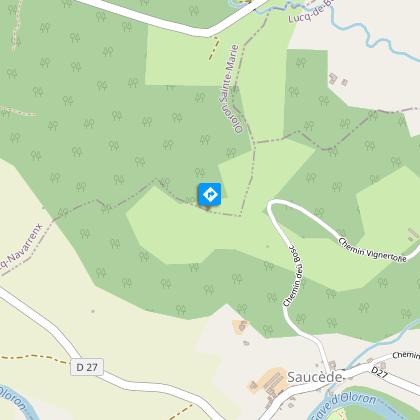
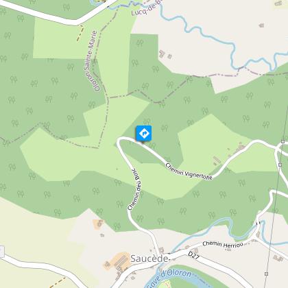
Map
Steps
Ratings and reviews
See around
N°93 - Entre gave et coteaux


Description
The name Saucède appears to originate from the willow trees ("saules" in French) that grow along the banks of the Gave. In the past, basket weavers would come to gather these willows to make baskets.
Technical Information
Walking
Difficulty
Easy
Duration
2h30mn
Dist.
7.7 km
Type of practice
Walking
Easy
2h30mn
Show more
Altimetric profile
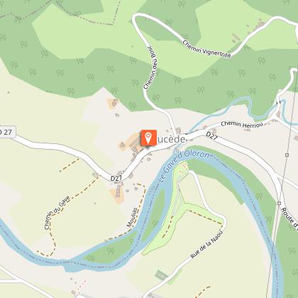
Starting point
7 Route du Bourg
,
64400
SAUCEDE
Lat : 43.2687072Lng : -0.6868062
Steps
Additional information
Balisage
Yellow
Deux traits jaunes
Typologie de l'itinéraire
Loop
Durée moyenne de l'expérience
2 to 3 hours
Thèmes
Natural
Data author

proposed by
Communauté de Communes du Haut-Béarn
12 place Jaca 64400 Oloron-Sainte-Marie Cedex France
Ratings and reviews
To see around