Alert
Alerts
Le Lauzet-Ubaye - Rousset (TSP Gravel)
Description
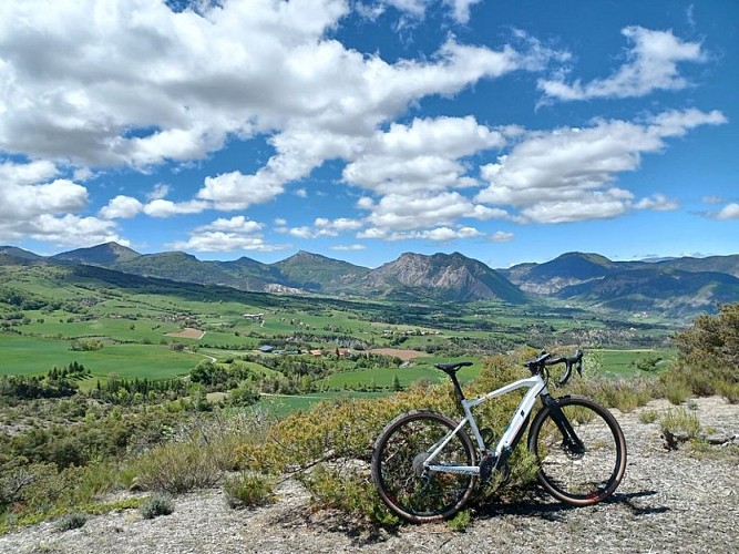
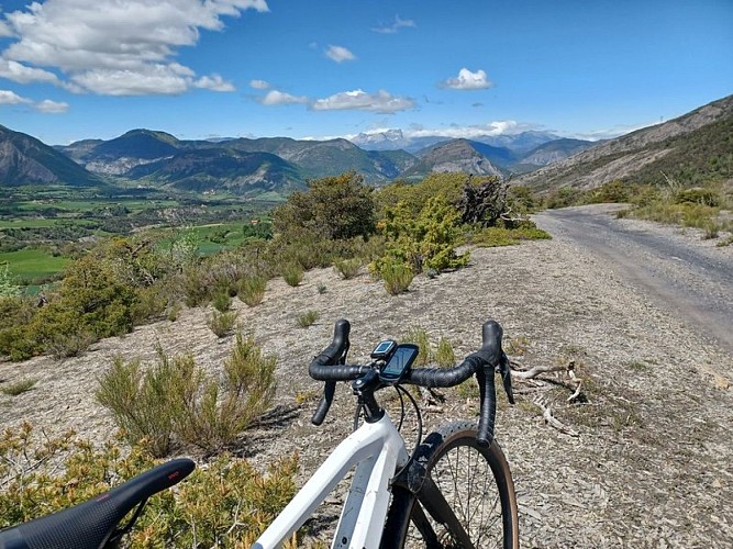
The descent into the "terres noires" certainly has the "wow" factor; the view from the Fonteniers ridge is exceptional.** Due to a technical problem, the actual altitude difference on this stage is around 800m, and not 3000m as stated in the route description.
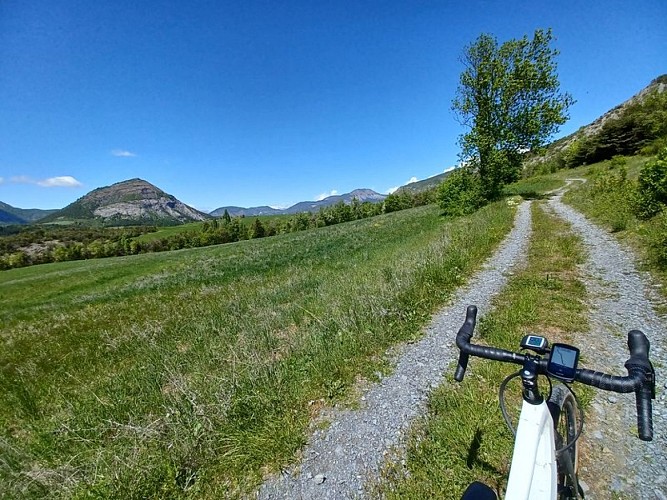
1) At the rafting centre, take the path on the right. Turn left uphill at the D900 road. (/!\ straight on for 4.5 km on this busy road) 2) At the start of a straight stretch, turn right downhill towards Villaret. At the hamlet, continue along the track. (/!\ presence of rocks on the descent). At the "Femme Morte" pass, turn left onto the path towards Bologne. Once you reach te first houses, leave the path and take the road opposite. At the junction with Chemin de la Tire, head down the road. Then head towards Le Lautaret.3) At Le Lautaret, cross the D900 B /!\ . Cross the hamlet on the main road. Turn left onto rue Yves Rechner. At Route des Garreaux, go straight on and ascend towards the "chemin de la diligence". At the road, continue straight ahead on the Chemin de la Diligence. /!\ stones. At the chapel on the D900, continue straight on.4) At Monclar, turn left onto the D207 towards the resort of Saint-Jean. At the bottling plant, turn right towards La Miande Les Vials Serre Nauzet. Turn right at Domaine de l'Adoux. At Serre Nauzet, go straight on, then at the fountain, take the track on the left towards Château de Montclar. 5) At the clearing, /!\ take the side track down to the right. At the D900, continue straight ahead towards "sous la Roche" and cross the hamlet. At Sainte-Anne, go straight ahead and descend onto the road and then the track. Above the hangar, turn left and continue straight ahead on the track. Stay on the main path ! At Villaudemar, turn left down the road.6) On the D900c, turn right towards the Gorges de la Blanche. 350m further on (before a bend at the FJ body shop), turn left down the "Chemin du gué du moulin" track towards "Plan des Sagnières". At "Plan des Sagnières", take the road on the right, then continue on the right towards "Thuriers". At route D1, turn left towards Saint-Martin lès Seyne. At Rougon, leave the Ladre road and turn right onto the Col de Saint-Martin road.7) Above the Col Saint-Martin, continue straight ahead on the track towards Chabanon crête des mélèzes then after 150m turn right. (/!\ The path then descends relatively steeply, with ruts). 8) At route D1, go left then right into the marl. At the junction, continue along the main road opposite. At the bend continue right on the grassy side track (/!\ path hard to see). At the D210 turn right. Go through Chaumenc. 9) After the bridge, take the small road on the right towards Champ d'Arène. After the post box, turn left onto chemin du Touron. Turn left at the E6 DFCI track, In Bréziers, turn right onto Rue du Clos de Barou. Continue straight ahead (D310), then turn right at the hairpin to join the D951. Turn right down to the Durance river.10) Before the canal bridge, take the road on the right towards Gréoliers. In Greoliers, go straight on at the fountain. Turn left at the D900c /!\ Cross the Durance and join the rond-point du barrage,
Technical Information
Altimetric profile
Starting point
Additional information
Advice
Avant de partir vérifiez l’état de votre vélo, surveillez la météo et équipez vous selon la saison et la durée de votre randonnée.Vous évoluez en zone de montagne, privilégiez des pneus de Gravel large, des freins à disque hydraulique et maitrisez votre vitesse. Prudence dans la descente du Hameau de Vière et pour rejoindre la vallée de la Durance.Pour plus de confort faites appel à un moniteur de cyclisme Secours : 112
Herd protection dogs
In mountain pastures, protection dogs are there to protect the herds from predators (wolves, etc.). When I hike I adapt my behavior by going around the herd and pausing for the dog to identify me. Find out more about the actions to adopt with the article "Protection dogs: a context and actions to adopt". Tell us about your meeting by answering this survey.
Public transport
SNCF: Chorges station, Embrun www.sncf-connect.com/bus : Valserres, La Bâtie Neuve, Chorges, Puy Saint Eusèbe, Puy Sanières, Embrun Baratier, Les Orres, Remollon, Theus, EspinasseMarseille-Briançon : (LER29) Marseille, Nice : Lignes Express Régionales (LER) +33 (0)809 400 415Grenoble : Transisère +33 (0)4 26 16 38 38Gap-Barcelonnette (LER535) Carpooling area : Rond point des Orres - 05200 BaratierPlane: Marseille Provence Airport (188km) - +33 (0)820 811 414Grenoble Alpes Isère Airport (158km) - +33 (0)4 76 65 48 48Lyon Saint Exupéry Airport - (203km) +33 (0)826 800 826Turin Caselle Airport - (178km) + 39 011 567 63 84
Access
From Grenoble, Lyon, Paris : RN 85 or RN 75. At Gap, take the RN 94 towards Briançon. From Marseille, Montpellier A51 to La Saulce, continue towards Tallard (D942) and Briançon (RN 94).
Arrival
Rousset
Ambiance
An excursion to the Alpes-de-Haute-Provence. From Ubaye, head inland for the Vallée de la Blanche. A series of climbs and descents punctuates the journey through this great natural realm. The last climb is the longest, with a grand finale on the Fonteniers ridge.
Departure
Le Lauzet-Ubaye
Data author
