Alert
Alerts
l'Aupillon


Description
This long and highly technical route, for experienced trail runners only, takes in mountain pastures and ridges.
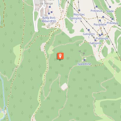
From the Les Orres 1650 snow line, ascend and follow the track that veers to the left shortly after pylon no. 2 of the Prélongis chairlift. Follow it as far as Les Orres 1800 and take a shady single track that will take you to the Lac de Sainte-Marguerite path, passing the ruins of the Eyssalette hut.
You will gradually emerge into the mountain pastures crossed by streams to reach Sainte-Marguerite Lake.
Now things start to get serious! Turn left onto a rocky path that twists and turns for almost 2 kilometres and leads to the Col de l'Aupillon.
Climb right to the Pic de l'Aupillon at 2916m and admire the view of the Alpes de Haute-Provence. Return to the path and take a single track along the ridge to reach the top of the Vallon de Rémolon.
Reach the top of the Pousterle chairlift via the hiking trails (11). The descent is by chairlift or on foot (several possible routes: consult the map at the top of the chairlift).
Technical Information
Altimetric profile
Starting point
Points of interest


Additional information
Public transport
Public transport: www.pacamobilite.fr
Advice
Consulter les conditions météo Prendre à boire et à manger S'engage sur des itinéraires adaptés à son niveau
Herd protection dogs
In mountain pastures, protection dogs are there to protect the herds from predators (wolves, etc.). When I hike I adapt my behavior by going around the herd and pausing for the dog to identify me. Find out more about the actions to adopt with the article "Protection dogs: a context and actions to adopt". Tell us about your meeting by answering this survey.
Advised parking
L'Estomac car park, Les Orres 1650
Access
From Embrun, take the D40 towards Les Orres 1650.
Arrival
Les Orres 1650, Les Orres
Ambiance
This long, highly technical route, for experienced trail runners only, takes you from mountain pastures to the ridge line. Start by discovering Sainte-Marguerite lake (2227m), where you can hear and see many marmots. The route then takes you to the Alpe du Verdun mountain, a high-mountain world of unspoilt flora. It ends with a superb traverse along the ridge below the Pic de l'Aupillon (2916m), the highest point in Les Orres.
Departure
Les Orres 1650, Les Orres
Data author
