Alert
Alerts
Loop 61 - Le Boscodon
Description
Notre Dame de Boscodon, a place steeped in history that inspires respect and tranquillity
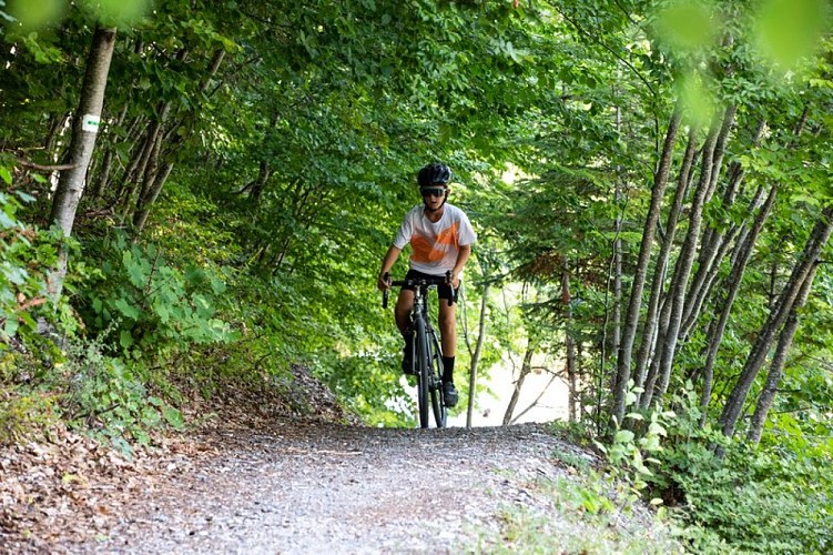
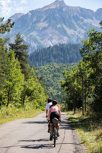
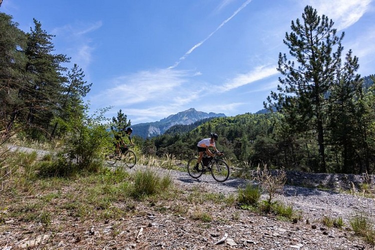
1) Opposite the lake (where the mountain bike trails start), reach the dam and turn left. Follow the course of the Durance. At the footbridge, cross the stream and turn right. Head along the left bank of the Durance, passing under the bridge. At the no-cycling sign, turn left to cross the business park. After the footbridge, continue along the dam towards Crots. At the end of the dam, turn 190 degrees left.2) Just before the N94, turn left into the cycle lane and cross the road through the tunnel. At the end of the tunnel, turn right. At the D90, turn left (/!\ for cars) At the crossroads, turn right, passing Crots town hall. At the Château de Picomtal roundabout, turn left.3) Before the bridge (Bellegrave stream), turn left then right along the stream to the bridge. At the bridge, turn right.4) At La Chènevières (at the stop sign), turn right up the road. At the entrance to the impasse de la Combe, turn right. Continue to the crossroads (recycling point) and turn left. After climbing the hairpin road, continue on the track.5) At the DFCI track H18, continue straight on the DFCI H16 towards "la montagne". At the DFCI track H15, turn left. Then continue straight ahead, leaving the Clos Besson forest road on your left. At the gîte de La Draye, continue straight ahead on the road. At the fountain, turn left towards Boscodon.6) After the "grande cabane" bridge, take the right-hand path down to the "Clos Joubert" forest road. Turn right at Boscodon Abbey. " Au Marquis" (after the bridge over the Boscodon), take the track on the right (picnic area).7) Cross the road and descend the track opposite. At the road go downhill for 20 m, then take the left-hand path marked GR. In the hamlet of Beauvillard, turn left at the road and then left again at the chapel. After the La Cagnolle viewpoint, descend the path carefully (rocks, roots). (You can avoid this short stony stretch by staying straight on the road at La Chapelle.)8) At the road (in front of the sawmill), turn right. Continue straight ahead and cross the N94 /!\. Descend the gravel path and turn right. At Chantereine beach, turn right. After the "Manu" camp-site, turn left onto the dam and head up the Durance. Cross the business park to reach the left bank of the Durance. Go under the bridge, cross the footbridge and turn left. Return to the finishing point.
Technical Information
Altimetric profile
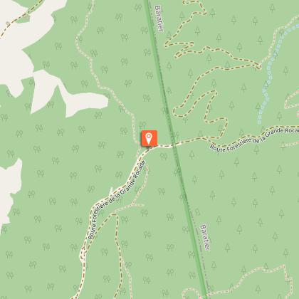
Starting point
Points of interest


Additional information
Public transport
SNCF: Chorges station, Embrun www.sncf-connect.com/bus : Valserres, La Bâtie Neuve, Chorges, Puy Saint Eusèbe, Puy Sanières, Embrun Baratier, Les Orres, Remollon, Theus, EspinasseMarseille-Briançon : (LER29) Marseille, Nice : Lignes Express Régionales (LER) +33 (0)809 400 415Grenoble : Transisère +33 (0)4 26 16 38 38Gap-Barcelonnette (LER535) Carpooling area : Rond point des Orres - 05200 BaratierPlane: Marseille Provence Airport (188km) - +33 (0)820 811 414Grenoble Alpes Isère Airport (158km) - +33 (0)4 76 65 48 48Lyon Saint Exupéry Airport - (203km) +33 (0)826 800 826Turin Caselle Airport - (178km) + 39 011 567 63 79
Advice
Avant de partir vérifiez l’état de votre vélo, surveillez la météo et équipez vous selon la saison et la durée de votre randonnée.Vous évoluez en zone de montagne, privilégiez des pneus de Gravel large, des freins à disque hydraulique et maitrisez votre vitesse. Prudence dans la descente du Hameau de Vière et pour rejoindre la vallée de la Durance.Pour plus de confort faites appel à un moniteur de cyclisme Secours : 112
Herd protection dogs
In mountain pastures, protection dogs are there to protect the herds from predators (wolves, etc.). When I hike I adapt my behavior by going around the herd and pausing for the dog to identify me. Find out more about the actions to adopt with the article "Protection dogs: a context and actions to adopt". Tell us about your meeting by answering this survey.
Advised parking
Embrun lake car park
Access
From Grenoble, Lyon, Paris : RN 85 or RN 75. At Gap, take the RN 94 towards Briançon. From Marseille, Montpellier A51 to La Saulce, continue towards Tallard (D942) and Briançon (RN 94).
Arrival
Embrun
Ambiance
Follow in the footsteps of the Challais monks, extraordinary builders and sheep breeders... these monks were practitioners of transhumance between abbeys and priories. This Gravel loop will introduce you to the monument, the rushing torrent and the forest with a common name: Boscodon, meaning 'rich forest in the mountain'.
Departure
Embrun
Data author
