Alert
Alerts
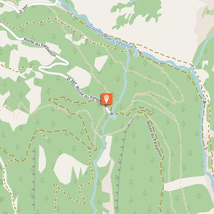
Loop 27 - The Col du Parpaillon


Description
A legendary pass, Le Parpaillon (2637 m) is one of the last remaining examples of what a major Alpine pass might have looked like before the era of cars and tarmac.
1) From the village square, take the road leading from the war memorial. At "Champ La font 2", climb the gravel track towards the hamlet of La Chalp. Continue straight ahead on the main road. At Travers du Moulin go straight up the track.2) At the bend go straight on (stony climb). At the bend in the road (D39T), turn right. At the picnic area, continue straight ahead. 3) At the Parpaillon tunnel, go through the tunnel (you will need lights) and turn around to go back down to Crévoux. Follow the route taken on the outward journey back to the village of Crévoux.
Technical Information
Altimetric profile
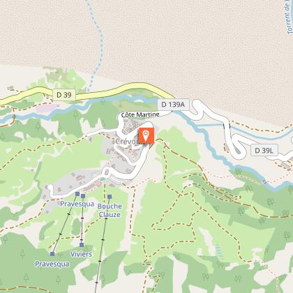
Starting point
Points of interest
Additional information
Public transport
SNCF: Chorges station, Embrun www.sncf-connect.com/bus: Valserres, La Bâtie Neuve, Chorges, Puy Saint Eusèbe, Puy Sanières, Embrun Baratier, Les Orres, Remollon, Theus, EspinasseMarseille-Briançon : (LER29) Marseille, Nice : Lignes Express Régionales (LER) +33 (0)809 400 415Grenoble : Transisère +33 (0)4 26 16 38 38Gap-Barcelonnette (LER535) Carpooling area : Rond point des Orres ‒ 05200 BaratierPlane : Marseille Provence Airport (188km) - +33 (0)820 811 414Grenoble Alpes Isère Airport (158km) - +33 (0)4 76 65 48 48Lyon Saint Exupéry Airport - (203km) +33 (0)826 800 826Turin Caselle Airport - (178km) + 39 011 567 63 60
Advice
Avant de partir vérifiez l’état de votre vélo, surveillez la météo et équipez vous selon la saison et la durée de votre randonnée.Vous évoluez en zone de montagne, privilégiez des pneus de Gravel large, des freins à disque hydraulique et maitrisez votre vitesse. Prudence dans la descente du Hameau de Vière et pour rejoindre la vallée de la Durance.Pour plus de confort faites appel à un moniteur de cyclisme Secours : 112
Herd protection dogs
In mountain pastures, protection dogs are there to protect the herds from predators (wolves, etc.). When I hike I adapt my behavior by going around the herd and pausing for the dog to identify me. Find out more about the actions to adopt with the article "Protection dogs: a context and actions to adopt". Tell us about your meeting by answering this survey.
Advised parking
Village Square, Crevoux
Access
From Grenoble, Lyon, Paris : RN 85 or RN 75. At Gap, take the RN 94 towards Briançon. From Marseille, Montpellier A51 to La Saulce, continue towards Tallard (D942) and Briançon (RN 94).
Arrival
Crévoux
Ambiance
Discover an unspoilt, pure and wild mountain where the marmots will announce your arrival. Like many roads at the time, this mountain road was built by the military. It's not unusual to come across road bikes that have lost their way after being misled by the classification as a departmental road!
Departure
Crévoux
Data author
