Alert
Alerts
Walking route: Tour of Pointe d'Ardens from Prétairié


IGN cards


Description
A lovely hike in the Abondance mountain pastures, with lovely views of Mont de Grange, the Valon de Pertuis and the Piron cliffs. You'll also reach the Cubourré site and the Plagnes lake, a Unesco Global Geopark geosite.
This hike takes you past alpine chalets and beautiful mountain scenery.
Starting from Prétairié, you climb through the undergrowth to reach the mountain pastures and chalets of Entre Deux Pertuis. The Pointe d'Ardens rises to an altitude of 1959 m.
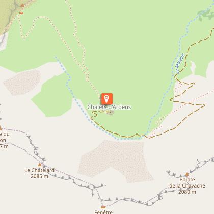
After a good climb, you can then descend to the chalets d'Ardents, at the foot of the Pointe du Piron cliffs, where you may even spot marmots below!
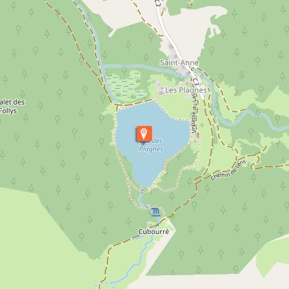
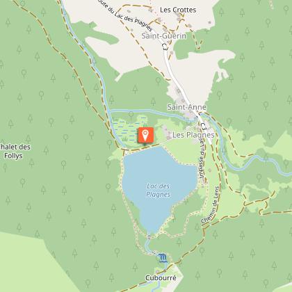
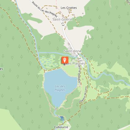
You'll then descend to the Cubourré site and Lac des Plagnes, a UNESCO-listed Geopark. Didactic panels explain the geological evolution of the site.
At the end of the lake, you'll reach Prétairié via a path and then a forest trail.
Technical Information
Altimetric profile
Starting point
Steps
Points of interest


Date and time
- From 01/06/2026 to 15/10/2026
Additional information
Contact
Phone : 04 50 73 02 90
Email : abondance@ot-peva.com
Website : https://leman-mountains-explore.com
Open period
From 01/06 to 15/10 daily.
Check with tourist offices in advance to find out the current access conditions.
Subject to favorable snow and weather conditions.
Updated by
Office de Tourisme Leman Mountains Explore - 24/11/2025
leman-mountains-explore.com
Report a problem
Environments
Lakeside or by stretch of water
Forest location
Lake view
Mountain view
Village 2 km away
Waterside
Type of land
Stone
Ground
Grit
Not suitable for strollers
Topo guides and map references
Topo guides references :
Hiking maps and guidebooks are available for purchase at tourist offices throughout the Evian and Abondance Valley region.
Map references :
- Map guide to 65 walks and hikes in the Evian region and Abondance valley
- Map of walking routes in the Portes du Soleil area in France and Switzerland
- IGN TOP 25 No. 3528 ET Morzine Chablais Massif Portes du Soleil
Location complements
The start of the hike is a 10-minute drive from the center of Abondance village. Follow signs for Prétairié.
Reception complements
Whatever your hike, remember to take cereal bars, sufficient water, sunglasses, sun cream, a small first aid kit, as well as clothes adapted to your outing according to the season and the weather forecast.
Tricky passages
Fat climb from Gurfève to Entre Deux Pertuis.
Guidebook with maps/step-by-step
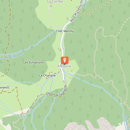
0/ "Prétairié" parking lot.
1/ Follow signs for "Entre Deux Pertuis" on the left. Climb through the forest, ignoring all junctions. When you reach the mountain chalets, continue upwards, following the signs for "Col d'Entre Deux Pertuis".
2/ At the intersection before the pass, take the left-hand path and follow signs for "Les chalets d'Ardens". At the chalets, follow signs for "Cubourré". Descend the small mountain cirque, and at the intersection after the stream, take the left-hand path through the forest towards "Lac des Plagnes". Follow the lake on the left.
3/ At the end of the path, turn left at the intersection and follow the signs for "Pré Chapeau" and "Le Cazot". At a small clearing, turn left and head slightly uphill to an intersection. Then turn right and begin the descent into the woods.
4/ At the next junction, turn right again. Continue downhill to the next junction, then turn right to reach the starting point.
Animals
Yes. Dogs must be kept on a leash due to the presence of livestock and wildlife.
