Alert
Alerts
Hiking at Lake Clair
IGN cards


Description
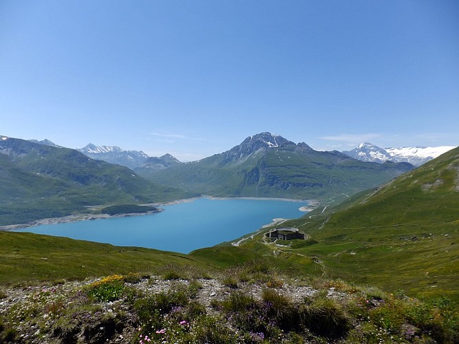
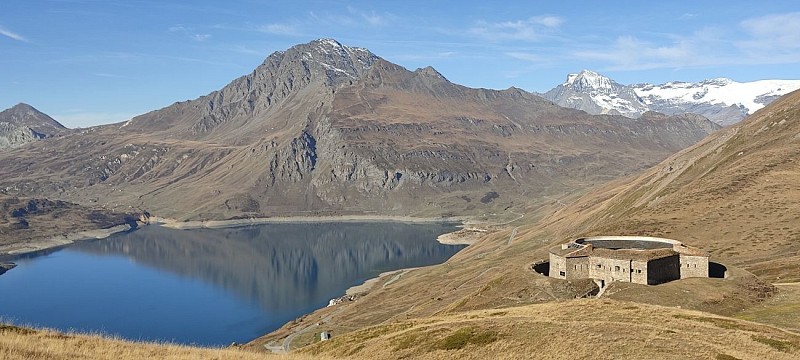
The Mont Cenis plateau is a place steeped in history, home to many forts,
including Fort Ronce, with its astonishing circular architecture. From this
watchtower, discover a breathtaking view of Lake Mont Cenis and the
surrounding peaks.
This plateau is an historic crossing point between France and Italy. Since it
was formerly a protected border, many military works have been built there.
Fort Ronce is your first stop. The door is open, come on in and picture the
life of the Italian soldiers stationed here all year round, under the watchful
eye of the French soldiers stationed across the way! Like them, enjoy the
breathtaking view of the lake with turquoise waters and the glaciers of the
Vanoise.
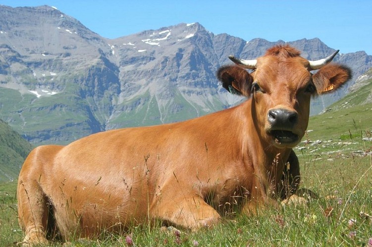
Then continue your ascent on the gently sloping path to Clair lake, whose
waters are fed by glacial melt pouring in from the glaciers that overlook it.
The water's none too warm... Peace and quiet reign here, interrupted only
by the tinkling of cowbells and the whistling of the playful marmots. You'll
come across a few rock blocks scattered along the path, so take care as you
navigate through them.
As you turn back, towards the sun reflected on the distant waters of Mont Cenis
lake, a burst of colours greets your enchanted eyes: alpine flowers that only
grow at this altitude, such as violets, bluebell campanulas, and yellow trolles.
Technical Information
Altimetric profile
Starting point
Points of interest


Date and time
- From 15/06/2026 to 15/10/2026
Additional information
Open period
From 15/06 to 15/10 daily.
Subject to favorable snow and weather conditions.
Updated by
Communauté de communes Haute Maurienne Vanoise - 23/12/2025
www.cchautemaurienne.com
Report a problem
Environments
Lakeside or by stretch of water
Mountain view
Waterside
Lake view
Mountain location
Presence of livestock and guard dogs
Contact
Phone : 04 79 05 99 06
Email : info@hautemaurienne.com
Website :
https://www.haute-maurienne-vanoise.com
http://www.cchautemaurienne.com/jy-vais-en
Type of land
Stone
Ground
Not suitable for strollers
Location complements
I'll get there by bus: Line 5 - Les Fontainettes stop (line equipped with a 5-seater bike rack).
By car: At the Col du Mont-Cenis, park in the Plan des Fontainettes parking lot near the pyramid. The trail starts on the other side of the road.
Topo guides and map references
Topo guides references :
Map and booklet "Haute Maurienne Vanoise. 115 walks and hikes - 35 trail routes. For all levels" (sold for €10 in Tourist Offices) - Red route n°91
Map references :
Map IGN 3634OT - Val Cenis
Reception complements
The duration of hiking trails is calculated using reference paces: 300 m/h ascent, 500 m/h descent and 4 km/h on the flat.
As hazards may occur at any time on the routes, the GPX tracks provided are not contractual. They are given for information only. Riders use them at their own risk, depending on their level of technological proficiency and their understanding of the terrain.
Guidebook with maps/step-by-step
To guide you in the field, consult the "step-by-step" directional diagram provided in pdf.
Animals
Yes. Pets allowed on leash only.
Data author
