Alert
Alerts
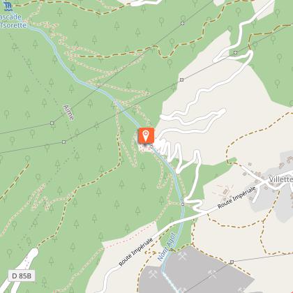
Hiking route : La Glière footpath
Description
A walking path along a stream that has been developed to combat the floods that used to regularly threaten the village of Villette
Nant Agot was often a threat for its frequent floods. The facilities built by man have made it possible to contain the whims of the stream.
Technical Information
Altimetric profile
Starting point
Additional information
Environments
Mountain view
Forest location
Mountain location
Updated by
Office de Tourisme de la Grande Plagne - 31/03/2026
www.la-plagne.com
Report a problem
Open period
From 01/01 to 31/12 daily.
According to snow cover.
Type of land
Stone
Ground
Contact
Phone : 04 79 55 67 00
Email : info.vallee@la-plagne.com
Website : https://www.la-plagne.com/la-plagne-vallee
Reception complements
FOR YOUR PLEASURE AND SAFETY
Safety rules
- Check the weather forecast before you leave.
- Avoid going alone. Let someone know that you are leaving and your planned route.
- Remember to drink, eat and take breaks throughout the hike.
Equipment
- Wear good shoes and suitable clothes for the mountains.
- Don't forget to take: sun cream, a hat/cap, sunglasses, warm clothes and rain wear, a mobile phone in case of problems.
- Take an IGN map with you. This map is given as an indication, it does not replace the IGN maps.
Best practices
- Stay on the marked paths and avoid the hayfields.
- Respect the environment.
- Watch out for animal herds, keep your dog on a lead.
- Take your rubbish away with you.
In case of accident: ring 112 or 18
Weather forecast: 32 50
Guidebook with maps/step-by-step
0/ Start from La Glière car park
1/ At the bridge, cross Nant Agot and take the path on the right that climbs into the forest.
2/ Join the "balcony" path (signposted), then cross the stream on the right and follow the path down to a forest hut. Go past the oratory and join the road.
3/ Return to the starting point.
Animals
Yes
Data author
