Alert
Alerts
Tour of Mont Bénand from La Beunaz chapel

Description
A family-friendly and slightly sporty walk through pastures and villages. Enjoy the beautiful views of the Mémises, Mont César and the Dent d'Oche, as well as Lake Geneva.
This discovery trail allows you to discover the natural and cultural riches of Mont Benand.
Magnificent views follow one another over Lake Geneva, the Jura, the Mémises, the Bernex valley with its peaks (Dent d'Oche, Mont César, Pic de Boré, Pelluaz, Chesnay) and the Gavot plateau. Classified as a Unesco Geopark site, explanatory panels help you discover all the treasures this area has to offer. You'll discover the Croix du Bénand and, with a little detour, the Mont Bénand barns, witnesses to the past and to life in the mountain pastures of yesteryear.
The tour of Mont Bénand is a very busy itinerary, with the presence of herds. For this reason, dogs must be kept on a leash and droppings must be collected. Please keep to the paths and keep your garbage in a safe place.
Technical Information
Altimetric profile
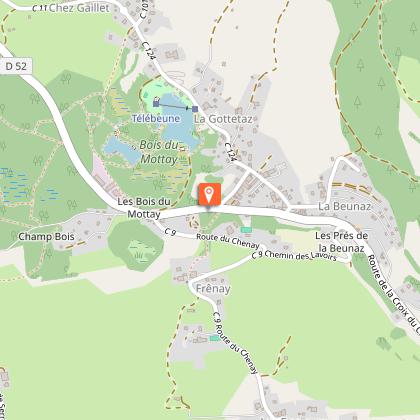
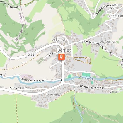
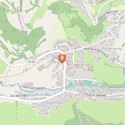
Starting point
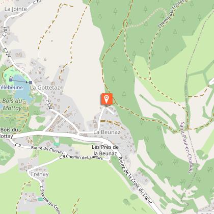
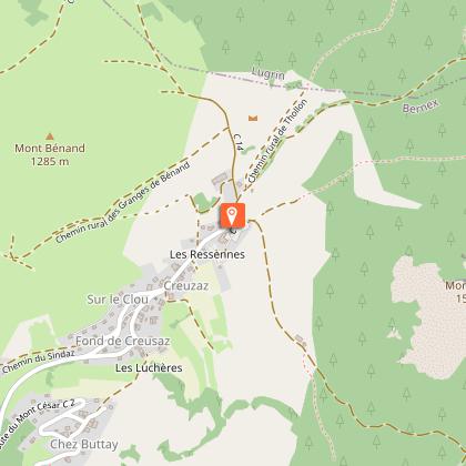
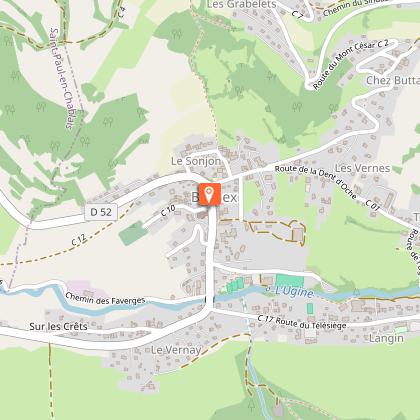
Steps
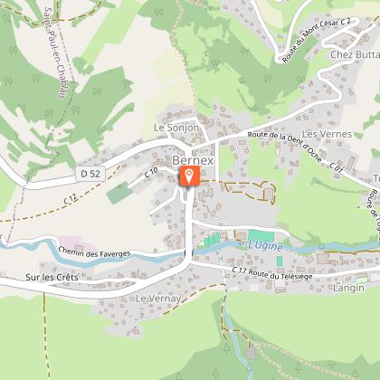
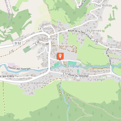
Points of interest

Date and time
- From 01/04/2026 to 30/11/2026
Additional information
Tips
Discover the geology of the area with the Geopark of Chablais: explanatory panels are on the route.
Sustainable tourism
The tour of Mont Bénand is a much-used itinerary with the presence of herds. To respect farming practices, natural areas and wildlife, please keep your dogs on a leash and pick up after them. Keep and sort your garbage, stay on the paths and close the fences.
Updated by
Office de Tourisme Leman Mountains Explore - 12/12/2025
leman-mountains-explore.com
Report a problem
Environments
Lake view
Mountain location
Presence of livestock and guard dogs
Sensitive Natural Area
Village 2 km away
Open period
From 01/04 to 30/11.
Accessible outside the snowy period and depending on the weather conditions. Please check with the Tourist Office beforehand to find out the current access conditions.
Contact
Phone : 04 50 73 60 72
Email : bernex@ot-peva.com
Facebook : https://fr-fr.facebook.com/officedetourismebernex/
Topo guides and map references
Topo guides references :
On sale in the tourist offices of the pays d’Évian.
Map references :
TOP 25 N°3528 ET
Type of land
Stone
Ground
Hard coating (tar, cement, flooring)
Location complements
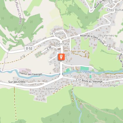
Parking at the hamlet of Creusaz, Bernex village center and Lac de La Beunaz.
Reception complements
Be properly equipped and shod.
Guidebook with maps/step-by-step
0/ Start from the chapel of Notre-Dame des 7 douleurs.
1/ Follow the road down to the crossroads and follow the signs for "Les Faverges". Then cross the hamlet and head up towards Bernex. You'll pass a pizzeria. Continue along this road, past the house and take the left-hand path.
2/ This path takes you through the fields to the entrance to Bernex village. Go down to the traffic circle, then turn left. Take the road that climbs to the left, past the school. Follow the road until you reach a field. Follow the path up through the field to Bénand.
3/ At the small crossroads, take the upward road opposite (Impasse du vieux village) and turn right after the second house. Follow the narrow road to a private passage. Take the track on your left. Continue across the field until you reach another road.
4/ Take the small road in front of you and climb up. You'll pass the Creusaz chapel. Keep climbing until you reach the end of the road and a farm. Follow the path through the mountain pastures. Ignore any forks in the road. At the Bénand cross, take the right-hand path. Continue into the woods. At the end of the forest, ignore the intersection and continue on the path in front of you. You'll come to a small farm.
You can stop off at the cross to admire the magnificent panorama.
5/ At the bend, take the right-hand track and continue downhill through the woods. You'll come to a small road and the appearance of houses. Continue downhill until you reach a crossroads. Continue downhill on "Route de la plage". At the stop sign, turn left. Follow the road for 500m and you'll reach your starting point.
Animals
Yes. Pets allowed on a lead only because there are herds.
