Alert
Alerts
Puys de Combegrasse and narse d'Espinasse
Description
This educational loop leads from the puy de Combegrasse, a strombolian volcano, to the puy de l'Enfer, whose pozzolan quarry enables us to study the heart of a volcano, and to the narse d'Espinasse, a peat bog in an explosion crater.
Technical Information
Altimetric profile
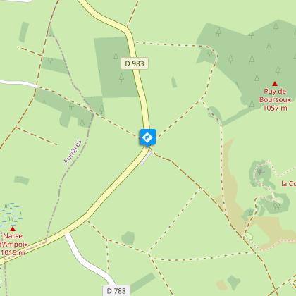
Starting point
Steps
Additional information
Distinctions
Listed PDIPR
Tips
- Le puy de l'Enfer.
- Views of the Chaîne des Puys and the Sancy massif.
- Small heritage site (watering place, wash-house).
- La Veyre stream.
- Siberian ligwort nature reserve.
- The Espinasse narse.
- View of the Forez peaks.
Updated by
Conseil départemental du Puy-de-Dôme - 02/06/2026
www.puydedome-tourisme.com/
Report a problem
Environments
Mountain view
Open period
From 01/01 to 31/12 daily.
Subject to favorable weather.
Contact
Phone : 04 73 79 37 69
Email : aydat@clermontauvergnevolcans.com
Website : https://www.clermontauvergnevolcans.com
Topo guides and map references
Topo guides references :
2014 - Randos à croquer - Discovering the Puy-de-Dôme - Conseil départemental du Puy-de-Dôme.
2019 - Randos volcans - Discovering the Puy-de-Dôme - Conseil départemental du Puy-de-Dôme.
Type of land
Ground
Location complements
From Clermont-Ferrand, follow signs for Bordeaux on the N89 and D2089. In Randanne, turn left onto the D983. Parking lot 2 km away.
Reception complements
For your own safety, always take a bottle of water, a hat, warm clothing and footwear suitable for walking.
Depending on weather conditions, certain itineraries are not recommended in bad weather (fog) or are not practicable, or even forbidden, during the winter season.
Some sites are fragile, so stay on the marked trails. Avoid picking wild flowers and disturbing wildlife. Pick up your garbage.
Animals are not allowed on some routes.
Guidebook with maps/step-by-step
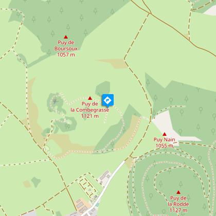
1/ From the start sign, take the stony path near the disabled parking area, ignoring the adjacent paths. As you go downhill, turn left onto the pozzolana path before the picnic area, and continue along the path which enters the pastures through gates and sluices and reaches the summit of the puy de Combegrasse (panoramic view, orientation table no.1). Continue along the ridge path to orientation table 2 (panoramic view). Make a U-turn for 150 m to the low point.
2/ Turn right and follow the downhill path marked by a small fence. At the end of the sluice, keep left, cross the pine wood and continue right along the grassy path. Go through the gate, back to the picnic area and return to the path at the start of the circuit. Turn left and then right at the road. Continue straight ahead until you reach another road.
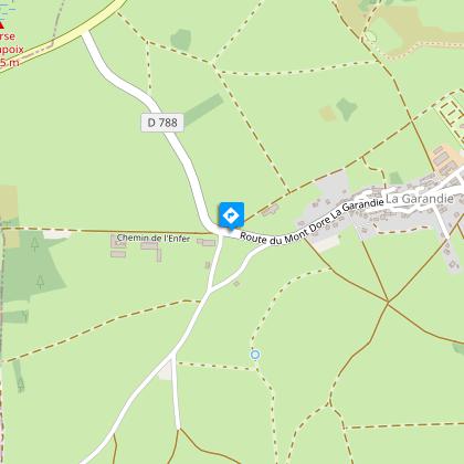
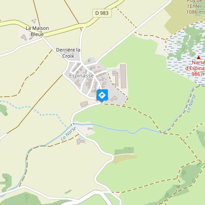
3/ Go right for 20 m, then cross the road and take the first track on the left near a farm building. At the crossroads, turn right and then right up the track. At the edge of the Puy de l'Enfer wood, keep left to follow the grassy path down to the narse (with a bird's-eye view of the narse). At the bottom of the descent, turn left, then immediately right twice in succession. At the junction of four paths, take the one on the right and climb up to a road.
4/ Turn right, cross Espinasse, keep right to pass a small cross and, at the fork, turn left to reach a road. Cross the road, continue straight ahead for 250 m and, at the crossroads, fork right. Follow this track, ignoring the adjacent paths (view of the Chaîne des Puys, Puy de Combegrasse), and continue straight ahead along a grassy path. At the road, turn right for 150 m, then left onto a pozzolana track between pastures. Ignore the adjacent paths; at the crossroads at the corner of the wooded plot, turn right and follow this path through meadows and woods to the road, which you cross (beware: fast-moving traffic) to get back to the starting point.
Proposed and managed by the Conseil départemental du Puy-de-Dôme - PDIPR.
Animals
No pets allowed, even on a leash, from May to October.
Data author
