Alert
Alerts
Le Pic de la Sauge
IGN cards


Description
Fancy a nice hike in the Bauges off the beaten track? The Pic de la Sauge offers an ideal alternative for those who love slopes, rocks and beautiful scenery. Come and discover the secrets of this little-known summit.
The first kilometer of the hike won't require too much effort, but it's only after crossing the river that things get serious.
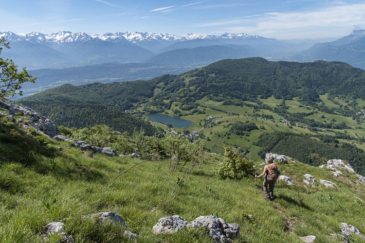
The trail leads into the Combe Noire, a remarkable beech-fir forest. It takes you under cliffs, from where a steep climb leads to the Rochers de Bévérau.
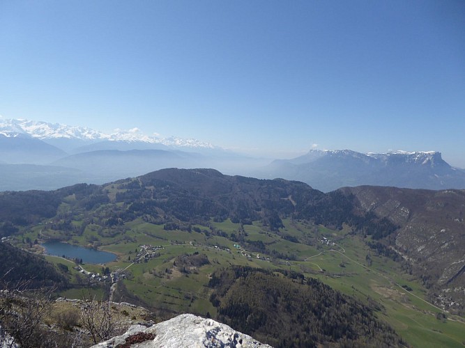
The magnificent scenery above is your reward. Below, the Lac de La Thuile nestles in the hollow of the mountains, and in the distance you can see Belledonne, the Chartreuse, and the Chambéry Valley overlooked by the Croix du Nivolet.
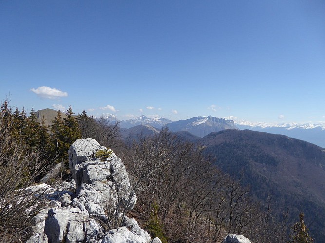
But the climb isn't over yet, and you continue on through a maze of rocks, looking for the yellow dots that point the way. A final steep climb takes you to the summit.
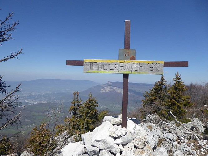
Here you're greeted by a cross and a second breathtaking view of Belledonne, the Chambéry Valley and the Bauges. Now you're invigorated for the descent.
Technical Information
Altimetric profile
Starting point
Date and time
- From 15/05/2026 to 31/10/2026
Additional information
Tips
After your hike, take a break at Lac de la Thuile. There's a small inn where you can quench your thirst.
Updated by
Grand Chambéry Alpes Tourisme - 14/10/2025
www.chamberymontagnes.com
Report a problem
Environments
Close to GR footpath
Mountain location
Pond within 5 km
Open period
From 15/05 to 31/10.
Subject to favorable snow and weather conditions.
Contact
Phone : 04 79 25 80 49
Email : accueil.savoiegrandrevard@chamberymontagnes.com
Website : https://www.chamberymontagnes.com/savoiegrandrevard/
Facebook : https://www.facebook.com/SavoieGrandRevardstation/
Location complements
The route follows a section of the GRP du massif des Bauges.
Type of land
Not suitable for strollers
Reception complements
When you arrive, please respect the parking spaces provided. Cars parked outside the spaces are likely to obstruct traffic, emergency services or local residents. If the parking lot is full, there are plenty of other walks nearby (starting from La Thuile, Curienne, Saint Jean d'Arvey...).
Don't forget to carpool or take the shuttle to the Bauges (www.lesbauges.com/itineraire-bauges.html)!
Guidebook with maps/step-by-step
Start: small parking lot at "Le Crouzat".
1/ Follow the road north towards Entrenants.
2/ At the 1st hairpin bend, take the carriageway towards "montagne de la Sauge". Follow this track to above the hamlet of Entrenants.
3/ Cross the river, then take the path up to the right.
4/ Make a few zig-zags, then at an intersection, leave the yellow and red path to take a smaller path on the right. This continues to climb and soon joins a slightly wider path.
5/ Keep climbing. The path crosses a beautiful beech-fir forest. At one point, the path is no longer clearly marked, so keep going straight up and you'll soon find the track again.
6/ You will then come to another path, marked in yellow. Leave the downhill path on your right, which you'll use on your return, and turn left. From here, follow the yellow markings.
7/ You pass under cliffs and then a steep climb takes you to the top of the Bévéreau rocks. Resume your ascent by following the yellow dots through a maze of rocks. After a few more steep climbs, a good path takes you to the summit of Pic de la Sauge, marked with a cross.
8/ For the descent, retrace your steps to the intersection left earlier.
9/ Follow the yellow markings all the way down. At first, you cross the cliffs, then continue to lose altitude on a path to the right. Much lower down, the path catches up with a wide track which takes you back to your starting point.
Animals
Yes
Data author
