Alert
Alerts
Type of practice
Walking
Medium
Presentation
Description
Map
Ratings and reviews
See around
Hiking route: Guebwiller – Grand Ballon


Credit : OT Région de Guebwiller
IGN cards
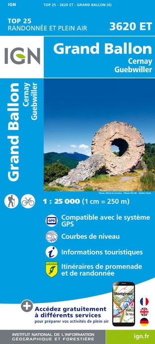
3620ET - GRAND BALLON CERNAY GUEBWILLER
Editor : IGN
Collection : TOP 25 ET SÉRIE BLEUE
Scale : 1:25 000
13.90€

TOP75028 - VOSGES DU SUD BALLON D'ALSACE LE HOHNECK
Editor : IGN
Collection : TOP 75
Scale : 1:75 000
9.80€

VEL04 - L'ALSACE A VELO
Editor : IGN
Collection : DECOUVERTE A VELO
Scale : 1:110 000
9.10€

TOP100D88 - VOSGES ÉPINAL NEUFCHÂTEAU ST-DIÉ-DES-VOSGES GÉRARDMER PNR DES BALLONS DES VOSGES
Editor : IGN
Collection : TOP 100
Scale : 1:100 000
8.40€

TOP100D68 - HAUT-RHIN TERRITOIRE DE BELFORT COLMAR MULHOUSE BELFORT PNR DES BALLONS DES VOSGES
Editor : IGN
Collection : TOP 100
Scale : 1:100 000
8.40€

201 ALSACE MASSIF DES VOSGES
Editor : IGN
Collection : TOP 200
Scale : 1:200 000
6.80€

89032 - LA TRAVERSEE DES VOSGES
Editor : IGN
Collection : DECOUVERTE DES CHEMINS
Scale : 1:100 000
9.10€

D70-88-90 HAUTE-SAÔNE VOSGES TERRITOIRE DE BELFORT
Editor : IGN
Collection : CARTES DÉPARTEMENTALES IGN
Scale : 1:150 000
5.90€

D67-68 BAS-RHIN HAUT-RHIN
Editor : IGN
Collection : CARTES DÉPARTEMENTALES IGN
Scale : 1:150 000
5.90€

NR09 BOURGOGNE FRANCHE-COMTÉ
Editor : IGN
Collection : CARTES RÉGIONALES IGN
Scale : 1:250 000
6.80€

SUISSE
Editor : IGN
Collection : DÉCOUVERTE DES PAYS DU MONDE IGN
Scale : 1:303 000
7.00€

ALLEMAGNE
Editor : IGN
Collection : DÉCOUVERTE DES PAYS DU MONDE IGN
Scale : 1:800 000
7.00€

EUROPE
Editor : IGN
Collection : DÉCOUVERTE DES PAYS DU MONDE IGN
Scale : 1:2 500 000
7.00€
Description
This hike takes you to Grand Ballon, the highest peak of the Vosges mountains, which rises up to 1,424 metres. From this pass, if the weather is clear, you can enjoy a breathtaking view over the Alsace plain, the Black Forest and even the Alps mountain range. Along the way, you will pass through a variety of landscapes of conifer and non-conifer forests, glades and pastures. As you gain altitude, you will see the changes in the Vosges flora.
Duration: 7h
Length: 23 km
Accumulated altitude: 953 m
Hiking sheet and topographical guide are available from the Guebwiller and Soultz Tourist Offices.
Technical Information
Walking
Difficulty
Medium
Dist.
20 km
Type of practice
Walking
Medium
Show more
Altimetric profile
Starting point
Parcours de Santé de la Sandgrube
,
68500
Guebwiller
Lat : 47.90591Lng : 7.20117
Additional information
Contact
Tel : 03 89 76 10 63
Email : info@tourisme-guebwiller.fr
Data author

proposed by
Office de tourisme de Guebwiller
3 rue du 4 février 68500 Guebwiller France
Ratings and reviews
To see around