Alert
Alerts
Type of practice
Walking
Hard
Presentation
Description
Map
Ratings and reviews
See around
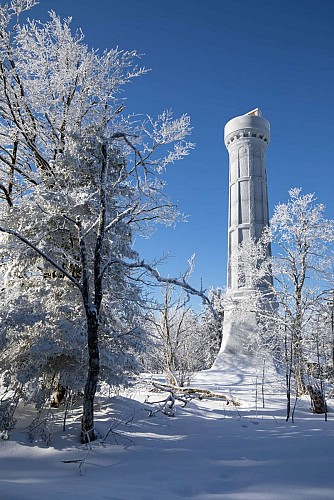
Hiking trail C26: From Rothau to the Champ du Feu
Credit : © J. Kauffmann-OTVB-ADT
Description
The proposed route is a sportive hike in the Bruche Valley, starting from Rothau. This beautiful hike will take you to the highest point of the Bas-Rhin, at 1099m. On your way you will be able to observe many protected natural areas and species: the peat bogs for example.
Technical Information
Walking
Difficulty
Hard
Dist.
25 km
Type of practice
Walking
Hard
Show more
Altimetric profile
Starting point
67570
Rothau
Lat : 48.45909Lng : 7.20775
Additional information
Contact
Tel : 03 88 47 18 51
Email : tourisme@valleedelabruche.fr
Site web : www.rando-bruche.fr/fr/tous-les-itineraires-de-la-vallee/f215004750_circuit-rando-c26-de-rothau-au-champ-du-feu-rothau
Data author

proposed by
Office de tourisme de la valle de la Bruche
114 GRAND'RUE 67130 SCHIRMECK France
Ratings and reviews
To see around