Alert
Alerts
Type of practice
Mountainbiking
Easy
2h
Presentation
Description
Map
Ratings and reviews
See around
Mountain bike route: Rosstall Route
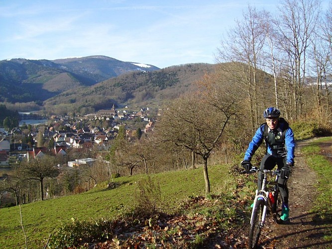
Credit : Francis Kruch
IGN cards
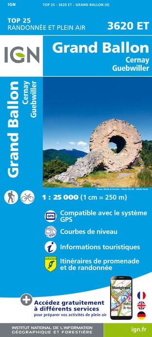
3620ET - GRAND BALLON CERNAY GUEBWILLER
Editor : IGN
Collection : TOP 25 ET SÉRIE BLEUE
Scale : 1:25 000
13.90€

TOP75028 - VOSGES DU SUD BALLON D'ALSACE LE HOHNECK
Editor : IGN
Collection : TOP 75
Scale : 1:75 000
9.80€

VEL04 - L'ALSACE A VELO
Editor : IGN
Collection : DECOUVERTE A VELO
Scale : 1:110 000
9.10€

TOP100D88 - VOSGES ÉPINAL NEUFCHÂTEAU ST-DIÉ-DES-VOSGES GÉRARDMER PNR DES BALLONS DES VOSGES
Editor : IGN
Collection : TOP 100
Scale : 1:100 000
8.40€

TOP100D68 - HAUT-RHIN TERRITOIRE DE BELFORT COLMAR MULHOUSE BELFORT PNR DES BALLONS DES VOSGES
Editor : IGN
Collection : TOP 100
Scale : 1:100 000
8.40€

201 ALSACE MASSIF DES VOSGES
Editor : IGN
Collection : TOP 200
Scale : 1:200 000
6.80€

89032 - LA TRAVERSEE DES VOSGES
Editor : IGN
Collection : DECOUVERTE DES CHEMINS
Scale : 1:100 000
9.10€

D70-88-90 HAUTE-SAÔNE VOSGES TERRITOIRE DE BELFORT
Editor : IGN
Collection : CARTES DÉPARTEMENTALES IGN
Scale : 1:150 000
5.90€

D67-68 BAS-RHIN HAUT-RHIN
Editor : IGN
Collection : CARTES DÉPARTEMENTALES IGN
Scale : 1:150 000
5.90€

NR09 BOURGOGNE FRANCHE-COMTÉ
Editor : IGN
Collection : CARTES RÉGIONALES IGN
Scale : 1:250 000
6.80€

SUISSE
Editor : IGN
Collection : DÉCOUVERTE DES PAYS DU MONDE IGN
Scale : 1:303 000
7.00€

ALLEMAGNE
Editor : IGN
Collection : DÉCOUVERTE DES PAYS DU MONDE IGN
Scale : 1:800 000
7.00€

EUROPE
Editor : IGN
Collection : DÉCOUVERTE DES PAYS DU MONDE IGN
Scale : 1:2 500 000
7.00€
Description
Starting at the Sandgrube, via the clearing of Bruyères, the Bildstoecklé and Peternit-Rosstall (translation for stable), this route will take you to Hugstein Castle (viewpoint) passing through Saint Barnabé and Buhl (with its church and altarpiece). The return is via the Hermitage and the Luspel.
Level: Easy
Start: Guebwiller – Sandgrube
Distance: 14.20 km
Accumulated altitude: 452 m
Towns crossed: Guebwiller, Upper-Rhine Soultz, Jungholtz Rimbach and Buhl
Topographic guide available from the Guebwiller and Soultz Tourist Offices.
Technical Information
Mountainbiking
Difficulty
Easy
Duration
2h
Dist.
14 km
Type of practice
Mountainbiking
Easy
2h
Show more
Altimetric profile
Starting point
Route du Col Amic
,
68500
Guebwiller
Lat : 47.90514Lng : 7.19745
Additional information
Contact
Tel : 03 89 76 10 63
Email : info@tourisme-guebwiller.fr
Data author

proposed by
Office de tourisme de Guebwiller
3 rue du 4 février 68500 Guebwiller France
Ratings and reviews
To see around