Alert
Alerts
Type of practice
Walking
Very easy
2h30mn
Presentation
Description
Map
Ratings and reviews
See around
Hiking trail B16: The Soultzbach waterfall
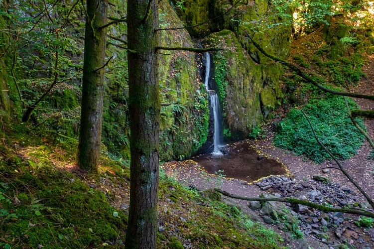
Credit : D. BETSCH / OTVB
Description
Along the way you can see the Ruchfels rock, the Soultzbach waterfall, as well as a water hole called "Salzloch", which has given rise to numerous legends. Some say it is bottomless, while others claim it is linked to the sea...!
Technical Information
Walking
Difficulty
Very easy
Duration
2h30mn
Dist.
9.1 km
Type of practice
Walking
Very easy
2h30mn
Show more
Altimetric profile
Starting point
rue du Général de Gaulle
,
67280
Urmatt
Lat : 48.52679Lng : 7.32514
Additional information
Contact
Tel : 03 88 47 18 51
Email : tourisme@valleedelabruche.fr
Site web : www.rando-bruche.fr/fr/tous-les-itineraires-de-la-vallee/f215003783_circuit-rando-b16-la-cascade-du-soultzbach-urmatt.html
Data author

proposed by
Office de tourisme de la valle de la Bruche
114 GRAND'RUE 67130 SCHIRMECK France
Ratings and reviews
To see around