Alert
Alerts
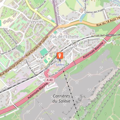
Hiking loop: Balcon paysager du Téléphérique
Description
A family hike to discover the northern part of the Salève. With no difficulty, you'll discover magnificent panoramic views over Lake Geneva.
The Balcons du Téléphérique walk is ideal for a family outing.
With no difficulty and very little difference in altitude, this walk takes in the Salève mountain and its many viewpoints over Geneva and its jet d'eau, with the Jura in the background.
Located in an area of flora and fauna interest (ZNIEFF), you'll have the chance to discover some of the species that call this mountain home.
The aerial tramway is also an exceptional structure. Inaugurated for the first time on August 5, 1932, it enables you to climb the mountain in 8 minutes instead of 2 hours with the cog railway.
Unfortunately, the Second World War and the advent of the "all-car" system led to its closure in 1975. It was not until 9 years later that it resumed operation, and was improved from year to year until the current works.
Technical Information
Altimetric profile
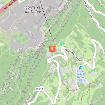
Starting point
Points of interest

Date and time
- From 15/05/2026 to 01/11/2027
- From 15/05/2027 to 01/11/2028
Additional information
Contact
Phone : 04 50 95 07 10
Email : ot@montsdugenevois.com
Website : https://www.montsdugenevois.com
Open period
From 15/05 to 01/11 daily.
Please check with the Tourist Office beforehand for current access conditions.
Subject to favorable snow and weather conditions.
Environments
Mountain view
Panoramic view
Lake view
Mountain location
Type of land
Ground
Not suitable for strollers
Topo guides and map references
Map references :
TOP 25 IGN 3430OT - MONT SALEVE
Updated by
Conseil Départemental de la Haute-Savoie - 12/05/2026
hautesavoiemontblanc-tourisme.com/
Report a problem
Reception complements
Whatever your hike, remember to pack cereal bars, plenty of water, sunglasses, sunscreen, a small first-aid kit, and clothing appropriate to the season and weather forecast.
Guidebook with maps/step-by-step
1/ From the cable car, head towards ‘Grange Gaby par Pré Berger’. You will pass the ‘Pré Berger’ and ‘Les Treize Arbres’ signposts.
2/ When you reach Grange Gaby, follow the signs for L'Observatoire, passing Sur la Grande Gorge.
3/ When you reach ‘L'Observatoire’, continue towards ‘Panorama de l'Observatoire’.
4/ From ‘Panorama de l'Observatoire’ continue towards ‘Table d'Orientation GR’.
5/ From the ‘Table d'Orientation’ signpost, follow the signs for the ‘Téléphérique Gare Supérieure GR’ via ‘Panorama du Mt Blanc’ to return to your starting point.
Animals
Yes. Pets allowed on leash only.
Data author
