N°4 Causses and Valleys


Description
This very pleasant circuit is the ideal way to explore theavants-causses and the agropastoral heritage: fortified caussenard farms, buissières, lavognes.From the F. Fabié square, take the D50 (usually called the graveyard road) for 2.5 km up to the Moulin du Juge.Before crossing the small bridge, take the path on the right hand side (2nd signpost). Cycle up the vale to the road intersection close to the famous dolmen de Tiergues. Then follow a wide path that leads to the hamlet of Tiergues. When you leave the hamlet, cycle up to the crest by the path leading West.Carry on 100 m until you reach an intersection where you will a cross. Take the left hand path which runs alongside a road. Cross the road and cycle to the Canissac farm.Cycle around the left side of the farm following a wide trail. Enjoy the views over the avant-Causses among which is Mont Combalou that shelters the village of Roquefort made world famous by its cheese.A path lined with box trees (bouissière) leads you up to the edge of the plateau towards the village of Vailhauzy. In the village, 50 m after the church take the small road to your left. After a rather steep ramp, carry on along a single track path and cycle down towards the disco carpark.Cross the road and cycle uphill for 50 m then take a path to your right and follow a track to your left below the retaining wall carrying the road. Cross the brook and ride up to the bridge of the old railway line.Reach the old railway track-bed and cycle up along it for 2 kmJust before a little bridge, take a path to the right side which joins the road that leads to Castel Cremat and Bages. Head towards the Caussanuéjouls farm (you will see a nice lavogne (a man made pond where sheep drink - it is a 400 m ride there and back to have a look at it), leave the farm on your left.Now take the path which runs along the edge of the plateau and take time to enjoy the views over the Verzolet valley that you will reach after you have passed through the hamlet of Hermélix.When you reach the bottom of the slope, take the turning to your right, then cross the bridge to the left and cycle across the dry brook. Keep riding on the left bank path up to Versols (medieval castle).From the left bank of the river Sorgues you will reach Lapeyre and eventually Saint-Affrique.
Technical Information
Altimetric profile
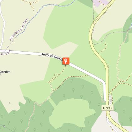
Starting point
Steps
Dolmen de Tiergues
Dolmen classé monument historique.Il fait parti de la vingtaine de dolmens recensés, pas tous bien conservés. Ces dolmens ont été fouillés au XXème siècle par Emile Cartailhac. le mobilier découvert lors de ces fouilles se trouve éparpillé à Rodez, à Toulouse....
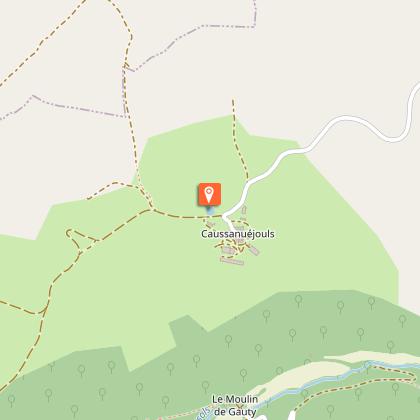
Lavogne de Caussanuejouls
Une lavogne, c'est tout simple à comprendre, il suffit d'imaginer un immense parapluie renversé qui récolte l'eau de pluie !Tout commence par une mare naturelle dont le sol argileux est totalement imperméable. Cette petite mare est une véritable aubaine pour l'homme qui aménagera très vite ces points d'eau si précieux car sur les causses l'eau s'infiltre dans le sol fissuré. Il commencera donc par daller l'intérieur puis finira par le pavage de son pourtour car il faut préserver la qualité de l'eau et empêcher le ravinement causé par le piétinement des troupeaux de brebis qui viennent s'y abreuver. Pour le dalage on utilise soit des lauzes, soit des pierres plates, soit des pavés posés les uns après les autres.Une fois construit, ce grand parapluie renversé accueillera une foule d'animaux, il suffit de se pencher au-dessus, ça grouille, ça gigote, quel folklore !De cette lavogne vous avez une vue imprenable vers le nord sur le Combalou, butte témoin qui abrite les caves d'affinage du Roquefort.
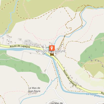
Château et vestige de fortification
La famille de Roquefeuil a occupé les lieux durant 8 siècles, de 1250 à 1810, date à laquelle le château est sorti de la famille. La batisse a alors été vendue à plusieurs propriétaires et une partie des bâtiments est devenu logis de ferme. Il a été racheté par les époux Roquefeuil en 1962.Le château est une partie du castrum (place fortifiée) qui comprenait tout l'ancien village dans une pointe entre Sorgues et Verzolet. La place forte, à l'origine (XIe siècle), ne comportait qu'un petit château qui a ensuite été étendu au XIIIe ou XIVe siècle pour les affronts de la guerre de 100 ans.
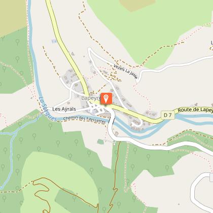
Village de Lapeyre
Lapeyre signifie en occitant "La Pierre", le village est construit sur le rocher.Le village dépendait au XIIe siècle de la Commanderie des Templiers, il a conservé son aspect médiéval avec ses vieilles maisons serrées autour de la Tour.L'église actuelle date de 1844, sur la place : vestige du couvent, fenêtres à meneaux, tour, et à l'intérieur de l'église une Vierge à l'enfant sculptée en 1860 à Rome par Steinhauser. Elle porte son enfant sur le bras droit et non le gauche comme cela doit-être, elle est tirée d'un seul bloc de marbre de carrare.Au cimetière, pierre tombale de Médora Leig, fille du poète anglais Lord Byron.Depuis le pont neuf, vue sur les vestige de l'usine textile. Elle aurait été crée en 1619-1683 pour traiter sur place la laine des moutons du Causse pour les manufactures royales de Lodève. Elle aurait disparu en 1877 pour réouvrir en 1887 pour la fabrication de drap, molletons, flanelles et couvertures. De 1923 à 1974, elle est propriété de Mr Tournier, l'usine fabrique alors des tissus de laine et de coton.
Points of interest

Église Notre Dame de la Miséricorde
L'Église actuelle de style néo-gothique est la cinquième église construite à Saint-Affrique. Elle fut achevée en 1905.À l'intérieur, découvrez :- La statue de Notre Dame de la Miséricorde, sculptée en bois doré datant du XVème siècle,- Les vitraux du choeur retraçant la légende d'Africanus.- L'Autel datant du XVI-XVIIè siècle.En sortant, admirez le clocher atteignant 71 m de hauteur.

Ville de St-Affrique
Pourquoi Saint-Affrique avec deux F ?Au Vème siècle, les Wisigoths Ariens persécutaient les communautés catholiques et interdisaient l’accès aux églises. Africanus, évêque, fut chassé du Comminges.La légende raconte qu’Africanus aurait terminé son exil dans un hameau au bord de la Sorgues et qu’il en aurait profité pour évangéliser les habitants. Il y aurait aussi accompli de nombreux miracles (voir les vitraux du Chœur de l’église Notre Dame de la Miséricorde).Le nom de cet évêque trouverait son origine dans la langue parlée par les Wisigoths et plus précisément dans la racine Affric ou Effric, signifiant « puissant et affreux ».Le nom de Saint-Affrique fut attesté en 942 dans le cartulaire (recueil des droits et des titres d’un monastère ou d’un évêché) de Vabres l’Abbaye. Une anecdote : Saint-Affrique n’a pas toujours conservé ce nom là. Pendant la Révolution Française on appela la ville Montagne sur Sorgues. En effet, à cette période il était de coutume de modifier les noms à consonance ecclésiastique.

Caussaunejouls Lavogne
How a lavogne works is very easy to understand; imagine a gigantic upturned umbrella that collects rainwater!In the beginning, there was a natural pond with impervious clay soil. This small pond was a real boon for people who quickly set these watering sources up as they were so critical on the causses where water seeps into the cracked limestone. First, they tiled the inside of the pond and finished off the work by laying paving stones around the edge of the pond to preserve the water quality and prevent gullying due to the large flocks trampling the soil when the sheep come to drink.The pond tiling was made either with lauzes, flat stones or with paving stones laid one after the other.Once completed, this gigantic upturned umbrella would provide a great variety of animals with a welcoming habitat, just look down over a lavogne and see how it swarms and buzzes with life; what a frenzy of activity!From this lavogne, you will enjoy a stunning view to the north over the Combalou, a residual mound that shelters the Roquefort maturing caves.

Castle and remains of fortification walls
The Roquefeuil family lived here over a period of eight centuries, from 1250 to 1810, the date on which the owning family had to sell the castle. The building was then sold to different owners and part of it was converted into a farmhouse. Then in 1962, a couple from the Roquefeuil family bought back the stronghold.The castle and the whole of the old village were included in a walled area called a castrum which spread out between the Sorgues and the Verzolet rivers. The castrum was originally composed (11th century) of only a small castle that was later extended during the 13th or 14th century to protect people from the clashes during the One Hundred Years War.

Village of Lapeyre
This village was controlled by the Templars Commandery during the 12th century and has kept much of its medieval architecture with its old houses clustered around the Tower. There is also the tombstone of Médora Leig, a daughter of the English poet Lord Byron which you can visit in the graveyard.
Additional information
Public transport
Travel by bus or train: www.mobimipy.fr/carpooling : BlaBlaCar, Rézo Pouce, Covoiturage-libre, Idvroom, LaRoueVerte, Roulez malin
Advice
Box tree moths are active from May to October. During the caterpillar phase, they feed on the leaves of box trees. They crawl down trees and move on long silken threads, although these threads are annoying when hiking they do not pose any health risk
Advised parking
Place of Marshal Foch
Access
Saint-Affrique, 31 km south-west of Millau by the D 992 and D 999
Arrival
At the tourist office
Ambiance
This ride offers a variety of terrains types and sceneries: trails and singletrack paths, breathtaking views over the town of Saint-Affrique and the Larzac foothills. The route can be taken whatever the weather conditions may be, even during rainfalls.
Departure
From the tourist office join the place François Fabié
Data author
