Alert
Alerts
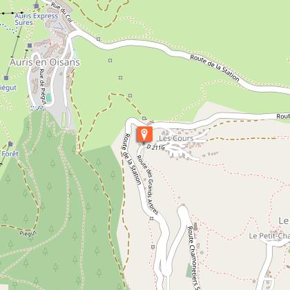
Puy-le-Haut > Les Cours, Auris
1 alert on this circuit
Alerte visiteurs
Itinéraire potentiellement soumis à de forts dégâts dus à des évènements météorologiques majeurs et dont la viabilité peut être incertaine, renseignez-vous avant de vous engager sur ce parcours.
Description
Also known as the letter carrier's path, this easy little trail meanders through meadows and offers a bucolic experience. You'll pass by the polished rocks characteristic of the local geology, as well as the Croix de Trévoux.
Retrace the history of the Chemin du Facteur, with a walk through meadows. Enjoy breathtaking views of the Romanche and the Écrins massif, where the Meije is king.
TECHNICAL INFORMATION
Departure point: Les Cours, Auris en Oisans
Height difference: 70 m
Round trip time: 2h
Distance : 6 km
MAP AND TOPO
IGN Top 25 Bourg d'Oisans and Alpe d'Huez 3335 ET
Topo guide OBP n°3 sentier 315+314+310
ITINERARY
Park at the parking des Cours, cross the village in the direction of La Mine (former ore mine at Freney-d'Oisans), then follow the road to the path on your right which leads to Puy le Bas. Continue along this path towards Puy le Haut.
- When you reach Puy le Haut, retrace your steps and follow the letter carrier's path. The path crosses a shadier area before crossing to the other side of the more open combe to Les Cours.
SIGHTS ALONG THE WAY
- the Croix de Trévoux (Trévoux means "three ways"), located at the crossroads of 3 roads at the intersection of the communes of Le Freney-d'Oisans and Auris-en-Oisans.
THINGS TO SEE AND DO NEARBY
- the heritage orientation trail, discovering the hamlets of Auris-en-Oisans (available from the tourist office or downloadable from www.auris.fr).
TO KNOW
The Les Cours / Puy-le-Haut walk is known as the Chemin du Facteur (Postman's Path), because for a very long time, the postman used to use this path to deliver his mail.
Dogs must be kept on a leash at all times, as herding dogs are present at certain times of the year.
Technical Information
Altimetric profile
Starting point
Date and time
- From 15/05/2026 to 31/10/2026
- From 15/05/2027 to 31/10/2027
Additional information
Updated by
Oisans Tourisme - 10/03/2026
www.bike-oisans.com
Report a problem
Environments
Mountain location
Open period
From 15/05 to 31/10 daily.
Subject to favorable snow and weather conditions.
Contact
Phone : 04 76 80 13 52
Email : info-auris@oisans.com
Website : http://www.auris.fr
Facebook : https://www.facebook.com/OisansTourisme/
Type of land
Ground
Topo guides and map references
Topo guides references :
OBP map/topo guide n°3, path 310
Map references :
IGN Top 25 Bourg d'Oisans et l'Alpe d'Huez 3335 ET.
Animals
Yes
Data author
