Alert
Alerts
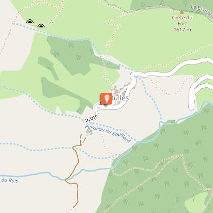
Refuge du Taillefer par Oulles
1 alert on this circuit
Alerte visiteurs
Le site est sujet à de fortes affluences en juillet et en août.
Nous vous invitons à découvrir notre suggestion à proximité pour profiter pleinement de notre territoire.
Itinéraire potentiellement soumis à de forts dégâts dus à des évènements météorologiques majeurs et dont la viabilité peut être incertaine, renseignez-vous avant de vous engager sur ce parcours.
Description
Starting from Oulles, the path leading up to the Taillefer mountain hut offers one of the clearest views over the Oisans mountain tops, from the Rousses to the Ecrins.
The Taillefer Plateau is a Natura 2000 site, where many species of flora and fauna are protected and sensitive, so we need to adapt our behavior so that the landscape and biodiversity continue to amaze us:
- I stay on the marked trails (paint, signs...). I don't take shortcuts that cause soil erosion, destroy vegetation and disturb wildlife and herds.
- I keep my dog on a leash to avoid disturbing wildlife and domestic herds.
- I don't make fires in the mountains. It destroys the soil for decades.
- I bivouac outside wetlands and pitch my tent at suitable times (7pm-9am).
- I don't litter.
- I don't pick flowers. I prefer a lasting souvenir by taking a photo.
- I ask about private ownership of certain areas.
TECHNICAL INFORMATION :
Start: Car park at the entrance to the village of Oulles
Ascent: 700 m
Duration: 2h30 uphill
Distance: 3.9km
Level: Medium
MAP AND TOPO :
OBP map n°1 (Oisans au Bout des Pieds): trail 636
IGN Top 25 map n°3335 OUEST
ITINERARY:
From Oulles, take the road to the hamlet of Pouillard, then follow the carriage road, leaving it after around 750 m for a path on the right.
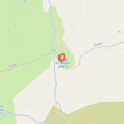
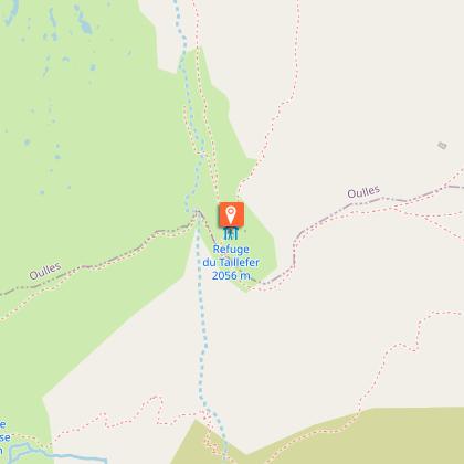
The path becomes steeper and offers fantastic views of the village of Oulles and all the Oisans massifs. It then enters the mountain pastures, passes beneath the Carrelet communal chalet and crosses to the Taillefer refuge.
THINGS TO SEE ALONG THE WAY
-The village of Oulles
-Taillefer lakes
-Taillefer refuge
NEARBY SIGHTS
-Ornon and its hamlets
-The village of Villard-Reymond
Technical Information
Altimetric profile
Starting point
Steps
Date and time
- From 01/05/2026 to 31/10/2026
- From 01/05/2027 to 31/10/2027
Additional information
Environments
Mountain view
Panoramic view
Lake view
Updated by
Oisans Tourisme - 11/03/2026
www.bike-oisans.com
Report a problem
Open period
From 01/05 to 31/10 daily.
Subject to favorable snow and weather conditions.
Contact
Phone : 04 76 80 03 25
Email : info-bourgdoisans@oisans.com
Website : https://www.bourgdoisans.com/
Topo guides and map references
Topo guides references :
OBP map no. 1 (Oisans au Bout des Pieds): trail 636
Animals
Yes
Data author
