Alert
Alerts
Lac des Quirlies - hike from Le Perron (Clavans-en-Haut-Oisans)
1 alert on this circuit
Visitor alert
As this route is potentially subject to severe damage due to major weather events and its viability may be uncertain, please enquire before embarking on it.


IGN cards


Description
A challenging, superb and varied hike. Meet the youngest lake in the Oisans region, with its waterfalls, mountain pastures and glaciers! All with panoramic views of the Grand Sauvage peaks, Plateau d'Emparis, Aiguilles d'Arves and La Meije.
Lac des Quirlies, at an altitude of 2566 metres, was created around 1950, following the retreat of the Quirlies glacier. It is the latest mountain lake in the Oisans region.
Its milky appearance is due to the fine clay particles contained in its waters, giving it an enchanting and mysterious appearance.
In spring, it's still possible to see the glacier plunging into the waters of the lake, offering an incredible natural spectacle.
TECHNICAL INFORMATION
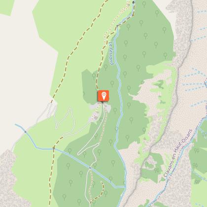
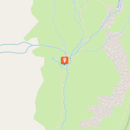
Start: hamlet of Les Perrons, Clavans-en-Haut-Oisans (1,608 m)
Ascent: 1,000 m
Round trip duration: 4 h outward and 2 h 55 return
Return distance: 14 km
Level: difficult (for experienced hikers), with an aerial passage, unbridged stream crossings and part of the route between rocky chaos and scree.
MAP AND TOPO
TOP 25 map no. 3335 ET - Bourg d'Oisans, l'Alpe d'Huez, Grandes Rousses, Sept Laux (Alps)
OBP map no. 3 (Oisans au Bout des Pieds): trails no. 332 and 334
ITINERARY
The first part of the hike begins in the mountain pastures. Very quickly and without difficulty, you come to a cirque of waterfalls known as the "Cascades du Pont Ferrand" (the one on the left comes from the Ruisseau de la Pisserote, the one on the right from the Torrent du Ferrand). The sublime and powerful setting for the hike is then launched!
An initial steep ascent through the slate quarry, a little airy but quick (around 15 minutes), will take you to the Ferrand waterfall and its summit.
The ascent of the glacial waters of the Ferrand then begins on a 4 km undulating trail. The valley gradually unveils itself, and eventually opens out onto green, flower-filled mountain pastures, contrasted by the high (often snow-capped) peaks of the Grandes Rousses massif on one side, and an imposing schist ridge on the other, the Échine de Praouat. The climb is gradual, pleasant and punctuated by small streams that join the Ferrand.
At the Chalet des Quirlies, the route becomes very challenging. It will take you 2 hours to climb 2.2 km (530 D+). Suffice it to say, it won't be easy. The first part of the ascent is through the mountain pastures. As you gain height, you'll be able to admire the beauty of the Ferrand torrent and its tributaries, which have been carving out the valley for centuries, with the impression that it flows into the Écrins.
Once you've reached the top of the waterfall, a final section awaits you. Here, the scenery changes completely: everything becomes mineral! You've reached the high mountains. You'll find your way through a rocky chaos that follows the stream coming down directly from the lake. You'll need to make a final, short but intense effort, as you still have 300 m of positive ascent to climb over 500 m.
This time, the milky-blue lake is right in front of you, held back by a granite moraine and surrounded by high glaciers. Let yourself be enchanted by this natural spectacle, both magnificent and mysterious.
Then turn around and admire the view. From here you can see the Arves and its needles that seem to dance across the pastures, the Meije, of course, and all the rest of the Écrins and its glaciers.
The way back is the same, and you'll be facing the same panorama as above! Be careful on the way down, especially in the scree slopes, with rocks that can move, and the slate quarry crossings, which are very slippery.
THINGS TO SEE ON THE WAY
- Pont Ferrand and its waterfalls
- Malatres and Quirlies glaciers and their median moraine
- Echine de Praouat (schist ridge)
NEARBY ATTRACTIONS
- The villages of Clavans-le-Bas and Clavans-le-Haut
- The hamlet of Le Perron and its house leaning against a rock
- The Sarenne pass
Technical Information
Altimetric profile
Starting point
Steps
Additional information
Open period
From 01/06 to 31/10.
Subject to favorable snow and weather conditions.
Tips
We recommend this hike in late spring and autumn.
During the summer months, you run the risk of encountering herds with their shepherds and guard dogs. The route offers few ways of getting around them. You'll have to turn back or wait for them to move, and risk not being able to make the round trip.
Sustainable tourism
Lac des Quirlies has been classified Natura 2000! This exceptional site is home to a remarkable and fragile biodiversity, protected by measures dedicated to its preservation. To make the most of this unique environment, please respect the regulations in force: stay on the marked trails, motorized vehicles and mountain bikes are prohibited. Remember to leave the site as clean as you found it, and take your garbage with you. Fires and camping-bivouacs are not permitted to ensure the tranquillity of the site. Together, let's protect this natural treasure!
Updated by
Oisans Tourisme - 06/10/2025
www.bike-oisans.com
Report a problem
Contact
Phone : 04 76 80 00 85
Email : info-ferrand@oisans.com
Website : https://www.oisans.com/stations-et-villages/clavans-haut-oisans/activites-a-clavans/randonnees-autour-de-clavans/
Type of land
Stone
Ground
Grit
Not suitable for strollers
Location complements
Park at Le Perron (on the hairpin bend) and take the track towards the Ferrand bridge, at the foot of the waterfall of the same name.
Topo guides and map references
Topo guides references :
OBP card on sale at Oisans Tourisme tourist offices.
Map references :
Carte TOP 25 n° 3335 ET - Bourg d'Oisans, l'Alpe d'Huez, Grandes Rousses, Sept Laux (Alpes)
OBP map no. 3 (Oisans au Bout des Pieds): trails no. 332 and 334
Reception complements
Don't forget to wear good shoes and bring water, a snack, a jacket, a cap/hat, sun protection and your charged phone.
Tricky passages
Aerial ascent for 15 minutes after the Pont Ferrand waterfalls. A challenging climb from the Chalet des Quarlies to the lake.
Animals
Yes. Warning: in the presence of herds and guard dogs, adopt the right gestures. It may be necessary to turn back. More information on pasto-kezako.fr.
Data author
