Alert
Alerts
Hiking – Bons Roman Gate
IGN cards


Description
Bons Gate is a vestige of the Roman road that once crossed the Oisans region. Easily accessible from the hamlet of Bons, this testimony to the past is situated below the village via a fairly steep path.
The hamlet of Bons enjoys a panoramic view of the Ferrand Valley, the sunny side of Auris and the Sarenne glacier with Pic Blanc towering above. Take the sheltered path through the cool deciduous forest, which will lead you to the "Roman Gate".
TECHNICAL INFORMATION
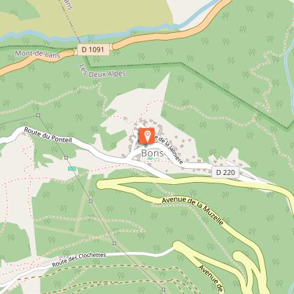
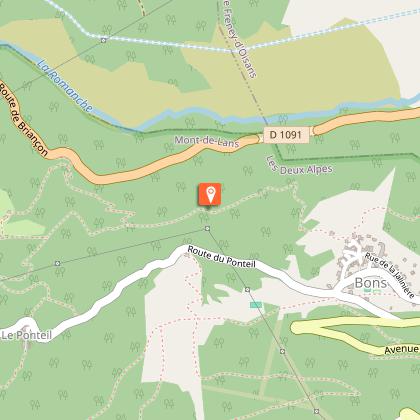
Departure: Village of Bons
Vertical incline: 60 metres
Duration: 45 mins
Distance: 800 metres
ITINERARY
The walk starts from the village of Bons, below the resort (10 mins by car). You can park at the entrance to the village in the car park next to the fire station. Make your way to the chapel: the starting point for the Roman Gate (Porte Romaine) is then very well signposted. Take a small stony path that winds its way down to the old Roman Gate, testimony to the likely passage of the Oisans Roman road, which would have been built during the reign of the Emperor Augustus (27 BC to 14 AD).
TO SEE ON THE WALK
- The "Roman Gate", a monumental arch cut into the rock, is of great interest today from a historical and archaeological point of view. Extensive research has indicated that the "Roman way", which linked Turin to Grenoble, almost certainly passed through here.
TO SEE NEARBY
- In Mont de Lans: the Chasal Lento museum
- In Les 2 Alpes: the international resort of Les 2 Alpes is accessible free of charge by chairlift from Mont de Lans during both the summer and winter seasons.
- Buissonnière lake
NOTE: This monumental half-arch is now listed in the Inventory of Historical Monuments and is in the process of being classified. The heritage of the Oisans region bears witness to human activities from the earliest times when the copper in the Grandes Rousses massif was mined during the Bronze Age. Over the years, ancient remains in the area multiplied. In Roman times, it was the Roman road of Oisans, sections of which can be seen at Rochetaillée and Bons. In the Middle Ages, it was the village of Brandes, whose inhabitants exploited a silver mine. In the modern period, many chapels, oratories, wash houses, fountains, ovens and sundials were built in local villages. Then came l’Herpie coal mine, Chalanches silver mine and Gardette gold mine. The construction of hydroelectric power stations in the Livet-Gavet Valley gave rise to some remarkable industrial architecture, as seen at Vernes power station.
Technical Information
Altimetric profile
Starting point
Steps
Date and time
- From 01/01/2026 to 31/10/2026
Additional information
Tips
Caution: This path can be slippery and needs good hiking shoes! Some passages can be delicate for children.
Updated by
Office de Tourisme des 2 Alpes - 18/09/2025
www.les2alpes.com/fr/
Report a problem
Open period
From 01/05 to 31/10 : open daily.
Contact
Phone : 04 76 79 22 00
Email : info@les2alpes.com
Animals
Yes
